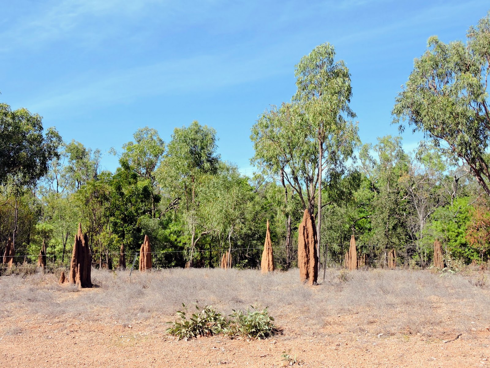
Tuesday, 12 July 2016

Cairns


(Magyar változat a végén)

Since last Thursday (7 July) we have been in Cairns staying in a nice caravan park. The weather was quite good, not as hot as before, a pleasant 26-27 degrees, but quite windy and sometimes partly cloudy. We tried to benefit as much from this last week of tropical weather as possible.
Our boat from Michealmas Cay

Michealmas Cay
One day we went out on a reef tour on a large sailing catamaran. It was sunny but windy and the sea was quite choppy. It is a 2-hour trip out to the reef then we could snorkel or dive at two different places, once at a reef pad, then at Michealmas Cay, a small sandy speck of island with minimal vegetation but a lot of birds (nesting terns), an interesting (and very smelly) place. We had been here once in 1991 with our children. 


I went snorkelling several times, and also hired and underwater camera to take some photos of this wonderful world. We came back to Cairns sailing most of the way in the strong winds.

Here are some more photos from the reef tour.


Palm Cove
We went up North to discover some of the beautiful beaches and spend a few more hours near the sea. Palm Cove was the nicest and most elegant but always very windy. Trinity beach was a bit calmer and less crowded. Yorkeys Knob was very quiet and the best place to just sit and relax. According to the beach reports the water temperature was around 25 degrees but it felt a bit colder when I tried. 


The Promenade
We walked around in the city centre and Kate did her usual discovery tour of the historical-architectural interests of the town (while I was lazying around the Lagoon).


Botanic Gardens
We visited again the Botanic Gardens and marvelled on that fantastic collection of tropical palms, trees, ferns, flowers, colours and shapes - and got the next lot of mosquito bites along the way across the wetland forests...


Barron Falls
One afternoon we drove up to the edge of the Atherton Tablelands to see Barron Falls. This is a third time we saw it, unfortunately always during the dry season when there is hardly any water in it, but even like that it is a spectacular view.

A few more photos from around Cairns


Now we have our last afternoon in Cairns, tomorrow morning we pack up and start our long trip to the South. So far the weather was very kind to us, but rain is forecast for the next few days. Just so that we don't regret leaving this nice place...

--------------------------------

Mút csütörtök (jul. 7.) óta Cairns-ben voltunk. Jó időnk volt, nem olyan meleg mint korábban, kellemes 26-27 fok napközben de elég szeles és néha kicsit felhős. Igyekeztünk kihasználni az utolsó hetet amit a trópusokon töltünk.
Michealmas Cay


Egyik nap egy hajótúrára mentünk a korall-zátonyokhoz. Napos, meleg idő volt de jó szeles és eléggé hullámzott. Két óra az út ki a korall-zátonyokhoz, aztán két helyen álltunk meg, egyszer egy zátonynál, másodszor meg a Michealmas Cay nevű kis homok-zátonynál, amin van némi növényzet és rengeteg vízi-madár, ez az állandó költő-helyük. A szótár szerint magyarul csér-nek hívják ezeket a madarakat, angolul tern. Voltunk már itt egyszer, 1991-ben a gyerekekkel együtt, nagyon érdekes (és jó büdös...) hely. Többször voltam a vízben snorkel-olni, és most először béreltem egy vízalatti kamerát hogy maradjon valami emlék erről a fantasztikus világról. Visszafelé majdnem végig vitorlával jöttünk a jó erős szélben, azt is élveztem.

Itt van még egy pár kép a korall-kirándulásról.


Yorkeys Knob Beach
Többször felmentünk észak felé, végigjártuk néhány szép tengerparti fürdőhelyet. Palm Cove volt a legszebb és legelegánsabb de mindig nagyon szeles. Trinity Beach kicsit csendesebb, kisebb a tömeg. Yorkeys Knob volt a legnyugodtabb, itt jól lehetett üldögélni a vízparton, olvasni és pihenni. A hirdetmény szerint a víz hőmérséklet 25 fok  körül volt, bár nekem hidegebbnek tűnt amikor bementem.


A Lagúna
Sétáltunk a belvárosban és Kati szokás szerint végigjárta az építészeti-történeti érdekességeket (amíg és lazsáltam a köpontban lévő nagy nyitott lagúna mellett).


Botanikus Kert
Ujra végigjártuk a botanikus kertet, megcsodáltuk ezt a fantasztikus gyűjteményt, pálmák, óriási növények, páfrányok, virágok, színek és formák - és közben beszereztük a következő adag szunygcsípést a mocsári erdőben sétálva...


Barron Falls
Egyik délután felmentünk az Atherton Fennsík peremére a Barron vízeséshez. Harmadszor voltunk itt, sajnos mindig a száraz évszak alatt amikor alig folyik benne víz, de így is szép látvány volt.

Itt van még több kép Cairns környékéről


Most van az utolsó délutánunk Cairns-ben, holnap reggel elindulunk dél felé. Eddig nagyon kegyes volt hozzánk az időjárás, de holnaptól esőt jósolnak. Csak hogy ne sajnáljuk annyira itthagyni ezt a kellemes helyet...

Friday, 8 July 2016

Borroloola to Cairns


(Magyar változat a végén)


Evening chores at a free camp site
We left Borroloola on Thursday 30 June. Our original plan was to go on the shortest route to Cairns on the East coast. That would be the Savannah Way near the Gulf of Carpentaria through to Queensland, Burketown, Normanton. But that includes more than 500 kms of dirt road, and after our difficulties on the Tanami Road (see details here), we were not looking forward to another 2-3 days of constant worry about whether our tyres will survive the rough conditions. Also, in 2012 we have done most of this route in the opposite direction from Cairns to Burketown, and saw most of what there was worth seeing. Along the section we have not done, between Burketown and Borroloola, there is nothing really interesting (as far as we know) that would worth the trouble. 
Another spectacular sunset on the plains
So we decided to go on the much longer but sealed Southern route through the Barkly Tableland and Mount Isa, then along the Flinders Highway through to the East Coast and up North again to Cairns. It was a very long route, more than 2,000 kms, it took more than a week to cover it with stop-overs at the Barkly Homestead, Mount Isa, a free rest area 40 kms after Richmond, Hughenden, 2 nights at Porcupine Gorge, and Atherton, before we arrived to Cairns. 


The waterhole
There were very few interesting sites along the way. One of them was just about 50 kms after we left Borroloola: the Caranbirini Conservation Reserve, where we stopped for a few hours. There are two sites of interest here. The first is a semi-permanent waterhole, a refuge for wildlife in the dry season as the surrounding landscape dries out. There is a covered cabin for bird watchers looking out on the water. We did not have much time to stay there but we saw one egret and the surface covered with flowering water lilies was quite amazing in itself.

Water lilies


Walls of the "lost city"

Pillars of the "lost city"
Then we went on a short loop walk across a spectacular "lost city". This area, like most of the top end of Australia, was once below a shallow sea where various types of sediment accumulated gradually becoming sandstone layers. After the sea level receded, the changing weather conditions over millions of years has eroded the sandstone into towering organ pipe structures. The pillars are up to 25 metres high with almost vertical sides where the thin layers of differently coloured sandstone show an interesting pattern. The stone columns and walls indeed create the feeling that you walk in the ruins of an ancient city.


The other place of interest was almost at the other end of this long stretch: Porcupine Gorge, about 60 km North of Hughenden. This is a National Park with a nice camping ground where we spent two nights.

This area is about 600 m above sea level, covered by sheets of basalt lava that erupted from small volcanoes some six millions of years ago. Porcupine Creek began to erode through the basalt, and cut through the softer sedimentary rock layers beneath the basalt forming the 120-150 m deep gorge. The hard basalt cap prevented its sandstone sides from eroding too quickly, creating the steep walls of the gorge.

Porcupine Gorge from the lookout
The first afternoon we walked out to a lookout at the rim of the gorge, from where we had an impressive view of a long section of the gorge and the interesting rock formation at the Southern end called the Pyramid. It was a beautiful sunny afternoon with just enough cloud to make the view more photogenic.

Next morning we went down to the bottom of the gorge and wandered up and down along the creek watching the different types of rock, the tiny fish swimming in the water and the flora around it. In the middle of the dry season the creek is mostly stagnant, amazing how this tiny creek could have created this huge gorge. We walked up to the bottom of the Pyramid; it looks perfectly regular from close up, hard to imagine that it was created by natural forces.


Apart from these two walks we spent the rest of the time sitting beside our van reading, resting and watching the scenery around. In the evening we made a fire just to enjoy the view of the flames under the clear sky full of sparkling stars.
The Pyramid
Atherton Tablelands
After leaving Porcupine Gorge we had to get through about another hundred kms of dirt road up to the Lynd junction but most of it was relatively well maintained, just enough to make a new coat of red dust on our freshly washed car (in Mount Isa). From then on it was sealed and an easy ride up to the Atherton Tablelands, an area at 8-900 m altitude with lush sub-Alpine vegetation. It was such a refreshing view to see this multitude of dark green colours after the dry, faded and dusty shades of the outback. We spent the last night in Atherton, then came down to the coast on a narrow winding road. Soon we reached our destination, Cairns, for one more week of tropical bliss before starting the long road down South.

----- 

Június 30-án csütörtökön indultunk tovább Borroloola-ból. Eredetileg az volt a tervünk hogy a legrövidebb úton megyünk Cairns-be a keleti parton, ami innen vezet Queensland-be a Carpentaria Öböl közelében Burketown-t és Normanton-t érintve. De ez az út, az ún. Savannah Way, több mint 500 km-en földtút, és a korábbi nehézségeink után a Tanami Úton (részleteket lásd itt) nem volt nagy kedvünk újabb két-három napot izgulni hogy vajon kibírják-e a kerekeink ezt a megpróbáltatást. Másrészt, 2012-ben megtettük ennek az útnak a nagyobbik részét az ellenkező irányban Cairns-től Burketown-ig, és megnéztünk minden érdekességet. Azon a szakaszon, ahol még nem jártunk, Burketown és Borroloola között, nincs semmi olyan nevezetesség ami megérné a fáradságot és izgalmat.
Napfelkelte a pusztában
Tehát úgy döntöttünk, hogy a jóval hosszabb de burkolt útvonalon megyünk délebbre a Barkly fennsíkon és Mount Isa-n keresztül, majd onnan a Flinders Highway-t követve egész a keleti partvidékig. Jó hosszú szakasz volt, több mint 2.000 km amit nyolc nap alatt tettünk meg.


Kilátás a madár-lesből
Az út nagy részét már ismertük, de azért volt néhány érdekesség. Az egyik mindjárt Borroloola után kb 50 km-re, a Caranbirini Conservation Reserve, ahol megálltunk egy pár órára. Két látnivaló van itt, az egyik egy kis folyó-szakasz ahol a száraz évszakban is megmarad a víz. Ahogy a környező vidék kiszárad, az állatok és főleg a madarak mind idegyűlnek. A víz szélén építettek egy kis fedett madár-lest, nem volt sok időnk nézelődni és a késő délelőtt nem a legalkalmasabb időpont. Csak egy vízimadarat láttunk, de a vízililiomokkal borított tavacska magában is nagyon szép látvány volt.


Egy kócsag (egret) a faágon

Az "eltűnt város" tornyai
Aztán körbejártuk a mellette elterülő ún. "lost city"-t (eltűnt város). Ez a terület valamikor egy sekély tengefenék része volt ahol különféle homok- és agyagrétegek leülepedtek és fokozatosan kővé tömörödtek. Később a tengerszint lesűlyedt, a terület felemelkedett, és az évmilliók során az erózió alakította ki ezeket az orgonasípként tornyosuló oszlopokat. Egyik-másik 25 m magasságot is elér, szinte függőleges falakkal, ahol a váltakozó színű vékony kőrétegek érdekes mintákat mutatnak. A kőoszlopok és falak tényleg úgy néznek ki mintha egy őskori város romjai között sétálnánk.


A fa gyökerei a sziklában is megtalálják az utat
A másik érdekesség már a keleti part közelében volt, kb 60 km-re észak felé Hughenden várostól: Porcupine Gorge nemzeti park. Két éjszakát töltöttünk itt egy nagyon kellemes táborhelyen.
Táborhelyünk a nemzeti parkban

Ez a terület kb 600 m-en fekszik a tengerszint felett. Hatmillió évvel ezelőtt több kisebb vulkán-kitörés bazalt lávával borította a felszínt. A Porcupine patak eróziója lassanként áttörte ezt a vékony bazalt-réteget, majd áttört az alatta fekvő puhább üledékes kőzeteken, így jött létre ez a kb 150 m mély, meredek falú kanyon. 

Az első nap délután elsétáltunk egy kilátóhoz ahonnan végigláttunk a kanyon egy hosszú szakaszán és a déli végén levő érdekes sziklatornyon amit Piramisnak hívnak. 

Másnap délelőtt lementünk a kanyon aljára és végigsétáltunk a patak mentén, elnézelődtünk a különféle kőzet-rétegeken, a vízben úszkáló kis halakon és a környező növényzeten. A száraz évszak közepén a patakból csak itt-ott egy kis tavacska marad, bámulatos hogy tudott ez a kis patak ilyen óriási szakadékot létrehozni. Elsétáltunk a Piramis tövébe; közelről nézve teljesen szabályosnak néz ki, nehéz elképzelni hogy a természet alkotása.


A Piramis


A két gyalogtúra mellett volt időnk a lakókocsi mellett üldögélni, nézni a tájat, olvasni. Esténként tüzet raktunk, szeretjük nézni a lángokat és a fantasztikus csillagos égboltot.


Az Atherton Fennsíkon
Továbbmenve észak felé Porcupine Gorge után még várt ránk vagy száz km földút, de szerencsére elég jó állapotú, csak arra volt jó hogy egy újabb adag vörös port terítsen a frissen lemosott autónkra. Utána már végig burkolt úton haladtunk fel az Atherton Fennsíkra, mintegy 8-900 m magasságba. Jól esett látni a fennsík szub-alpesi növényzetének harsogó sötét-zöld árnyalatait az "outback" fáradt poros fakózöldje után. Az utolsó éjszakát Atherton faluban töltöttük, aztán egy hosszú meredek kanyargós úton leértünk a tengerpartra és hamarosan megérkeztünk Cairns-be. 

Most itt maradunk még egy hétig élvezni a trópusi időjárást és tájat, mielőtt elindulunk a hosszú úton dél felé.

Sunday, 3 July 2016

Mataranka and Borroloola


(Magyar változat a végén)


Mango plantation along the Arnhem Highway
Saturday 25 June we left Couzens Camp in the Mary River National Park, back to the Arnhem Highway, and returned to the Stuart Highway. We saw huge fruit tree plantations along the way, alternated with bushland and lots of termite mounds again.


The thermal pool at the Resort
We turned South on the Stuart Highway and after about 400 km we reached Mataranka. Mataranka is a small rural community, only a few hundred inhabitants. Its main tourist attraction is the thermal pools at several places with warm (34 degrees), crystal clear water bubbling up from underground springs. One of the pools is right at the Mataranka Homestead Resort, offering different kinds of accommodation, including a caravan park. We spent the next two nights here doing nothing much other than resting and enjoying the thermal pools.


Bitter Springs
A bit further back from the Homestead is another, bigger thermal pool called Bitter Springs. It was named by a worker on the Overland Telegraph Line in 1871, for the bitter taste and smell of the water. The smell is caused by bacteria that use the oxygen from the sulphate minerals in the water, leading a by-product of hydrogen sulphide, also known as rotten egg gas. Actually, the smell is not as bad as the name suggest, and the water is very pleasant. The water here flows in a half-circle loop of a few hundred metres where one can float with the current among the thick forest of tall Livistona palms and paperbark eucalypti. We both have done a few rounds with the current, walking back along the pool each time.
The palm forest around Bitter Springs

The area around the pools is a natural breeding ground of the little red flying fox. While they are protected species, they make a lot of damage in the palms, and nuisance to the tourists. At the Resort water sprinklers are installed at the level of the palm tops in an (not too successful) attempt to move them away from the walking tracks.

(We have been here in 2012)

Monday (27 June) morning we continued Southward on the Stuart Highway, then after about 160 kms we turned East on the Carpentaria Highway. This is mostly a one-lane road with very little traffic, going through a very sparsely populated area. If we meet a car in the opposite direction, both cars have to slow down and move aside on the wide gravel shoulder to let the other vehicle pass. Fortunately there is so little traffic, it only happens a few times along the way.


The Carpentaria Highway
Our destination was Borroloola, near the Gulf of Carpentaria, but it was too far for one day. We spent the night at a free camp site beside a creek called Little River. As most other waterways around here, it is not flowing during the dry season, but there was quite a large pool of water beside the camp and even saw a few water birds, hunting for their evening meal. We met a couple from Adelaide and had a good chat with them after dinner. It was a nice evening, much cooler than further North and fortunately free of any flying and biting insects.


Our camp site at Little River
Next morning (28 June) from here it was only another 130 kms to Borroloola. About 60 kms before Borrolooa we passed the huge McArthur River Mine where zinc, lead and silver are mined and transported to the port at Bing Bong at the Gulf of Carpentaria, 50 km passed Borroloola. From here on, the road becomes two-lanes and much better quality. 


The Police Station Museum
The township of Borroloola is located on the McArthur river. It was officially created in 1885, after the discovery of various metallic ores but mining ventures were mostly unsuccessful until the 1960s and the town never developed as a major centre. It works as a service and supply centre for the surrounding areas and for the tourists mostly coming here for fishing in the estuarine waters and in the Gulf. According to the tourist brochures "fishing up here is out of this world", but as we are not into fishing, we could not verify this.


A painting from the Art Centre
We spent two nights here, doing some shopping and looking at all the "attractions", of which there are not that many. The old Police Station, built in 1886, now restored as a museum, houses an impressive collection of tools, machinery and information displays about the history of the town. 

There is a local art centre showing and offering for sale (for exorbitant prices) a collection of Aboriginal art works.


The old and new  road across the McArthur River
A bit further out of town we had a look at the McArthur river where the old crossing is beside the new bridge. This leads to the Savannah Way, an unsealed gravel road toward Queensland. Originally our plan was to continue along that road, this was the main reason we came here. But then, we changed our mind...


--------------------


Újabb termesz-várak
Szombaton, június 25-én indultunk tovább a Mary Riaver NP-ből, vissza az Arnhem Highway-re, majd onnan a Stuart Higway-re. Útközben sok gyümolcsfa-ültetvényt láttunk, bozótos területekkel váltakozva, tele itt is sok termesz-várral.


Bitter Springs
A Stuart Highway-n dél felé folytattuk az utat, és kb 400 km után értünk Mataranka-ba. Ez egy kis falusias település csak pár száz lakossal. A fő turista-csalogató a környékén található termálvizű fürdők, 34 fokos meleg kristálytiszta vízzel ami földalatti forrásokból tör föl. Az egyik ilyen fürdő a Mataranka Homestead Resort-ban van, ahol különféle szállás-lehetőségeket kínálnak, van egy kemping is. Itt töltöttük a következő két éjszakát. Első este mindjárt fürödtünk egy jót a közeli termálfürdőben.

Másnap visszamentünk a kicst távolabbi nagyon termál fürdőhöz, amit Bitter Springs-nek (keserű forrás) hívnak. Egy munkás nevezte el így 1871-ben mert a víz valóban kesernyés izű és szagú. A szagát a vízben lévő baktéria okozza, ami a vízben oldott szulfát sókból elvonja az oxigént, és kénhidrogén marad belőle. De valójában nem olyan rossz a szaga és a víz nagyon kellemes. Itt egy pár száz méter hosszú félkörben lehet lebegni a lassú árral a sűrű pálmaerdő közepén, amit többször is megtettünk.


Pálmaerdő a fürdő körül
A fürdő körüli pálmaerdő állandó lakóhelye egy denevér-fajtának (little red flying fox). Ezek védett állatok de elszaporodva nagy kárt tesznek a pálmaerdőben és sok kellemetlenséget okoznak a turistáknak. A Resort-ban magas oszlopokra erősített permetezővel prbálják korlátozni őket legalább a gyalogutak környékén, nem sok sikerrel.

(Jártunk itt 2012-ben is...)


Az egysávos autóút
Hétfőn, jun. 27.-én tovább indultunk dél felé a Stuart Highway-n, és kb 160 km után keletnek fordultunk a Carpentaria Highway-re. Ez legnagyobb részén egy egysávos út egy nagyon gyéren lakott terülten keresztül. Ha szembejön egy autó, mindkettőnek le kell húzódnia félig a széles padkára, csak így tudnak elhaladni egymás mellett. Szerencsére olyan kicsi a forgalom, ez ritkán fordul elő.


Az uticélunk Borroloola település volt a Carpentaria Öböl közelében, de ez túl messze volt, megálltunk éjszakára egy szabad táborhelyen egy kis patak mellett amit Little Creek-nek hívtak. mint a legtöbb folyóvíz ezen a vidéken, ez sem folyik a száraz évszakban, de itt megmaradt egy elég nagy vízmedence, még néhány vízimadarat is láttunk halászni. Találkoztunk egy Adelaide-i házaspárral akikkel jól elbeszélgettünk vacsora után. Kellemes este volt, jóval hűvösebb mint északabbra és szerencsére mentes minden csípkedő rovaroktól.

Másnap reggel (jun. 28) innen már csak 130 km volt Borroloola-ig. Kb 60 km-el B. előtt hagytuk el a hatalmas McArthur River Bányát, ahol cink-, ólom- és ezüst-kitermelés folyik, amit a Bing Bong nevű kikötőbe szállítanak a Carpentaria Öbölben, 50 km-re Borroloola-tól. Innen kezdve széles kétsávos jó állapotú út vezetett Borroloola-ba.


Táborhelyünk Borroloola-ban
Borroloola a McArthur folyó partján fekszik. Hivatalosan 1885-ben létesült, miután különféle fém érceket találtak a környéken, de a bánya-vállalkozások többnyire sikertelenek voltak egész az 1960-as évekig és a településből soha nem lett fontos központ. Ma a környező lakosság  valamint a főleg horgászni érkező turisták szolgáltató és ellátóhelye. Állítólag ez a világ egyik legjobb horgász-vidéke, de mivel mi nem horgászunk, ezt sem bizonyítani sem cáfolni nem tudjuk.


A művészeti központ

Két éjszakát töltöttünk itt, kicsit vásároltunk, és végigjártuk a "nevezetességeket", amiből nem sok van. A régi rendőrség épülete 1886-ban épült, ma felújítva a városi múzeum, tele mindenféle régi eszközökkel, és információs táblákkal amik bemutatját a város történetét.


A McArthur folyó a régi gázlóval
Van egy helyi múvészeti központ, ahol Aboriginal festményeket mutatnak be és árulnak (elképesztő árakért).


Kicsivel a városon kívül megnéztük a McArthur folyót a régi gázló és az új híd keresztezésénél. Ez az út vezet az ún. Savanah Way-re, egy többszáz km-es földútra Queensland felé. Eredetileg az volt a tervünk, hogy erre megyünk tovább, ezért jöttünk ide. De aztán meggondoltuk magunkat...