Friday, 6 July 2012

The Gibb River Road


(Magyar összefoglaló a végén)


Tuesday, 26 June, El Questro campsite - We left the Cockburn rest area quite early and headed to the Gibb River Road turnoff. There we stopped to reduce the tyre pressure by 10 psi both in the car and the van as recommended. And so we started off the Gibb River Road, for our first stop at Emma Gorge, 25 km further down. The road is quite wide and easy but fairly corrugated. The lower tyre pressure helped a bit, but there was still a lot of noise and resonance in the car. We'll just have to get used to this for the next 6-800 kms if we want to do this - and we do want to. And hope our car and van will be up to the challenge...


Emma gorge
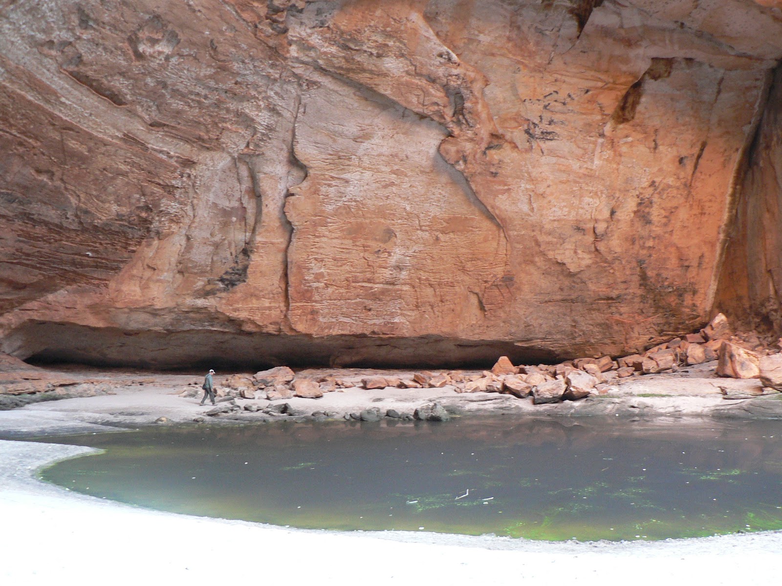
Emma Gorge is part of the El Questro wilderness park, so first we had to buy a permit at the resort to have the privilege to access the gorge. In the car park we had to open up the van and switch the fridge to gas, then we went on the gorge walk. It is a 1.6 km trek along the creek bed up to a huge circular waterhole among 120 m high vertical rock cliffs and a waterfall. It was quite a difficult walk, clambering through big fallen rocks and loose gravel, but it was worth the effort. The view and the vegetation all along and especially at the end is spectacular. The weather was clear and sunny but the air was not very hot so we did not feel like plunging in the pool, just had a bit of rest and appreciation of the surroundings then turned back.


From there it was another 11 kms to the turnoff to El Questro, and another 16 kms to the Station, on similar corrugated gravel road, with a few water crossings, including the Pentecost river, the first "real" water crossing with our van, even if the water was no more than 20-30 cm - it went without any problems. At the station we booked into the campsite and booked an afternoon boat tour to Chamberlain Gorge. We felt quite tired after the morning walk, so this seemed a better activity for the afternoon than another gorge walk. Then we set up the van, had lunch and a bit of rest, and by 3 pm we were at the jetty for the boat tour. 
Chamberlain gorge
The tour was not bad, but not a big deal either. The Chamberlain gorge is beautiful, but after Ketherine Gorge, it is hard to get excited about it. Especially after cyclone Ingrid devastated the whole area in 2005 and destroyed the vegetation along the water edge. The boat trip was a relatively short upstream run and back, but the lack of substance was compensated by the amount of champagne and fruit offered. There was also a bit of fish feeding at the turn-back. 
Overall, this El Questro wilderness park is far too commercial, profit oriented in every respect. We paid $40 for the permit (for 2 persons) and then another $40 for the campsite, where neither power, nor water are provided, only the site and amenities. Compared with other caravan parks and national parks it seems highly overpriced for what it provides. It was not a surprise, we knew what to expect, I am just confirming what we read in our guidebook. And it seems that there are plenty of customers who are happy (or at least, willing) to pay these prices, including ourselves... We had to come here because "you never-never know if you never-never go"!


Zebedee Springs
Wednesday, 27 June, Ellenbrae Station - We got up early and by 7 am we were at the Zebedee Hot Springs, only a few kms from the El Questro campsite. The water is about 30 degrees, flowing through several small pools in a beautiful palm jungle among the towering rock cliff faces. The pools are quite small and it is a very popular spot, but at early morning it was still not too busy. The water felt very good in the chilly morning, when the air is about 10 degrees. Coming out though is a bit of a shock, but it was worth it. Then we went back to the camp, had breakfast, packed up and left. There would have been many more attractions to visit at El Questro, but we had enough of this place. 
The Gibb River road
We crossed the Pentecost River
We travelled along the Gibb River road. The road was not too bad, quite wide and dusty, some sections fairly corrugated, but with the lower tyre pressure it was more bearable, though we had to get used to the rattling and dust from oncoming cars. Fortunately there was not too much traffic, about 2-3 cars per hour. The first real obstacle was the Pentecost River crossing, quite wide and bumpy rock bed, but the water was no more than about 30-40 cm, we got through easily.


We made a quick detour to Home Valley Station, just to look around. On the way out we were held up by a group of horsemen herding some cattle to a holding paddock, one of the tourist attractions offered by the station. 

Then stopped at a lookout a few kms further West. There is a nice view from here to the Cockburn Ranges. The other "attraction" is that if you climb up at a big rock and hold your arm up high, you can get mobile reception. Not very strong but good enough to send a few SMS messages to our children. 


The outdoor bathroom at
Ellenbrae Station
Around noon we found a parking spot and stopped for lunch, and by 3 pm we reached Ellenbrea station. We had enough of the driving for one day, so we booked into the campground. The station is a small but interesting place if one prefers more natural, down-to-earth environment rather than a tourist resort. The facilities are very basic and unusual, built by hand from bush materials. The campground is huge, and there was only one other camper on the site when we arrived, and one more came later in the evening. There is a swimming hole nearby, we had a look but did not feel like going in. Rather, we had a good hot shower heated by firewood, in the half-open bathroom-toilet. In the evening the 3 camping families came together around a campfire and we had a good chat with a couple from Perth and another from Austria.


Thursday, 28 June, Manning Gorge campsite - The night at Ellenbrae stn was even colder than before. At sunrise there was 7 degrees in the van. We have enough clothes and sleeping bag for the night, but it is not very comfy to get out of bed, and it takes about 2 hours to warm up to a more acceptable temperature. Unfortunately we have no facilities for heating without electricity. So the evenings and mornings are very chilly even inside the van.
Wandering cattle on the Gibb River Road
This morning, after long deliberation we changed our plan. We wanted to go up to the Mitchell Plateau, but it would take 4 days, one to Drysdale Stn, one to the Mitchell Plateau campsite, one to do the walk to Mitchell Falls, and one to get back to Drysdale stn, and we sould have to spend two nights in a tent, and the evening and morning outside where it would be even colder than in the van. Also, the travel on these gravel roads is anything but enjoyable, we will have enough of that on the 680 kms of the Gibb River road itself without detour. We have seen the Mitchell Falls from the air on our scenic flight last Thursday. Still, I know it would be much more interesting to do the walk and see it from ground level, but on balance, we though it would not worth all the inconvenience and hassle for 4 more days.


The van in the water
So we headed South-West on the Gibb River road. The road quality was very variable, some sections are almost as good as a sealed road, other parts are terribly corrugated. The landscape around the road is not particularly interesting. There were a few more water crossings but nothing serious. We got to the Kalumburu road junction by midday, where se stopped at the rest area for lunch and a little rest. Then we went on towards Derby for another 100 kms, including a few terribly rough sections. We got to the Mount Barnett Roadhouse around 3 pm, filled up the tank and booked into the Manning Gorge campsite, which is 7 kms up North from there. It is a nice wide area under big boab trees. There are a lot of people here, but enough place for everybody. We found a good site, made up the van, had a hot shower, cooked dinner and had a nice evening.
The Manning gorge campsite
Crossing the river
Friday, 29 June, Manning Gorge campsite - This morning we did the walk to the gorge itself. It was quite a difficult walk. The guide says it is 2 kms one way, but it felt much longer. First we had to cross the Manning river, which is about 50 m wide and deep, clear and very cold water. According to the guide the only way to cross is by swimming, and using the styrofoam boxes provided to take our gear across. We were prepared to do that but there was no need. There was a tin dinghy for everyone to use that could be pulled across on a rope and pulley. Then the walk took us across open stone country, up and down 3 little hills and valleys. It took more than an hour to get to the gorge in soaring heat. 
Manning gorge
There are several wide pools of water among the rock walls, and a pretty cascading waterfall at the end, a very picturesque place. We tried the water, but it was icy cold, I could not stand it for more than 30 seconds. But it was good to cool down. Then we just sat on a sandy bank for a while and enjoyed the scenery. Then it was time to go back, another one and a half hour trek in the midday heat. But the gorge was really beautiful, it was worth the effort. 


We had a late lunch in the van - in 32 degrees; these are the usual conditions here, freezing cold in the evening, night and morning, and baking hot over the day, no other option; if you don't like it, you should not come here - and a nice lazy afternoon resting and reading. In the evening we celebrated Kate's birthday in style, with some champagne. A nice day overall.


Saturday, 30 June, Bell Gorge campground - Today we drove another 100 km along the Gibb River Road Westward, and got to the Silent Grove campgorund. On the way we stopped at the Imintji store, just to have a look. This area is part of the Leopold Ranges National Park. The campgound is about 20 km to the North of the Gibb River Road, a wide, shaded and well managed area with some showers and toilets. We picked a good-looking site - it was good to arrive early, before 11 am, as this is a very popular place, it fills up quickly - set up the van, then immediately went on to visit Bell Gorge. 


Swimming in Bell gorge
The Bell Gorge car park is 10 km further up. Then it's a short walk to the top of the falls. It was a much easier walk than yesterday, although the track was rocky, uneven. According to some guides this is the most beautiful gorge along the Gibb River road - it is hard to rank them, but definitely this is a wonderful place. After looking around from the top, we took off our shoes and crossed the creek, then climbed down to the bottom part of the falls. There are several large waterholes down there among the smooth and slippery rock platforms, with lots of people swimming and sitting around. We also had a few good swims; the water is pretty cold, but not as freezing as Manning Gorge was. After the refreshing plunge, we had our picnic lunch there. Then we climbed back up and came back to the camp around 3.30 pm. By that time the camp has filled up well, we got a few neighburs a bit close for comfort. We still had some time for resting and cooking and hope to have a nince evening.
At the top of Bell Gorge
Windjana gorge campground
Sunday, 1 July, Windjana Gorge campground - Windjana Gorge is again about 100 kms further West on the Gibb River Road, then another 21 kms to the South to get to the campground. The Gibb River road section was quite good, with a few sections just re-graded in front of us. But then the access road to the gorge was pretty heavily corrugated in the first few kms. At the entrance we met the couple from Perth, Mark and Judy, whom we had an evening together at Ellenbrae stn. We got to the campsite early again, so we could pick a nice shady spot and set up the van. We had lunch and a rest. 
Windjana gorge
After 3 pm, when the heat abated a bit, we went to the gorge itself. It is an amazing place. Each time I think, another gorge, how boring, but when we got there, it turns out that it is soo totally different from the others we have seen. This one is a Devonian reef, 360 million years ago it was a coral reef under the sea. It is still very easy to see the same formations as what we have seen when snorkeling at the Great Barrier Reef. And the river going through the gorge, the Lennard river, is full of "freshies", we saw a lot of them resting along the water edge. 
Freshies in Windjana gorge
We came back to the campground around 4.30 pm, had a shower, then our firends, Mark and Judy invited us over for a bit of a chat and pre-dinner drinks. At the same time we had a chance to enjoy the sunset lights on the towering limestone walls behind the campground.
With Mark and Judy at the camp, the reef cliff in the background
Inside Tunnel Creek Gorge
Monday, 2 July, Windjana Gorge campground - This morning we left the van at the campground and went to visit Tunnel Creek National Park. It is 35 kms to the East, on fairly good gravel road, still part of the same Devonian Reef range. As the name suggests, Tunnel creek has carved a tunnel across the limestone of the Napier Range. It is about 750 m long tunnel that one can walk through, or rather scramble through slippery rocks and wade along the creek itself in darkness, using your own torch. The entrance is quite impressive with the walls of the Napier Range towering above. Inside we got into a big hall where there is still some daylight, with high ceiling and some stalactites. The path further in would go through a knee-deep pool of water and behind that the complete darkness, but we felt we had seen enough. We don't like caves, we did not have very good torches and my wet shoes filled up with gravel and became quite uncomfortable. So we turned back and came out only after a few minutes. Still it was interesting, it was not a waste of time.
On the way back we stopped at a historic site, the ruins of Lillimooloora Homestead, later a Poice Outpost. This was the place where the aboriginal freedom fighter (or outlaw by the settlers) Jandamarra shot a policemen and started his 3-year war against the police, finally having been shot at the entrance of Tunnel Creek. There is not much remaining from the building, only a few walls, but the story is interesting enough to attract visitors.
Back in the campsite we found a bad surprise. We have left the awning out on the van and by the time we got back, a strong windblow has damaged it. Someone in our absence has put a rope and tied the edge to the ground. The curved roof rafter was bent over, and one end where the awning is attached to the van was broken. The case of the awning was also bent a bit. I managed to realign it so that we could close it but it dose not look very safe. I fitted a rope around that end, hope it wont fell off on the road. The awning still looks usable but not sure how long. We will have to have it checked out by someone in Derby or Broome.
In the afternoon we had a second walk in Windjana Gorge. It is such a wonderful place, it was worth a second look. 


At the end of the Gibb River Road
Tuesday, 3 July, Derby - In the morning we packed up and left Windjana Gorge, and got to the end of the Gibb River road. It was an interesting trip, with many great places we were able to see, but we were glad to be back on the tarmac. No more dirt and corrugations! We had enough of that for a while. Our car worked very well, apart from the electric park brake that hated the dirt and often complained about it with screeching noises and refused to work. Our van coped also quite well with the difficult conditions, except for the dust intake which we were unable to stop. I would expect an off-road caravan should be better insulated.


We reached Derby and by midday we booked into a caravan park close to the centre of town. And we had mobile connection and email, and some radio stations, although not our favourite (ABC Classic). Back to the civilized world. After lunch and coffee we went for a tour of the town, the jetty, the main street lined with beautiful boab trees, and did some shopping. We also visited the visitor centre, and booked a luxury tour to the Horizontal Falls for Thursday.


Now we have the monumental task of cleaning everything, the van and the car in and outside, and all our clothes and belongings, as everything is full of red dirt. It will take a few days to get through it, but that is part of the experience.


Our itinerary can be seen at the following Google Map:
http://g.co/maps/wcwv8 
(Note that to see the route after Bowen, you need to move down to the bottom of the right panel, and select the following pages!)


Kedden, 26-án indultunk el a Gibb River Road-on. A tanácsokat követve leengedtünk a keréknyomásból 10 psi-t, remélve hogy a földút bordázata így elviselhetobb lesz. Ezen a napon nem mentünk messzire, csak kb 50 km-t, de így is eléggé megszenvedtük a bordázatot. Volt egy elég nagy patak is amin keresztül kellett menni, ez volt az elso "igazi" vízkeresztje a lakókocsinak, minden simán ment. Elso uticélunk az Emma Gorge volt, itt elgyalogoltunk a gorge-ba, nem hosszú de elég nehéz úton, sokat kellett patakmederben, nagy köveken csúszni-mászni. A végén eljutottunk egy kerek katlanba, vagy 120 m magas függoleges falak között, egy szép vízesés az oldalán, alján meg jó nagy vízmedence, gyönyöru hely. Sokan fürödtek, mi megkóstoltuk a vizet, és ennyi elég volt, jéghideg. De a látvány megérte a fáradságot.
Aztán továbbmentünk az El Questro Station kempingtáborába, oda is elég nehéz bevezeto földúton, néhány patakon átkelve. Itt megszálltunk, és délután befizettünk egy hajótúrára a Chamberlain Gorge-ba. Úgy elfáradtunk a délelotti mászkálásban, jobban esett kényelmesen nézelodni. A Chamberlain Gorge jóval szélesebb, és nem volt olyan érdekes, mint amiket eddig láttunk, de azért jól elnézelodtünk. Ami hiányzott a látvány különlegességébol, azt pótolták gyümülccsel, pezsgovel, nem bántuk. Volt egy kis hal-etetés is a végén, még egy teknost is láttunk.
Másnap (szerda, jun 27) reggel korán felkeltünk, és elmentünk autóval a közeli Zebedee Hot Springs-hez, hoforrásokhoz egy szép suru pálmaligetben. Több kisebb természetes vízmedencén folyik keresztül a patak, ezekben lehet fürödni. Elég kicsi az egész, és nagyon népszeru, jó korán mentünk, így még elviselheto volt. Bemenni nagyon kellemes, kijönni a reggeli 10-12 fokba nem annyira. Utána vissza a kempingbe, reggeli, pakolás, indulás. 
Tulajdonképpen még rengeteg látnivaló lett volna az El Questro station területén, de azokat inkább kihagytuk. Nem volt egy szimpatikus hely. Nagyon kommerciális, és ahhoz képes amit nyújtanak, nagyon drága. A kemping alapszolgáltatásaiért kétszer annyit fizettünk, mint máshol, és jóval kevesebbet kaptunk érte. Viszont remek a nemzetközi propagandájuk, áradnak hozzájuk a gazdag ázsiai és európai turisták, mindig sokan vannak, megtehetik hogy sokat kérnek.
Tovább a Gibb River road-on (GRR). Ez a szakasz nem volt olyan rossz, jó széles és viszonylag egyenes, néha rövidebb szakaszok erosen bordázottak, de az alacsonyabb keréknyomással jobban elviselheto. A zaj és vibráció mellett a szembejövo autók porfelhoje is elég kellemetlen, és jól le kell lassítani, mert teljesen láthatatlanná válik az út egy idore. Szerencsére nem volt nagy forgalom, óránként talán 3-4 autó jött szembe, és 1-2 meg is elozött, mert nem mentem gyorsabban 60 km-nél, így biztonságosabb. Nem sokkal az indulás után kereszteztük a Pentecost folyót, ez a legnagyobb vízfolyás amin keresztül kell menni, elég széles, jó köves az alja, de most a víz nem volt több mint 30-40 cm, így könnyen átjutottunk.
Útközben tettünk egy kitérot a Home Valley Station-hoz, csak éppen körülnézni, mert errol is azt olvastuk, hogy nagyon kommersz lett. Egy kicsit tovább volt egy kilátópont ahol megálltunk egy rövid idore, megcsodálni a környezo Cockburn hegyláncot, no meg gyorsan küldeni egy SMS-t a gyerkeinknek. Az egész GRR mentén ez az egy pont ahol mobil vétel található, de csak úgy, ha a telefont feltatom amilyen magasra csak birom.
Délután elértünk Ellenbrae Station-hoz, itt szálltunk meg éjszakára. Ez egy muködo marha legelteto telep, de van kempingjük is. Érdekes hely, minden ház, épület, mellékhelyiség helyi anyagokból van elég kezdetleges de ötletes módon összetákolva, nem ötcsillagos hely, de nekünk jobban tetszett, mint az El Questro. Itt alig van látogató, csak 3 pár volt velünk együtt, este összeültünk egy kis tuz mellett, jót beszélgettünk egy perth-i és egy ausztriai házaspárral. Az éjszaka nagyon hideg lett, reggel 7 fok volt a lakókocsinkban napkeltekor. Alvás közben nem fáztunk, jól fel tudunk öltözni, de az este meg foleg a reggel nagyon kellemetlen. Aztán 1-2 óra alatt jól felmelegszik megint, déltájban meg már harminc fok van vagy több is, de azt jobban viseljük mint a hideget. Sajnos csak egy kis elektormos hosugárzónk van, ami áram nélkül nem sokat ér. Ezekben a GRR melletti táborhelyeken nem lehet sem áramot sem vizet kapni a lakókocsihoz, csak WC és zuhany van általában, de meleg víz már nem mindig, az is csak délután, estére kifogy a napelemmel melegített víz.
Másnap reggel (csüt, 28 jun), részben a hideg éjszaka hatására is, megváltoztattuk az utitervünket. Eredetileg azt terveztük, hogy felmegyünk a Mitchell Plateau-ra, ami egy 4 napos kitéro lenne az GBR-ról, és abból kettot sátroban kellene tölteni, mert oda nem jutna föl a lakókocsi. Nehéz volt lemondani róla, de úgy érzetük, hogy nem érné meg a kellemetlenségeket, a nehéz, rossz, döcögos uton kb 500 km plusz vezetést (borzasztó távolságok vannak itt), a még hidegebb estéket-éjszakákat, nem is beszélve arról ha valami baj történik az autóval azon a méginkább elhagyatott környéken. A fo látványosságot, a Mitchell vízesést már egyébként is láttuk a repülorol múlt csütörtökön.
Így hát tovább mentünk délnyugat felé a GRR-en, változó minoségu útszakaszokon, de változatlan állandó nagymennyiségu porfelhoben. Megint kb du. 3 felé értünk az aznapi végcéunkhoz, Mount Barnett Roadhouse-hoz, ahol megtankoltunk és 7 km beköto úton bejutottunk a Manning Gorge táborhelyre. Ez egy szép tágas terület, sok boab fával. Jó helyet találtunk, és pihentünk, foztünk, kellemes esténk volt. 
Másnap (péntek, jun 29) is ittmaradtunk. Reggel elgyalogoltunk a gorge-hoz, ami egy elég nehéz túra volt. Eloször át kellett jutni egy jó széles (több mint 50 m) és mély patakon. Az utikünyvünk szerint át kell úszni, a holmit meg a parton odakészített hungarocell dobozokban áttólni, de végül erre nem volt szükség (szerencsére, mert késobb megtapasztaltuk, hogy a víz jéghideg), mert volt egy kis csónak két csiga között kötélen kifeszítve, abba beülve át tudtuk húzni magunkat szárazon. Aztán jött egy jó hosszú és elég nehéz gyalogút, míg végül eljutottunk a gorge-hoz, ami nagyon látványos volt, megérte a fáradságot. Lehetett volna fürödni is, én meg is próbáltam, de fél percnél tovább nem bírtam, olyan hideg volt a víz. Úgyhogy csak üldögéltünk és élveztük a látványt egy ideig, aztán mentünk vissza, ugyanazon az úton. Délután kipihentük a fáradalmakat, este pedig megünnepeltük Kati születés- és az én névnapomat egy üveg pezsgovel.
Szombaton (jun. 30) továbbmentünk kb 100 km-t a GRR-on, és még 20 km-t a beköto úton a Bell Gorge táborhelyéhez.  Ez egy nemzeti parkban van, de nagyon rendes kis hely. Jó hogy korán érkeztünk, így jó árnyékos helyet tudtunk választani. Miután felállítottuk a lakókocsit, még 10 km-t kellett autózni a gorge-hoz. Onnan már elég rövid volt a gyalogút, és gyönyöru szép a gorge, ez az egyik legszebb a sok közül. Megnéztük fölülrol, aztán lemásztunk az aljához, és itt jót fürödtünk is mindketten, jobb volt a víz, bár itt is elég hideg, de kibírható. Itt ettük meg az ebédünket, aztán mentünk vissza a táborba.
Vasárnap (jul 1) újabb kb 100 km után fordultunk el a Windjana Gorge táborhelyhez. Ez is hasonló volt az elozohöz, itt is jó helyet találtunk, és megszálltunk két éjszakára. Elso délután besétáltunk a Windjana Gorge-ba, ez tényleg könnyu séta volt az elozo napokhoz képest, és megint egészen különlegesen szépet láttunk. Minden alkalommal úgy indulunk, hogy na megint egy gorge, milyen unalmas, és mindig kiderül, hogy teljesen másmilyen mint az elozo, össze sem lehet hasonlítani oket. Ez a gorge egy 360 millió évvel ezelott (Devon) egy tengerparti korall-zátony vonulat része volt, aztán a  tenger visszahúzódótt, a terület felemelkedett, és a Lennard folyó lassan keresztülvágta magát a kanyonon. Jó széles, a kétoldalán vagy 120 m magas függoleges sziklafalak, amiken tisztán kivehetoek a korall-alakzatok, hasonlóak ahhoz, amit a Great Barrier Reef-en a vízalatt búvárkodva láttunk. A másik érdekessége hogy a Lennard folyóban rengeteg édesvizi krokodil él, láttunk vagy egy tucatot a parton sütkérezni, meg sem mozdulnak, és nem félnek az embertol, egész közel lehet menni hozzájuk. Nagyon érdekes hely volt. 
A táborhelyen megint összeakadtunk a perth-i házaspárral akikkel korábban Ellenbrae-ben már találkoztunk. Most is összeültünk egy kis beszélgetésre, szimpatikus emberek. Hívtak, hogy keressük meg oket ha eljutunk Perth-be.
Másnap (hétfo, jul 2), csak autóval elmentünk a közeli (35 km) Tunnel Creek-hez. Ez is annak a Devoni korallzátonynak a része, de itt a folyó a föld alatt vágott alagutat magának a korallon keresztül. Bele lehet menni, és végigmészni a majd egy km-es szakaszán, de nagyrészt vízben kell gázolni, és elemlámpát vinni mert sötét van. Vittünk lámpát, és vízbe való cipot is, de végül csak a kezdeti szakaszába mentünk bele, mert nem volt kedvünk a sötétben vízben botorkálni, a lámpánk meg nem volt elég eros ahhoz, hogy bármit is lássunk. De ez a kezdeti szakasza és a bejárata is elég érdekes volt, azért nem bántuk hogy megnéztük.
Visszafelé megálltunk egy történelmi emlékhelynél, a Lillimooloora Homestead, késobb rendorörs romjainál. Az 1880-as évek vége felé itt nagy kegyetlen véres küzdelem folyt az európai telepesek és az aboriginal oslakók között, és egy helyi szabadságharcos vagy bandita (nézopont kérdése), Jandamarra 3 évig bujkált a rendorök elol, míg végül megölték. A romok nem olyan érdekesek, de a történet sok turistát ide vonz.
A táborba visszaérve kellemetlen meglepetés várt. A A lakókocsink oldalán az árnyékoló elotetot kinyitva hagytuk, és amíg el voltunk, feltámadt a szél és egy szélroham kifordította és megrongálta az egészet. Valaki észrevette és lekötözte a végét a távollétünkben, de így is elég nagy bajt csinált. Egy középso merevíto rúd teljesen eldeformálódott, és a tartószerkezet egyik vége eltörött. Sikerült valamennyire visszahajlítgatni, úgyhogy be  lehet csukni, és talán még használni is lehet majd, de nem lesz tökéletes. Majd meglátjuk hogy muködik, és mit lehet tenni vele késobb.
Kedden, jul 3-án felpakoltunk Windjana Gorge-ban, és továbbindultunk a GRR-on, és délre visszaértünk a burkolt útra! Az oldal-kitéroket beleszámítva kb 900 km-t utaztunk földuton, nagyon érdekes volt, sok szépet láttunk, de örültünk, hogy ujra aszfalt van alattunk. Most egy ideig nem vágyunk újabb földútra, elég volt a porból és rázkódásból.
Déltájban beértünk Derby-be, és megszálltunk egy kempingben. Ujra van áramunk és vizünk, mobil és rádió vételünk. Szeretjük az exotikus kalandokat, de jó dolog egy kis civilizáció is. Most egy ideig ezt fogjuk élvezni.
Amit nem fogunk élvezni, de azért meg kell csinálni, az a tisztogatás ami most következik. Az autó is meg a lakókocsi is tele van porral, sárral kívül-belül, a ruháink és egyéb használati cikkeink is jó piszkosak, ez lesz a következo program.


Az útvonalunk a következo Google Map-on látható:
http://g.co/maps/wcwv8
(A Bowen utáni szakaszokhoz le kell menni a jobboldali panel aljára, és a következo oldalakra kattintani!!)

Wednesday, 4 July 2012

Purnululu (The Bungle Bungles)


(Magyar összefoglaló a végén)


[We were out of mobile reception in the last 12 days, travelling to the Bungles and then on the Gibb River Road. Now we are back in civilzation, but it will take a few days to catch up with the blog. I will split it up to several parts. There is a lot to report...]


Friday, 22 June, Warmun - As the first step towards the Bungles, this morning we drove down to Warmun, about 200 kms South from Kununurra, and checked into the campsite at the Roadhouse. We will leave the van here tomorrow when we go into the Bungle Bungles, that is Purnululu National Park. We got here before midday and set up the van in a nice, shady but quite small space. There is nothing much to do here, the only attraction is an Aboriginal Art Centre, which we wanted to visit, but we found it closed. So we had an easy relaxing afternoon in the camp, doing some cooking and preparations for tomorrow. This will be our first night away from the van, using the tent, so we need to do a bit of thinking and repacking.


Creek crossing on the way to the Bungles
Sunday, 24 June, Warmun - We have just returned from a two-day trip to Purnululu, so now I have to summarise the last two days. Saturday morning we left the van in Warmun, and drove down to the NP. It is 53 km dirt road to reach the park, quite hard at some places but not really dangerous, just lots of tight curves, blind crests, quite a few water crossings and of course, dust and corrugations. Following the advice at the turn-off, I reduced the tyre pressure by 10 psi, and it did make the corrugations less uncomfortable indeed. The roads inside the NP are easier but still corrugated and dusty, and there are quite long distances to reach the various attractions.
Echidna Chasm
On Saturday we went to the North section of the park. We got to the car park at 11 and did the first walk, to Echidna Chasm. This is a narrow gorge going deep into a fault line in between 200 m high vertical rock walls with varying colour hues. Towards the end the two walls are no more than a metre apart. 


Mini Palms Gorge
After lunch we did the other walk on the North side, to Mini Palms Gorge. This one is a bit longer, to another narrow gorge with lots of palms and a large circular amphitheatre at the end. At some sections we had to squeeze through narrow gaps between large fallen rocks, fortunately we are thin enough to make it. I don't have the language skills to do justice to the scenery that we saw, all I will say is that it is amazing. Even the photos and videos we took can only show very little of the whole panorama. 

Our campsite
After the second walk we had to rush to the Kurrajong campground to set up our tent before sunset. We have not used this tent before so it took a while to do it and we missed the sunset walk. The evening was pretty cold, but we were well prepared. By 8 pm we finished dinner and we were happy to go to bed early. 
Sunday morning we got up as soon as the sun rose, around 6 am, had breakfast and packed up everything, which took about 2 hours, but just after 8 am we were on our way to the Southern part of the park, about 35 km away. We got to the car park around 9 am, and went on a walking tour including all the attractions around here. This is the most famous area of the park, all the pictures and commercials about the Bungle Bungles show these characteristic behive rock formations. 


Cathedral Gorge
We went around the Domes, to the Cathedral Gorge - my favourite of all we saw, a large amphitheatre with amazing acoustics - and then to a lookout to see more domes. By lunchtime we finished all the walks apart from the Piccaninny Gorge walk which is a several-day hike with bush camping, not our cup of tea. So after lunch and coffee we bid farewell to the Bungles and drove back to Warmun, the same way as we came. It took most of the afternoon, a pretty tiresom drive. In fact, the whole two days of the Bungles were pretty intense, but it was worth it, a wonderful experience. When we got back to our van at Warmun, we had a quick dinner after packing and rearranging all our gear and cleaning the car as much as we could from all the dust, then we went to bed early as we were dead tired.


Monday, 25 June, Cockburn Rest Area - This morning we went to check out the Art Centre in Warmun, but we did not find anything interesting. Then we left Warmun and drove back North, to the junction of the Great Northern and the Victoria Hwy, to this nice Cockburn Rest Area. We set up the van and had lunch and a bit of rest. 
Then we drove back to Kununurra, another 45 km back, to stock up before we embark on the Gibb River Road trip. We also visited an art gallery where I found what I was looking for: a large selection of engraved boab nuts. We saw some of these in the Kalumburu museum and I thought they would be a nice souvenir for this part of Australia. It was hard to chose one, but finally I picked one. We also dropped into the Argyle Diamonds shop, just to see what's on offer; there is plenty of nice gems but it was not hard to leave without buying anything...
By 5 pm we were back at the van, for a quiet evening. Tomorrow morning we head to the Gibb River Road!


Our itinerary can be seen at the following Google Map:
http://g.co/maps/wcwv8 
(Note that to see the route after Bowen, you need to move down to the bottom of the right panel, and select the following pages!)


[Az elmúlt 12 napban olyan helyeken jártunk ahol nem volt internet kapcsolat. Tegnap érkeztünk vissza "civilizált" környezetbe, és most egy ideig itt is maradunk a környéken, de bele fog telni egy pár napba amíg behozom a lemaradást. Több részletben fogom küldeni mert sok a mondanivaló és egyszerre nincs olyan sok idom írni.]


Múlt pénteken, jun. 22-én felszedtük a sátorfánkat Kununurra-ból és továbbmentünk dél felé a foúton kb 150 km-t egy Warmun nevu kis helyre. Itt megszálltunk egy kempingben 3 napra, legalábis a lakókocsit itt hagytuk, és másnap (szombat) reggel csak az autóval mentünk a közeli Purnululu nemzeti parkba, jobban ismert nevén a "Bungle Bungles"-hez. Ez az egyik leghíresebb nevezetesség ezen a vidéken, egy érdkes természeti képzodmény, sok-sok kúp vagy kaptár alakú sziklaformák, szuk kanyonok közel 200 m magas függoleges sziklafalak között, pálmaligetek,...


A parkhoz eljutni nem könnyu, 50 km földút, keskeny, erosen kanyargós, sok beláthatatlan bukkanóval, néhány patakon is át kell kelni. Ezért hagytuk a lakókocsit kint, ezt nem bírta volna. Maga a park is óriási terület, egy nap alatt nem tudtuk volna megnézni az összes látnivalót. Vittünk sátrat, gázfozot, minden szükséges felszerelést, és ott töltöttük az éjszakát sok más látogatóval együtt. Nem lett volna rossz, csak estére-éjszakára jó hideg lett, biztos tíz fok alatt. Alvás közben nem fáztunk, de az este meg a reggel nem volt kellemes. Azért túléltük, megfázás nélkül, és a látnivalók megérték a kellemetlenséget. Jó sokat kellett gyalogolni is, többnyire kiszáradt patakmederben, laza kavicson vagy nagyobb sziklákon mászni-kapaszkodni, jól elfáradtunk bele, de nagy élmény volt. Rendben vissza is értünk a foútra és az otthagyott lakókocsinkhoz vasárnap estére, jól esett ujra a kényelem. 


Másnap, hétfon reggel ujra felpakoltunk és visszamentünk északra, a Kununurra útelágazásig. Itt egy pihenoben meg lehet aludni egy éjszakára. Felállítottuk a lakókocsit, megebédeltünk, aztán itthagytuk a lakókocsit, és bementünk Kununurrába bevásárolni a "nagy útra". Másnap reggel elindultunk a Gibb River Road-on, egy majd 700 km hosszú földút a Kimberley régió közepén, ami felfuzi a környék legtöbb érdekes és híres nevezetességét. Ezt mondják Ausztrália utolsó igazi természetes vadonságának, ez volt az egész tervezett utunk legfobb célja. De ezt az utazást majd a következo beszámolóban írom le (hamarosan).


Az útvonalunk a következo Google Map-on látható:
http://g.co/maps/wcwv8
(A Bowen utáni szakaszokhoz le kell menni a jobboldali panel aljára, és a következo oldalakra kattintani!!)

Thursday, 21 June 2012

Kununurra, WA

(Magyar összefoglaló a végén)


A boab tree
Saturday, 16 June, Saddle Creek Rest Area - Not much to report. In the morning we took advantage of the good internet connection to upload the next posting to our blog site, then packed up and left Katherine on the Victoria Highway. We travelled all day with a lunch stop at the Victoria Roadhouse, and stopped a little before the Western Australian border. Just after Timber Creek we saw the first boab trees, an indication that we are getting close to WA. This Saddle Creek rest area is a very popular spot, because it is under a beautiful red rock escarpment. We got here around 5 pm and the area was almost fill, but we could still find a space to set up the van. Kate had a lot of cooking to do, to make use of all the vegetables that otherwise would have to be thrown out at the WA border.


It was a very hot day, the hottest so far that we experienced. 34 degrees all afternoon, and even now, more than an hour after sunset it is above 30 degrees in the van. The fan in the ceiling does not help much. Hope it will cool down a bit more over the evening so that we can sleep. 


Sunday, 17 June, Kununurra - It took a long time yesterday evening to cool down, and even the night was warm, at sunrise it was still 24 degrees. Just an hour after breakfast we got to the WA border, with two short stops to finish off with our remaining fruit supply that can't be taken to WA. The quarantine inspection went smoothly and quickly, no problems. By around 11 am we gont into Kununurra.


In fact, it was 11 am Northern Territory time, but in WA it was only 9.30 am, a big change, showing how far we came from Sydney, 2 hours time difference. But both NT and WA times are a bit misaligned with the "real" time of day. In NT sunrise was only around 7.15 am, and sunset at 6.15 pm, now in Kununurra we just saw the sun going down exactly at 5pm. Anyway, we will get used to it.


Our campsite in Kununurra
We booked into a lakeside caravan park; it was not simple, first we were told to wait as there were no more powered sites available, but finally we've got the nicest site that we ever had before, a big well shaded grassy place among palm trees normally reserved for groups. We spent most of the day in the camp, plunging in the pool and resting. Late afternoon we went for a little drive to discover the town, did some shopping and climbed up to a lookout just beside the town centre, Kelly's Knob. Beautiful views of the surrounding rocky landscape and the town and lake in the evening lights, well worth the effort.
View of Kununurra from Kelly's Knob
We have now passed more than two months on the road, one-third of our planned trip, and travelled more than 10 thousand kms. Fortunately we are still enjoying the experience and each other's company... Another milestone to mention is that now that we entered WA, we have visited each Australian state.


Monday, 18 June, Kununurra - It was strage to wake up to daylight around 6 am, 1.5 hours earlier than in NT, but we can easily get used to this. In the morning we went to Lake Argyle, about 70 kms from here. It is a nice easy and scenic drive among various red rock outcrops characteristic of the Kimberley region. 
First we visited the Durack Homestead, moved up from its original place which is now under water and rebuilt as a museum showcasing the early life and the history of the Durack family. 


Then we went on to several lookout points to get a view of the Ord River Dam and Lake Argyle, a vast man-made lake 21 times the size of Sydney Harbour. It is a beautiful sight the dark-blue water in between the red rock ranges with a bit of lush vegetation around the lake.
The Ord River Gorge below the dam
A curious bird at the Lake Argyle picnic area
By midday we were back in town and dropped in the Visitor Centre to get some info on the Gibb River road, but we did not hear anything new.
We spent the afternoon in the camp, resting and chatting with a couple of fellow Eco Tourer owners, Brian and Maree, discussing our travel experiences and little tricks about our van.


Tuesday, 19 June, Kununurra - Today we did an excursion to Wyndham, the Northernmost town in WA, about 100 km from Kununurra. On the way up we made a detour on 23 km dirt road to see the "Prison Tree", a very old, enormous boab tree, with a huge cavity in its trunk, that was used in the early days to keep prisoners locked up inside overnight. The tree is said to be more than 2 thousand years old. It is a very interesting sight indeed. 


The rivers at Wyndham Port
Wyndham is a small and fairly desolate sleepy little town, not much life in it. There is a nice lookout above it, called the Five Rivers lookout (or the Bastion), because one can see five rivers: King, Pentecost, Durack, Forrest and Ord River, coming together and flowing into the Cambridge Gulf. There is a little port with very little movement in it. There was a meatworks until the mid-80s but when it closed, the town has started to decline. There is a crocodile farm as a tourist attraction that is not attracting many tourists, at least right now. 


Another giant boab tree in Wyndham
There is a small museum that we visited, showing life and history of the town and surroundings, it was quite complete and interesting. We had lunch in the Wyndham Town Hotel, that looked abandoned from the outside, and poorly maintained from the inside, but the pan-fried barramundi was not too bad. Overall, an interesting experience, but not one of the top destinations in our trip.


On return to Kununurra we did some shopping then a quiet afternoon at the camp.


Wednesday, 20 June, Kununurra - This morning we had to move to a different place in the caravan park because a group was coming to the place originally given to us. It was only a short distance, but still we had to pack up the van completely and then set it up again, it took about an hour. Our new place is just beside the pool, also quite nice, apart from the continuous buzzing of the pool machinery day and night but we have to live with that, and we can.


At the Hoochery Distillery
Then we went on a little tour of attractions around Kununurra: first the plantations irrigated by the Ord River channels and the Sandalwood Factory, where we glanced through all the various cosmetics on offer, all made of sandalwood oil. Then to the Hoochery Distillery, where they make rum and different kinds of liquers from sugarcane. We sampled some of the products and ended up buying a few for later enjoyment. 


The Ivanhoe Crossing
From there we drove to the Ivanhoe Crossing, where an old road is going across the Ord River at a ford. Although the water level is just about 10-15 cm above the cemented ford, the crossing is closed to vehicles as the water is flowing very fast. It is an interesting place to look at, and seemingly very popular with local (and tourist) fishermen.


We came back to the camp by lunchtime and spent a lazy afternoon reading and resting.


King George Falls

Thursday, 21 June, Kununurra - Today we went on a scenic flight around the Northern coast of the Kimberley. It was a very small aircraft, a Cessna-210, with a young female pilot. The flight took 4.5 hours, but it took almost all day with a stopover in Kalumburu, the Northernmost community in WA. It is hard to describe in words the magnificent scenery we saw all the way. There were several highlights: the North coastline with its pristine beaches and clear green-blue waters of the Timor sea, the King George Falls, and in the afternoon the Mitchell Falls and the Cockburn Ranges.


The altar in the Mission Temple
Kalumburu started off as a Benedictine Mission at a different place called Pago in 1913, then moved to the current location in 1931. There were monks and nuns, the last of which left only a few years ago and the township is now managed by the aboriginal community. But the Mission is still alive and working for the community. We visited the mission and the museum established by the missionaries from 1984. It has a large collection of artifacts, local and from other parts of Australia and the world. It also presents the past and present history of the town. 


After the museum we also saw the site where two WW2 aircrafts crashed, the scattered parts of the fuselage are still very impressive.
Apart from the highlight tourist attractions, flying low above the earth in a small plane is in itself a very interesting experience, almost any part of the landscape seems so beautiful from above. We thoroughly enjoyed this experience. We have several anniversaries coming up in the next few days, this was a collective present for both of us.
The Mitchell Falls
The Cockburn Ranges and the Gibb River Road
It was about 4 pm by the time we got back to the camp, so there was no time for anything else, but this flight tour was enough excitement for a day. 
Tomorrow we head off to the Bungles!


Our itinerary can be seen at the following Google Map:
http://g.co/maps/wcwv8 
(Note that to see the route after Bowen, you need to move down to the bottom of the right panel, and select the following pages!)


Szombaton reggel elindultunk Katherne-bol, és egy éjszakai szabad-kempingezés után vasárnap reggel átléptünk Nyugat-Ausztráliába és délelott 11 felé meg is érkeztünk Kununurra-ba. Pontosabban a határ-átlépéssel az órát is vissza kellett állítani másfél órával, úgyhogy itteni ido szerint fél tízkor érkeztünk. Hozzá kell szokni ehhez az ido-különbséghez. Eddig a Northern Territory-ban hét után kelt csak a nap, és este negyed 7 körül volt naplemente. Itt meg már reggel 6-kor kel a nap, viszont este 5-kor megy le, így jó hosszú téli estéink vannak. Igaz, hogy közel vagyunk a legrövidebb naphoz, ez nem is olyan meglepo.
Kununurra egy elég kis város, de a fo turista-idényben, ami most kezdodik, nagyon felduzzad, rengeteg a magunkfajta "gray nomad", no meg pár fiatalabb utazó, mi is elég nehezen kaptunk helyet a lakókocsinknak. Ez az észak-keleti kezdopontja a Kimberley-régiónak, az itteni leghíresebb turista-nevezetességnek.
Vasárnap óta itt töltöttük az idot, kisebb kirándulásokat tettünk a környéken, és sokat pihentünk ebben a kellemes kempingben. Egyik nap elmentünk a Lake Argyle-hoz, egy hatalmas mesterséges tó az Ord folyó gátja fölött. Több szép kilátó pontról lehet körülnézni a tóra és a környezo tipikus vöröses-barna szikladombokra. Mellette meglátogattunk egy régi farmházat is a 18. szd végérol, az egyik elso híres farmer család, a Durack család eredeti farmházát, amit szétszedtek és ujra felépítettek itt amikor a duzzasztás elkezdodött.
Egy másik nap kirándultunk Wyndham-ba, 100 km északra egy kis kikötovárosba, ami nem volt nagyon érdekes. Alig van benne élet mióta megszunt a mellette korábban muködo hús-feldolgozó üzem. Viszont a környezete elég érdekes, öt folyó jön itt össze egy kis helyen és közös torkolattal folyik a Cambridge öbölbe. Van egy kilátó-pont a városka fölött ahonnan mind az öt folyót be lehet látni. Egy másik érdekességért 23 km-es kitérot tettünk földuton: az ún. "börtön-fa", egy óriási boab-fa, aminek üreges a belseje és van egy nagy luk az oldalában, a régi idokben a rendorök útközben ide dugták be a foglyot éjszakára. A fa enélkül is csak a méreteivel fantasztikus látvány, több mint kétezer évesre becsülik. Láttunk egy másik hasonló méretu óriást is Wyndham-ban, luk és más történet nélkül, de az is gyönyöru volt.
Itt a környéken megnéztük a duzzasztóvból öntözött területeket, ahol most leginkább indiai sandal-fákat nevelnek, megnéztük a gyár bemutató-termét ahol remgeteg kölönféle kozmetikumot készítenek a fából sajtolt olajból. Aztán megnéztünk egy lepárló üzemet, ahol cukornádat dolgoznak fel, rumot és többféle likort csinálnak belole. Kóstolót is kaptunk, és végül vettünk is egy kis tartalékot a további útra.
Ma pedig egész különleges élményben volt részünk: elmentünk egy repülos kirándulásra. Majdnem egésznapos túra volt egy kis ötszemélyes gépen (Cessna-210) egy szimpatikus fiatal no pilótával, rengeteget láttunk, 4 és fél órát repültünk, fel a kontinens északi partja mentén nyugatra és kicsit délebbre vissza egy nagy körben, közben egy sor nevezet természeti szépséget láthattunk, folyóvölgyeket, vízeséseket, sziklás hegyláncokat, elhagyott tengerparti öblöket a Timor tenger partján. Délben leszálltunk egy Kalumburu nevu kis aboriginal faluban, ebédet is kaptunk és megnéztük a "misszió"-t amit Benedek-rendi barátok alapítottak 1913-ban. Láttuk a múzeumot rengeteg érdekes rajzzal-képpel faragással, és a misszió történetével. A nevezetsségek mellett maga a kis repüloben alacsonyan repülés is nagyon érdekes ujdonság volt nekem, a föld jelentéktelenebb részei is olyan szépek fölülrol. Persze jó sokba került, de nagyon élveztük, megérte. Ez volt a közös ajándék mindkettonk közeli ünnepeire.


Holnap reggel aztán tovább indulunk a következo látványosság felé.


Az útvonalunk a következo Google Map-on látható:
http://g.co/maps/wcwv8
(A Bowen utáni szakaszokhoz le kell menni a jobboldali panel aljára, és a következo oldalakra kattintani!!)