Wednesday, 12 November 2014

The Victorian Alps

 (Magyar változat a végén)


Bowna rest area
On this tour our first destination was the Victorian Alps, then we planned to go across the Snowy Mountains, finishing the tour somewhere on the NSW South Coast in about 2 weeks time. On the first day (Thursday,  30 October 2014) we travelled South along the Hume Highway and spent the night near the Victorian border at a free campsite (Bowna rest area), a pleasant spot although no facilities whatsoever, just a little clearing under big eucalypt trees but a bit further from the road, reasonably quiet and we had everything we need in our van.


Beechworth main street and Post Office
On Friday we passed through to Victoria and settled for the night in a caravan park in Beechworth. This is one of the many small towns born during the mid-19th century gold rush and still living from its past history and tourism, plus farming but they seem to be living quite well. In the morning we walked along the main street up and down, among many well preserved and maintained historical buildings, including the courthouse and gaol, where Ned Kelly had spent two years. 


They think there is still gold there...
In the afternoon we drove out to another old gold mining centre nearby, El Dorado and the Woolshed Valley. In its heyday in the 1870s more than 2000 people lived in and around town digging for gold. Almost nothing remained visible from that era, only signs and info boards telling the stories and showing some old photos. Some of the sites are showing the activities of the Kelly Gang in this area. We drove along the valley, in 33 degrees, dutifully reading all the stories, and saw quite a few people still digging or panning for gold around the river. Then at the end visited the Woolshed Falls. 
Woolshed Falls
New playground in Bright
After the hot and humid Friday, by Saturday morning the temperature dropped down to 14-15 degrees and rained almost all morning. We drove to Brigth, the tourist centre of the Victorian Alps where we had spent our end-of-year holiday with a group of friends in 2007. We planned to stay at a free campsite just outside town, but after a quick look at the site in pouring rain we gave up the idea and went back to Bright. We were lucky to find a spot in a caravan park at the second attempt, as all places were booked out due to the Melbourne Cup long week-end holiday. 


Octoberfest in Bright
By late morning the rain has stopped and we had a walk around the town centre. It is always a very busy place, now it seemed all Victorians have assembled here for some reason. We admired the beautiful tree lines, cedars, bunyas and others, along the streets. Octoberfest was still going on (in November) in a big tent with weissbier and German sausages and the Wondonga Brass Band playing the appropriate "schrammel" tunes. 
View of the Bogong High Plains from Tawonga Gap
This is what we saw from Falls Creek
In the afternoon we went to visit Falls Creek where we haven't been before. At the beginning the weather was quite promising, nice views from the Tawonga Gap towards the Falls Creek valley, but by the time we climbed up to the Falls Creek ski resort (at 1760 m elevation), it was 4 degrees and sleet. So we just turned around without getting out and drove back home.   


Next day (Sunday, 2 Nov) the weather was a bit better. We continued Southbound, first stopping at the nearby salmon and trout hatchery, to feed the fish and enjoy their play and fight for food in the water. 


Victoria Falls campsite
Then, after climbing through the Alps at Mount Hotham, we stopped at a nice free camp site at the Victoria Falls Historic Area. The history here also relates to gold mining but this time it is not the mining itself but the first hydro-electric power plant built in Australia based on the small dam on the Victoria River nearby. We spent a pleasant afternoon and evening here, visiting the falls, and chatting with some fellow-campers at their fireplace. The night was pretty cold though, 3 degrees inside the van at daybreak, as this spot is still close to 1000 m elevation.
Victoria Falls
Alpine flowers
 Monday morning we drove in to Omeo, "the business centre for the Omeo Region and a pioneering farming town known for its gold rush history and High Country Cattlemen". It was a beautiful day, bright sunshine, we walked around the old historic precinct, showing the usual old buildings, courthouse and gaol (it seems these were the most important community buildings everywhere). 
The Gaol, Omeo
Court House, Omeo


At lunchtime we visited one more gold mining area just outside town, the Oriental Claims Historic Area. We did one of the loop tracks around the mining sites, had lunch, then moved on.
Oriental Claims gold mine

The Blue Duck Inn
Our campsite for the next two days was at Anglers Rest, just 30 kms to the North of Omeo, where the Cobungra, Bundarra and Mitta Mitta rivers meet. A very nice spot right on the river bank. The historic Mitta Bridge and the Blue Duck Inn are at the bottom end of the campsite for hungry and/or thirsty anglers (blue duck is the name of a gold claim which did not produce any gold). There were quite a few other campers around on Monday (which was a public holiday in Victoria, together with Tuesday when the big race was on in Melbourne) but the place was almost empty by next morning. 
The Mitta Bridge

Wallace's Hut
On Tuesday we drove back up towards Falls Creek and did a short walk to Wallace's Hut, then on to Cope Hut and back. We have been here in 2007 but it is such a nice area, beautiful alpine vegetation that it's worth a second look. It was pretty cold up there (around 1750 m elevation), no more than 10-11 degrees and very strong winds out in the open, but it was a nice walk nonetheless. We came down to the campsite for lunch and a quiet afternoon and evening, with some cooking and tea around the fireplace.  


Snow gums on the high plains
Life at Anglers Rest
Making tea on the fire

2014 okt. 30-án csütörtök reggel indultunk Sydney-ből az újabb lakókocsis túránkra, amit 2 hétre terveztünk. Az elso nap csak utaztunk dél felé, a Victoria-i határ közelében álltunk meg éjszakára egy szabad kemping-helyen. Kellemes hely volt, ugyan semmi létesítmény nem volt, csak egy szép tisztás a nagy fák tövében, de kicsit messzebb az úttól, nem volt túl zajos, és szerencsére önellátók vagyunk, van miden ami szükséges a lakókocsinkban.

Pénteken átjöttünk Victora államba, és egy Beechworth nevu kis városkában szálltunk meg egy kempingben. Ez is egy 19. szd-i aranybányász település, ami a múltjából él, foleg turizmusból, no meg a környéki állattartásból, de úgy tunik, elég jól élnek. Délelőtt körülsétáltunk a város foutcáján, megnéztük a "történelmi" épületeket, minden nagyon szépen rendben van tartva. Ebéd után meg tettünk egy autós körutat, egy másik jelentős arany-bányászati központba, Eldorado a neve, ma már csak táblák mutatják az egykori bányászati és egyéb emlék-helyeket, pl. itt "dolgozott" Ausztrália leghíresebb "bushranger" (rabló) bandája, a Ned Kelly gang. A végén még egy szép vízesést is láttunk.

Az idő jól felmelegedett, napközben 32-33 fok volt, reggel meg 9 fok volt a lakókocsiban, de nem panaszkodunk, mindkettot kibírtuk, soha rosszabbat.

A pénteki hőség után szombaton 14-15 fok volt és majdnem egész nap zuhogott az eső, ehhez alakítottuk a programot. Továbbmentünk Bright-ba, egy Alpok-völgyi turista-központba, ahol 7 éve nyaraltunk a szokásos baráti társasággal. Mivel Victoria-ban 4-napos hosszú hétvége volt (a Melbourne Cup lóverseny alkalmából) minden kemping tele volt, de végül nagy nehezen kaptunk egy helyet, ott aludtunk. Nem így terveztük, de az esőben ez volt a legjobb megoldás. Napközben azért nem esett végig, körülsétáltunk a faluban, volt mindenféle attrakció, többek között Oktobefest alkalmából nagy sátorban sör és német kolbász, fúvós-zenekarral. Felautóztunk egy sí-központba is kb 1750 m-re, de mire felértünk 4 fok volt és havaseso esett, úgyhogy ki se szálltunk az autóból, visszafordultunk.

Másnapra kicsit megjavult az ido, továbbindultunk dél felé, átmásztunk a Victoriai Alpokon (1800 m magas hágón) és aztán egész héten kellemes szabad kemping-helyeken töltöttük az éjszakát. Volt hogy éjszaka-hajnalban nagyon hideg volt, de már elég jól fel vagyunk szerelve, tudunk védekezni. Megnéztünk egy Omeo nevu kisvárost, elgyalogoltunk a Wallace's hut-hoz, ez a 19. szd második felében épült bádog-teteju fa kunyhó, ahol a pásztorok laktak a nyári idényben. Itt is jártunk már 2007-ben, de olyan szép a környéke meg az alpesi növényzet, szívesen megnéztük ujra. A kedd délutánt a táborhelyen töltöttük, olvastunk, pihentünk, főztünk, este tüzet raktunk, teáztunk a tűz mellett. 

Saturday, 28 June 2014

Back to Sydney

(Magyar változat a végén)

Saturday, 28 Jun 2014

Memorial to Dorothea Mackellar, Australian poet,
author of  "My country", in Gunnedah.
In the background, one of the places
we looked for koalas unsuccessfully.
 Thursday morning we had another enjoyable plunge in the hot thermal pools of the Moree caravan park, then we packed up and left, starting slowly back towards home. By lunchtime we reached Gunnedah. This town is said to be "the koala capital of Australia" which sounded exciting enough to spend the afternoon and  night here. During the 23 years we had spent in Australia we travelled a lot, we saw lots of native animals in the wild, but only one koala back in 2001 on Philip Island, from very far, a small dark blob at the very top of a big tree. In the afternoon we went to the visitor centre to inquire where to go to find some. We got several suggestions, we went to each place, walked along, looked every tree, but there were no koalas.

Industrial landscape in the Upper Hunter Valley
Flying foxes invaded the
town square in Singleton.
Friday morning again we had a half-day drive back towards Sydney and a stop-over in Singleton. After lunch and siesta we went in to the town to look around, it was a nice sunny afternoon, we enjoyed the walk in the centre. But the night was pretty chilly, early morning it was 4 degrees inside the van - fortunately we could switch on the electric heater and wait in our sleeping bags until the air warmed up a bit in the van.

The Anglican Church, Singleton

Saturday morning we packed up and by lunchtime we were back at home in Sydney - The end of another short but enjoyable trip, that has proven that even winter-time may be worth travelling in our van if we stay in caravan parks with power supply.

                                                                         -- o --

Csütörtök reggel még egyszer kiélveztük a kemping termál-medencéit, aztán indultunk tovább, illetve lassan hazafelé. Délre Gunnedah-ba értünk, itt megszálltunk egy éjszakára. Ez a város úgy hirdeti magát, hogy "ez a koalák fővárosa", ami izgalmasan hangzott. A 23 év alatt amit itt töltöttünk, sokat utaztunk, rengeteg vadon élő állatot láttunk, de koalát eddig csak egyszer, még 1991-ben, akkor is egész messziről, egy magas fa tetején egy kis sötét csomó. Délután bementünk a turista-idrodába, megkérdeztük, hova menjünk koalát keresni, hát küldtek erre-arra, el is mentünk mindegyik helyre, végignéztük az összes fát, de koalát nem sikerült látnunk. Ettől eltekintve helyes kis város volt, sétáltunk egyet, nem bántuk meg.

Pénteken megint csak délelőtt autóztunk hazafelé, déltájban megszálltunk Singleton-ban. Ebéd és pihenés után megint bementünk a városba körülnézni, nagyon szép napos idő volt jól esett sétálni. Éjszaka viszont jól lehűl a levegő, reggelenként 4-5 fok van a lakókocsiban, de ilyenkor bekapcsoljuk a hősugárzót, és visszabujunk a hálózsákba, megvárjuk amíg kicsit felmelegszik.

Ma, szombat reggel hazaindultunk, és fél egy felé rendben ide is értünk. A házban mindent rendben találtunk, azóta már nagyjából kipakoltunk, elkezdtük a rendrakást, mosást, stb. de még maradt belőle bőven holnapra is. 

Wednesday, 25 June 2014

Moree

(Magyar változat a végén)

Wednesday, 25 June 2014, Moree

Our grandson, Linux
Monday morning we got the news: our grandson was born on 22nd Jun!! His name is Linux, 3.30 kg, 50 cm, mother and baby are doing well, everybody is happy, including us... It goes without saying he is the most beautiful child on Earth...


We spent Monday still in the Warrumbungle NP, doing two shorter easy walks near the campsite, the Wambelong Canyon and the Burbie Canyon tracks and enjoying our new grandparent status. We saw lots of birds, kangaroos and a few emus. We were looking for that koala again in the afternoon, going slowly from tree to tree, but could not find her. 
The Wambelong Canyon
Sandstone Caves, Pilliga Nature Reserve
Tuesday morning we left the Warrumbungles, stopped in Coonabarabran for some shopping and filling up with fuel and water, then headed North towards Moree. Along the way we stopped at the Sandstone Caves in the Pilliga Nature Reserve, about 33 km North of Coonabarabran. This is an Aboriginal site for the local Gamilaraay people, but apart from some grindig grooves and a few rock engravings most of the art here was created by nature itself, an amazing cavalcade of colours and forms carved into to soft sandstone walls by heat, wind and water. A 1.7 km circuit leads around the sandstone hill through the numerous caves. 
Sandstone Caves, Pilliga Nature Reserve

Sandstone Caves, Pilliga Nature Reserve

Sandstone Caves, Pilliga Nature Reserve
The Thermal Bath in the caravan park
We reached Moree around 4 pm, just in time to get one of the last available spare places in the caravan park. Moree is famous for its hot mineral baths, discovered by accident in 1895 when, searching for irrigation water, wells were sunk into the Great Artesian Basin from which 41 degree hot mineral water came up. We were surprised to find the place full of, dominantly elderly, people crammed into the caravan park, as well as to the many hotels and motels of the town. The caravan park itself has its own thermal baths, which we had to try immediately. The hot (37-39 degree) water is very enjoyable indeed in the chilly winter air, but the pools were a bit too crowded for our liking.

A Queen Ann style building from the 1920s in Moree
Today, we went to the town centre in the morning, and as usual, after a brief stop at the visitor centre, we dutifully walked along the heritage trail to discover some historic buildings. Then we went to the recently renovated Aquatic Centre to enjoy a bit more of the main attraction of Moree. It is a very nice complex, with several pools of different temperature, from 28 in the Olympic swimming pool to 40.5 in the hottest sitting basin. We enjoyed the clear sunny day with relatively few other people in the various pools. 

The Olympic pool in the Aquatic Centre


Enjoynig the thermal waters
We went back to camp for lunch and spent the afternoon in the van, exhausted from the morning exercise. After that very nice aquatic centre we did not feel like sitting again in the crowded baths in the camp.


Hétfő reggel kaptuk a hírt, hogy (brüsszeli idő szerint) jun. 22-én vasárnap délután megszületett az unokánk!! Neve Linux, 3.30 kg, 50 cm, mama és fia jól vannak, mindenki boldog, minket is beleértve. Mondanom sem kell, hogy a világ legszebb kisbabája...

A hétfői napot még a Warumbungle NP-ben töltöttük, két könnyebb túrát tettünk a tábor közelében. Láttunk sok kengurut, madarat meg néhány emut. Délután megint kerestük a koalát, fától-fáig jártunk lassan szemlélődve, de nem láttunk semmit.

Kedden tovább indultunk a Warrumbungles-ből, előbb Coonabarabran-ban bevásároltunk, feltankoltunk, aztán észak felé vettük az irányt. Kb 33 km-re Coonabarabran-tól tettünk egy kis kitérőt a Pilliga Nature Reserv-ben a Sandstone Caves-hez (homokkő barlangok). Ez  a helyi Gamilaraay Aboriginal törzs szent helye, de néhány sziklavéset mellett a legtöbb művészeti alkotást itt a természet készítette, a nap-víz-szél eróziója alakított csodálatos színes  rétegeket-alagzatokat. Körülsétáltuk a sziklahegyet, megcsodáltuk a barlangokat és alig tudtuk abbahagyni a fényképezést-filmezést.

Délután 4 felé értünk be Moree-ba, éppen idejében hogy még helyet kapjunk a kempingben. Moree a termál-vizéről híres, amit 19895-ben véletlenül fedeztek fel, mikor öntözővíz után kutatva lefúrtak az artézi medencébe, ahonnan 41 fokos termélvíz tört fel. Nem számítottunk rá, hogy ilyenkor télidőben is minden hotel-motel-kemping tele van a fürdőzésre vágyó többnyire idősebb tömegekkel. A kempingnek is megvannak a saját termál-fürdői, amit mindjárt este ki is próbáltunk. A meleg (37-39 fokos) víz valóban nagyon kellemes a csípős (6-8 fokos) esti levegőben, de a tömeg a medencében kevésbé. 

Ma délelőtt bementünk a városba, végigjártuk a városi műemléki séta fontosabb állomásait, aztán bementünk a nemrég felújított Aquatic Centre-be, még egy kicsit élvezni a város fő nevezetességét. Több nagy és kisebb medence van itt, különböző hőfokú vízzel, 28 fokos az olimpiai méretű úszómedence, az ülőfürdőkben a legmelegebb 40.5 fokos. Másfél órát úszkáltunk, üldögéltünk felváltva a medencékben, és jól kifárdava jöttünk vissza a kempingbe ebédelni. Délután meg csak a lakókocsiban pihentük a fáradalmakat, már nem volt kedvünk visszaülni a kemping zsúfolt termálfürdőjébe.                                                            

Sunday, 22 June 2014

The Warrumbungles

(Magyar összefoglaló a végén)

Sunday, 22 Jun 2014. On the road again! This will be a short trip, just 8-9 days, mostly to get our van moving a bit, but also to enjoy travelling again, as much as possible to enjoy during winter time. 

Our campsite at the Warrumbungles
Our first target was the Warrumbungles National Park. We have been here once before, in 2001 with our children, when Marty was doing his research work at the Siding Spring Observatory. But it was a long time ago and we had good memories of this wonderful area, we thought it was time to have a second look.
And it did not disappoint. We left Sydney on Thursday afternoon, and spent the night at a small caravan park in Lithgow. The night was pretty cold, around 4-5 degrees outside, but with power connection we could enjoy comfortable conditions inside with our little electric heater. Friday morning we left Lithgow around 9.30 am, and travelled almost all day (days are short here this time of the year), through Mudgee, Gulgong, Dunedoo, Mendooran, Coonabarabran, to the Warrumbungle NP. We arived around 4 pm, just in time to set up camp still in daylight. The camping is managed by the National Park, very nice, well maintained and supplied with all necessary amenities, hot shower, power connection and very good mobile reception. This was also quite important for us now, as our daughter is expecting her first child any day now. In the evening we talked to her and heard the news that there is no news yet, just waiting for the big moment... 
The Belougery Spire and Crater Bluff from the campsite
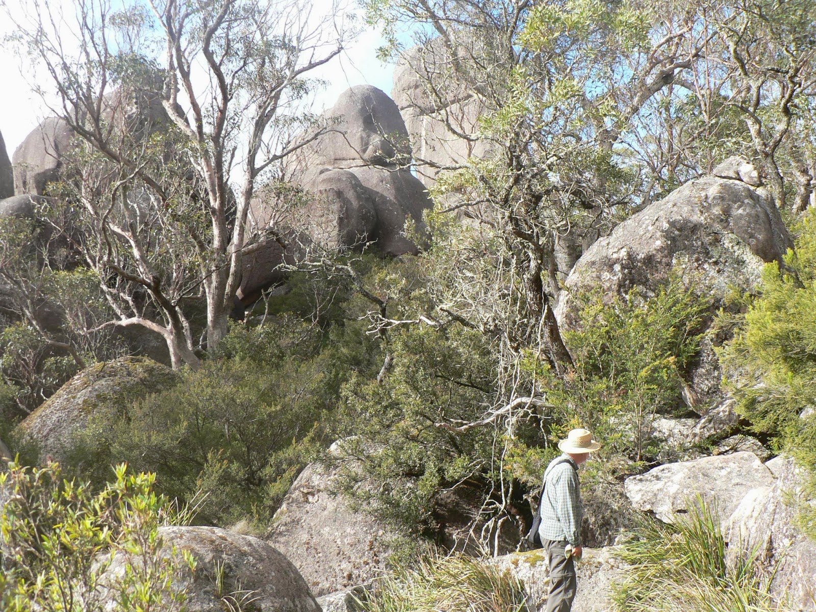
After the cloudy and periodically rainy Friday, we woke up to clear blue sky and beautiful sunshine on Saturday. It was still pretty cold of course, around 3-4 degrees, but the sun has soon started to warm up the air. We went on a long walk, up to the Breadknife and Grand High Tops, the most exciting rock formations in the park. It was about 14 km return, with 450 m up-and-down, a reasonably difficult walk for us, but the path is very well developed, some steeper sections brick-paved, and about 250 steps at the base of the Breadknife. Unfortunately the top section along the East side of the cliff was closed, damaged during the 2013 bushfire, so we had to take the longer and less interesting route on the West. 
At the top, 980 m elevation
But the view from the top was well worth the effort. We were very lucky with clear blue skies, only as much cloud around the horizon to make it more picturesque. We had lunch and coffee at the top, a bit of rest to take photos, then it was time to leave.  
Looking down to the Breadknife from the top
Sunset at the campsite
By the time we got back to the car park, we felt every bit of joint and muscle in our body hurting - we are not used to this much walking, but despite the pain, it was a beautiful day, followed by a hot shower and dinner in our well heated caravan.
Today again the sky was sunny in the morning, but soon clouds moved in and it stayed cloudy until lunchtime. In the morning we got an SMS fom Eszter on the way to hospital, to say that she is going into labour. Exciting!!... 
The Anglo-Australian Telescope
We still felt the effects of yesterday's walk, and planned to have an easy relaxing day. We went up to the Siding Spring Observatory and visited the ANU exhibition, lots of interesting information about all aspects of astronomy, interesting but soon it was too much for us... We took a tour of the Anglo-Australian Telescope (AAT), the largest of them all, an impressive construction. 


The rock formations from the AAT terrace
There were beautiful views of the National Park from the terrace of the AAT, and some nice little artworks, perhaps created by the astronomers in their free time during the day when they are not observing.

We came back to the camp for lunch and rest. Still no news from Eszter... Later, we went for a little walk to find a koala that was saved from the fire by the park rangers, nursed back to life and recently released nearby. We walked around for about half an hour in the area but could not see anything.
We got a message from Sebastian, Eszter's partner, that she is still in labour, it is going very slowly. All we can do is just wait and hope everything will be all right...

Csütörtökön indultunk az újabb lakókocsis utunkra. Az estét Lithgow-ban töltöttük egy kis kempingben. Jó hideg volt éjszaka odakint, 4-5 fok körül, de volt áramunk, így tudtunk fűteni a lakókocsiban, nem fáztunk.

Pénteken utaztunk tovább, nagyjából egész nap, délután 4 tájban értünk ide az első tervezett fő célpontunkra: a Warrumbungle nemzeti parkba. Ez Sydney-től kb 500 km-re van észak-nyugat felé, egy szép hegyes völgyes vidék érdekes vulkáni kúpokkal és szikla-alakzatokkal. Egyszer már jártunk itt 2001-ben, amikor Marci idejárt csillagászati megfigyeléseket végezni, mert itt van az egyetemi csillagvizsgáló is. Nagyon kellemes kemping van itt, tágas, nyugodt (persze ilyenkor télen, nincsenek sokan), de itt is van áram, tudunk fűteni és melegvizes zuhanyozó.

A tegnapi kellemetlen felhős-esős idő után ma, szombaton gyünyrű tiszta napsütéses reggelre ébredtünk. Persze most is jó hideg volt, 4-5 fok, de a nap hamarosan felmelegített. Ma nagy gyalogtúrát tettünk, felmásztunk az ún. Breadknife (kenyérvágó kés) melletti csúcsra. Jó hosszú út volt, kb 14 km oda-vissza, és 450 m szintkülönbség, de elég jól bírtuk egész hazáig, most viszont nyögünk mindketten, minden tagunk fáj. De megérte, nagyon szép túra volt, gyönyörű kilátás, szép idő. Este nyalogattuk a sebeinket, jót vacsoráztunk, pihentünk.

Szerencsére ez egy nagyon jól közművesített park, van jó mobil-vételünk is, úgyhogy anyukámmal és Eszterrel is tudtunk beszélni. Izgatottan várjuk az unoka érkezését, Eszter is örülne már neki, de egyelőre úgy látszik, a kisfiú jól érzi magát odabent. Hát, most már bármikor jöhet, csak rajta múlik.
Ma, vasárnap reggel 6 felé kaptuk a hírt Esztertől, hogy útban van a korházba, 4-perces fájásai vannak - megkezdődött!! Izgatottan várjuk a további fejleményeket. 

Délelőtt elmentünk a Siding Spring Observatory-ba, megnéztük az Australian National University kiállítását, mindenféle csillagászattal kapcsolatos tudományos információ, érdekes, de egy idő után kicsit túl sok nekünk, nem tudunk ennyit egyszerre befogadni. Felmentünk az Anglo-Australian Telescope épületébe is, óriási, 3.9 m-es tükör van az aljában, érdekes látvány. A teraszáról nagyon szép kilátás nyílik a nemzeti park különféle sziklaképződményeire. Az oldalában meg van egy pár jópofa szobor, talán a napközben unatkozó csillagászok alkotásai.

Ebédre visszamentünk a kempingbe, délután meg koala-vadászatra mentünk. Állítólag egy a tűzből megmentett koalát nemrég engedtek szabadon itt a közelben, körbejártuk jópárszor a jelzett területet, de nem láttunk semmit sajnos.

Közben meg várjuk az újabb híreket Eszterről, de eddig csak annyit tudunk, hogy még mindig a szülőszobában van, lassan megy a folyamat. Kívánjuk a legjobbakat, és reménykedünk!...
   

Wednesday, 12 March 2014

Along the Waterfall Way

(Magyar összefoglaló a végén)


The statue of Captain Thunderbolt In Uralla
He was a famous bushranger, shot dead in 1870
and buried in Uralla. 
Wednesday, 5 March. From Nundle we travelled Northbound and after a short stop-over in Uralla to replenish our stocks we turned East from Armidale on the Waterfall Way towards the coast. 


Camping at Dangars Falls
Our first stop was just 19 km from Armidale, at Dangars Falls. It is part of the Oxley Wild Rivers National Park, another wide and deep gorge with a 100 m plus waterfall, which was also dry right now. But the gorge was beautiful, the camping place well developed and we had the whole place to ourselves. We spent 3 nights at this very enjoyable place. 
Dangars Falls
The first afternoon we walked around the rim of Dangars gorge, checked out the view of the non-falling falls and the gorge from several lookouts. The second morning we did a walk to the adjacent Mihi falls, also dry, but just as enjoyable.
Visitors at our camp
The Mihi gorge
The Anglican Church, Armidale
The third day we left the van at the camping ground, and spent the whole day in Armidale.  Armidale was a pleasant surprise. It is a very nice town, everything is neat and tidy, the streets are clean, as if all the roads were just recently re-surfaced, beautiful green gardens, lots of well maintained old buildings and public parks.  
The Mall, Armidale


Inside the historic Booloomonbah mension,
now part of the University of New England
 The whole town had a very "English" character, true to its role as the centre of the New England region. The people at the tourist information office  were also very helpful. In the morning we walked around the town centre following the heritage trail. We had lunch in a cafe at the city mall, then drove around the town to visit some more heritage interests further from the centre.
  
St Patrick Orphanage, Armidale, now a private residence


The Wollomombee river

Saturday, 8 March. We followed the Waterfall Way to the East. Our next stop was  Wollomombee Falls, about 50 km from Armidale. This is the tallest waterfall in NSW, more than 200 m - that is, when there is any water in it, which was not the case now. But the gorge was amazing enough even without water. We walked around the rim to several lookouts to appreciate the views from every possible angle. 
Wollomombee Falls on the left, Chandler Falls on the right
There is also a camping ground here, but following the advice we got at the Armidale tourist centre, we continued on another 20 kms to the New England National Park, and settled for the night at the Little Styx campsite. This is a popular free site just outside the national park, at the bank of the Styx river. It stands at 1320 m elevation, at the foot of a hill, where the weather is often foggy and always pretty cold. This was our first really cold and wet night on this trip.
The Styx river
In the Antarctic Beech forest
Sunday morning we crossed the Styx river, into the national park (rather than into the underworld, as in Greek mythology...:) and drove up to the Point Lookout at the top of the mountain that has no name (or we just could not find it). The cliffs of the plateau are the result of basalt lava flows from the Ebor volcano, active until about 18 million years ago. There is no waterfall here for a change, but at 1564 m elevation it is supposed to have a wonderful view of the surrounding area, as far as the ocean, 70 km away. That might be the case in clear weather, but all we could see was the clouds surrounding us in the dripping rain. But the vegetation more than compensated for the lack of views: we made a walk in the Antarctic Beech forest, the remnants from the ancient Gondwana supercontinent, scrambled along the escarpment, and enjoyed very much this fantastic environment despite the wet and cold weather. 

We also caught sight of a pair of lyrebirds in courtship dance and managed to get a short video of the event.


Ebor Falls
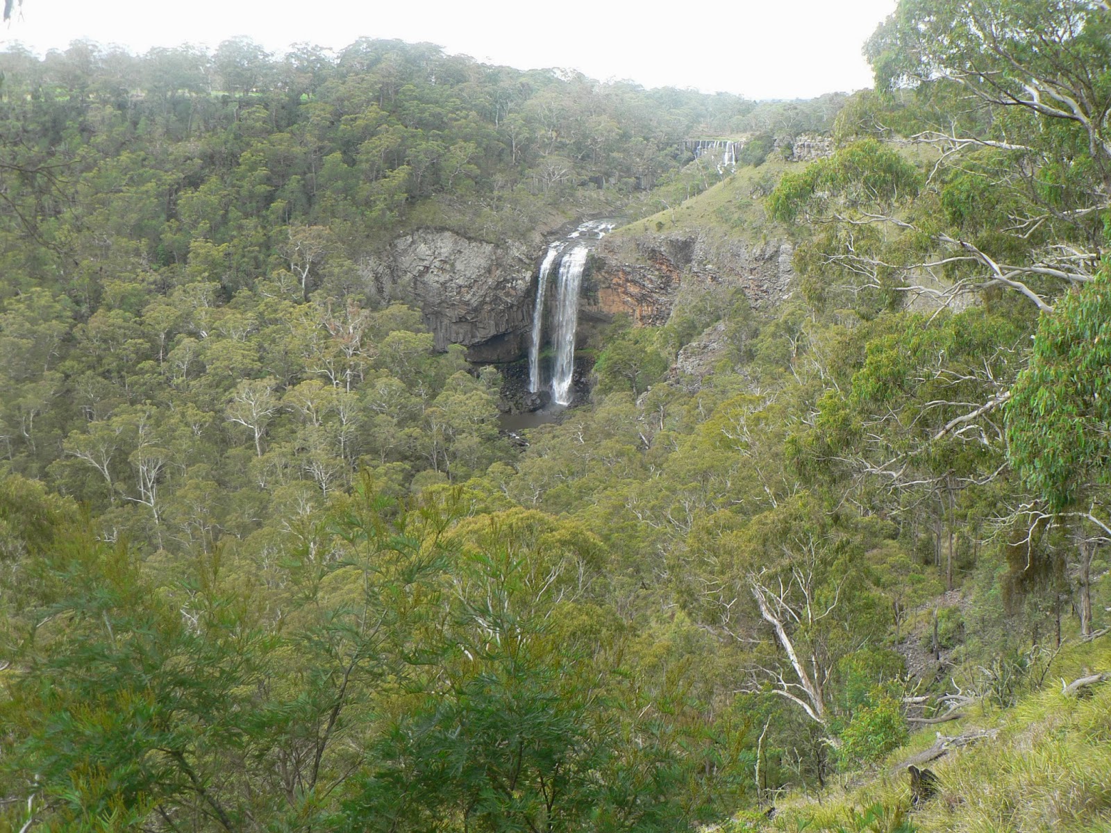
We went down to the camp for lunch, and in the afternoon we visited two other national parks close-by. The Guy Fawkes National Park is just 11 kms away, and just a km away from the main road on the North side we saw Ebor Falls, where the Guy Fawkes river takes its first plunge off the Northern Tablelands. This is a high rainfall area, so this was the first falls we saw with water actually flowing in it. 


Upper Ebor Falls


The way to to top
On the way back to the camp we made a detour to the Cathedral Rock National Park. The rock is actually a circular granite outcrop hill, and a track rises around it through sub-alpine woodland. We went along half-way, then scrambled up the boulders to the top at 1560 m above sea level, it was a challenging climb, but the view of the surrounding tablelands was the reward.
Cathedral Rock
Back in the Little Styx campground it started raining and we had another cold and wet night.


Dangar Falls
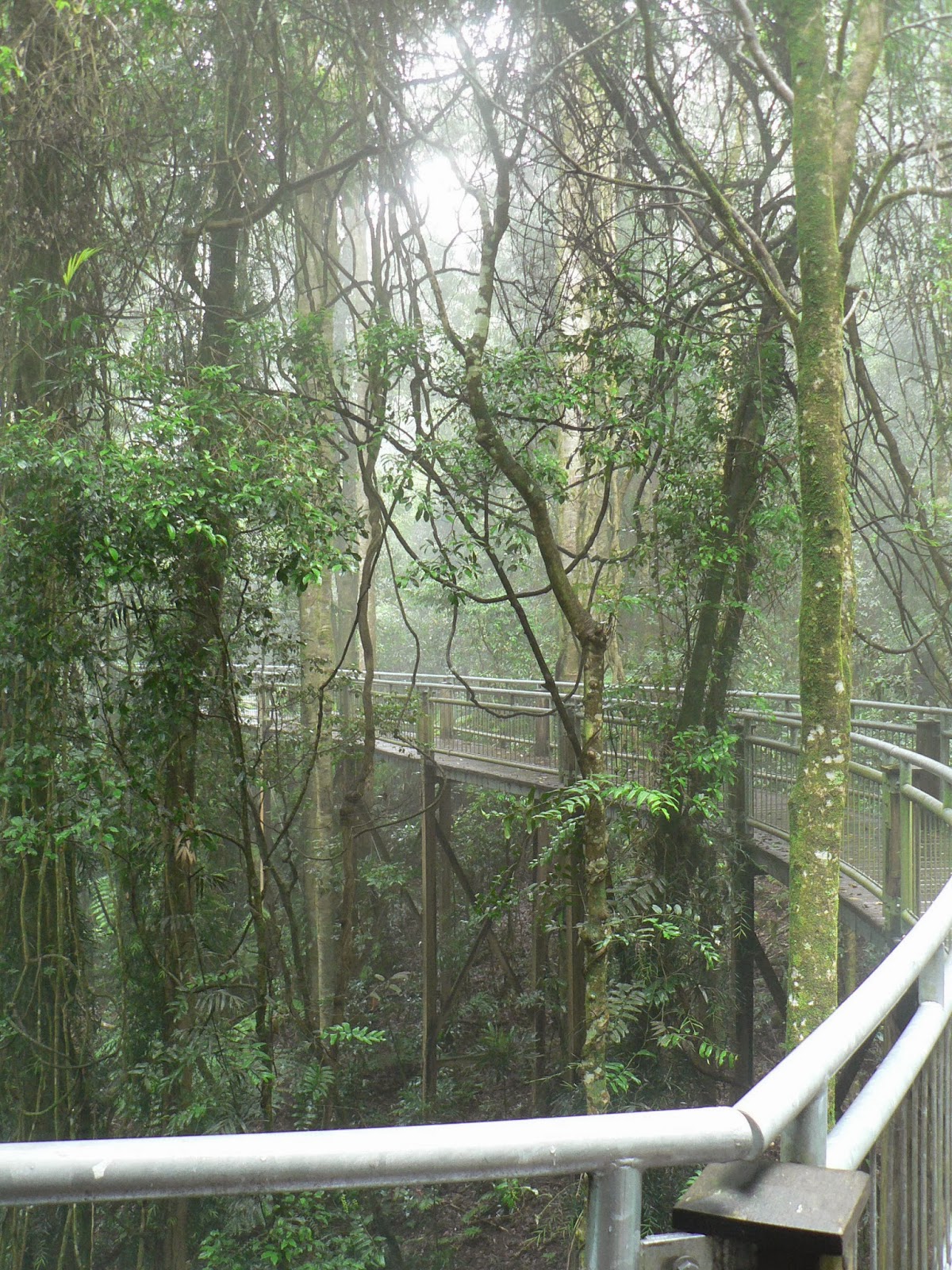
Monday 10 March, we packed up the van in cold rainy weather, and continued our descent along the Waterfall Way. On the way out of the camp, we stopped at the trout hatchery to buy some smoked trout. Our next stop was at Dorrigo.  We stopped at Dangar Falls, 2 kms to the North of the town. Then we spent a few hours at the Rainforest Centre, walking around another pocket of Gondwana rainforest, and enjoying the views of the rainforest canopy from the short elevated "skywalk". 


The rainforest from above

One of the "skywalks"
After lunch in the afternoon we continued our descent towards the coast, and spent the night at a 5-star caravan park in Nambucca Heads. We enjoyed the return to the warm sunny summer weather, had a plunge in the very salty water of the lagoon, and a nice walk on the Break wall along the Nambucca River.
Sunrise at Nambucca Heads
Tuesday, 11 March, After another early morning walk along the river, we packed up and started our journey towards Sydney on the Pacific Highway. Early afternoon we reached Hawks Nest, and settled in a caravan park just behind the ocean dunes. Another clear and warm sunny day, we went down to the beach, I had a plunge in the water. 


Sunrise at Hawks Nest
Wednesday, 12 March, We spent the morning on the beach. A beautiful late summer day, blue sky, sunshine, blue water, white sand, we enjoyed a relaxing few hours on our last day. Then, after lunch, we drove back to Sydney. We reached Hornsby at around 4.30pm, and it took almost another 2 hours to get through the worst of the peak hours down to home, but we got home safely.

On the beach, Hawks Nest
So this was the end of this journey. We travelled about 2,500 kms, visited 10 national parks and 2 state forests, camped for free on 11 of the 25 nights, saw many waterfalls without, and a few with, water, and found many amazingly beautiful places that we had never heard about before. But we already decided that we have to go back to this region once more, when there is more water in the falls. 

A map showing our route and places we visited can be seen at the link below:
https://mapsengine.google.com/map/edit?mid=zQ8zxb0MhjcQ.kpVanEZB15uI

                                                              ------------ o --------------
                              
Március 5-én szerdán Nundle-ből észak felé folytattuk az utat, és egy rövid megálló után Uralla-ban, ahol feltöltöttük a készleteinket, Armidale-nél keletnek fordultunk az ún. Waterfall Way úton.
Elso megállónk a Dangars Falls-nál volt, 19 km-re Armidale-től. Ez is az Oxley Wild Rivers nemzeti park része, egy újabb széles és mély szurdokvölgy egy vízeséssel, ami szintén száraz volt éppen. De a völgy és a környezet így is nagyon szép, és egy jól kiépített táborhely van mellette, ahol teljesen egyedül táboroztunk 3 napig. Az első délután körbesétáltunk a szurdok peremén, megnéztük a kiltást mindegyik kilátó pontról. A második nap délelőtt tettünk egy hosszabb gyalogtúrát a szomszédos Mihi Falls-hoz, ami szintén száraz volt éppen, de a környék és a völgy megérte a fáradságot. A harmadik napon a lakókocsit a táborhelyen hagytuk, és az egész napot a közeli Armidale-ben töltöttük.
Armidale kellemes meglepetés volt. Nagyon szép kisváros, minden rendes és tiszta, mintha az összes utcákat frissen burkolták volna, gyönyörű zöld kertek, sok jól karbantartott régi épület, és városi park hatalmas európai fákkal. Az egész városnak nagyon "angolos" karaktere van, híven a szerepéhez, mint a New England régió központja. A turista központaban is nagyon kedvesek és szolgálatkészek voltak. Délelőtt gyalog körülsétáltuk a városközpontot, vágigjártuk a "müemléki" épületeket. A gyalogos utcában ebédeltünk egy kerthelységben, délután meg autóval jártuk körbe a távolabb eső nevezetességeket.  
Márc. 8-án szombaton folytattuk az utat kelet felé a Waterfall Way-en. Következő megállónk a Wollomombee Falls-nál volt, kb 50 km-re Armidale-től. Itt van a leghosszabb vízesés NSW-ben, több mint 200 m mélységbe zuhog a víz - már ha éppen zuhog, mert most ez is ki volt száradva. De a szakadék így is csodás látványt nyújtott a peremen körben található kilátó-pontokról. Itt is van egy táborhely, de az Armidale-i turista központban kapott tanácsot követve tövábbmentünk még kb 20 km-t a New England nemzeti parkhoz, és ennek a tövében táboroztunk le a Styx folyó partján. Ez a hely 1300 m fölött van, egy még magasabb hegy lábánál, gyakran ködös és hideg, mint éppen most is az volt. Ez volt az első kellemetlenül hideg nedves éjszakánk az út során.
Vasárnap reggel átkeltünk a Styx folyón, a görög mitológiai alvilág helyett felfelé a hegyre, aminen nincs neve (vagy csak mi nem találtuk meg), csak a kilátó pontnak a tetején, nagyon leleményesen Point Lookout-nak hívják, 1564 m magasságban. Itt a változatosság kedvért nincs vízesés, viszont jó időben gyönyörű kilátás lenne a környező hegyek-völgyekre le egész a tengerig légvonalban 70 km-re. Mi persze megint benne voltunk a ködben-felhőben, alig 10-20 m-re lehetett látni a csepergő esőben. De amit a közelben láttunk a növényzetből, az bőven kárpótolt a kilátás hiányáért: besétáltunk az Antarctic Beech erdőbe, a valamikori Gondwana kontinensről megmaradt ősi erdőrészletbe, kicsit fel-le-másztunk a szakadék oldalában, nagyon élveztük ezt az elvarázsolt környezetet, mintha egy mesebeli film díszlete lenne. A szakadék a hajdani, 18 millió évvel ezelőtti Ebor vulkán bazalt-lávafolyam maradványa. Láttunk egy szerelmi táncát járó lyrebird párt, és sikerült is egy kicsit lefilmezni belőle.
Ebédelni visszamentünk a táborhelyre, és délután meglátogattunk két másik közeli nemzeti parkot. Előbb az Ebor Falls-nál álltunk meg, ahol a Guy Fawkes folyó indul lefelé az északi felföldről. Ez a rész már a vízválasztótól a tenger felé van, ahol sokkal több eső esik, így ez volt az első vízesés amiben víz is volt.
Visszafelé tettünk egy kitérőt a Cathedral Rock nemzeti parkba. A "rock" egy magas, meredek gránit sziklahegy, amit félig körüljártunk és felkapaszkodtunk a tetejáre 1560 m magasra. Elég nehéz volt fel- és lemászni, de szép kilátás volt a tetejéről.
Este a Styx folyó mellett megint esett és jó hideg volt az éjszaka.
Márc. 10-én hétfőn csurom vizesen pakoltunk össze és indultunk tovább. Kifelé jövet megálltunk a szomszédos pisztráng-keltető telepen, vettünk egy pár füstölt pisztrángot. Aztán a következő állomásunk Dorrigo volt. Itt is meg kellett nézni egy vízesést, Dangar Falls, alig 2 km-re a városkától. Aztán a közeli Rainforest Centre-ben töltöttünk egy pár órát. Itt is az őskori Gondwana esőerdő maradványai a látványosság, amit szépen kiépített gyalogutakról lehet megnézni. Van néhány magasra felépített állványzat is ahonnan az erdőség koronája látható felülről.
Körülsétáltunk, aztán ebéd után továbbindultunk a tengerpart felé. Estére Nambucca Heads-nél értünk le a partra, itt töltöttük az éjszakát egy szuper kemping és üdülő-telepen. Jól esett visszatérni a kellemes meleg nyári időbe, még fürdötünk is egyet a kemping előtti lagúnában, este meg vigisétáltunk a Nambucca folyó gátján egészen a torkolatig.
Kedden, márc. 11-én mégegyszer elsétáltunk a folyó gáton, megnéztük a napfelkeltét, aztán továbbindultunk hazafelé. Kora délután értünk Hawks Nest-be, itt szálltunk meg egy közvetlen a parti dűnék mögötti kempingben. Ekkor is kellemes nyárias idő volt, lementünk a partra, én fürödtem is. 
Szerdán, márc. 12-én a délelőttöt a tengerparton töltöttük. Nagyon szép nyár végi tiszta napos meleg idő volt, alig pár ember volt a parton, jól esett lustálkodni az utolsó délelőttünkön. Aztán ebéd után felpakoltunk és továbbindultunk hazafelé. Fél 5 körül értük el Sydney északi végét, de még majdnem 2 óráig tartott mire átvergődtünk a legnagyon csúcsforgalmi időszakon, de szerencsésen hazaértünk.
Így ért véget ez az utazás. Kb. 2500 km-t utaztunk, jártunk 10 nemzeti parkban és 2 állami erdőségben, a 25 éjszakából 11-et ingyen táboroztunk, számtalan vízesést láttunk szárazon, és egy párat vízzel együtt, és sok olyan csodálatos helyet találtunk amiről még sosem hallottunk. De azt már elhatároztuk hogy erre a vidékre vissza kell mennünk majd ha víz is lesz a völgyekben.