(Magyar változat kékkel)
This trip is quite different from our previous caravanning adventures, because this time we travelled without our caravan most of the time. The idea for this trip was born from the need to take our caravan back to Melbourne for extensive repairs under warranty that would take at least a week to complete. So we left the van in Melbourne and took the ferry to Tasmania for a bit of touring and a visit to our son Marton and his partner, Jodi, in Hobart.
 |
| Oura Beach |
We left Sydney on Monday 26 January 2015, and took a leisurely 2 days to get down to Melbourne. On the first evening we stopped at Oura Beach at the Murrumbidgee river. (https://goo.gl/maps/AuYBp) It is a bit of a detour from the boring drive along the Hume Hwy, but a very nice spot that we have visited before in October 2013. And it did not disappoint, again we had a very pleasant evening in warm, sunny weather at the river bank.
Next day, we crossed to Victoria, but turned South-East towards the Yarra Valley, another area that we had passed through before. We wanted to spend the night quite close to Melbourne so that we can get in good time to the dealers, Caravan Court (CC).
 |
| We saw an echidna at Kinglake |
We checked out a free camp site at the Kinglake National Park, but the access road was too steep and narrow for our van, so we ended up at Toolangi Recreational Reserve, another free camp site we had visited before. (https://goo.gl/maps/fuc1R) Toolangi (the word means "tall trees" in an Aboriginal language) is a small rural township, less than 300 population, in the middle of a State Forest with beautiful tall trees indeed. In the 2009 bushfires there were 2 deaths and 18 houses burnt down in the town.
 |
| The Tall Trees in Toolangi |
We had a walk around the centre, it looked very much a sad lifeless place, nobody around, but the trees and gardens were nice and colourful. We also wandered in the Singing Gardens, left behind by the late poet C. J. Denis, a resident of the town. His house was burned down, but the garden is well maintained and operated with a tea room. In the evening I watched live on my computer as Andy Murray beat Nick Kyrgios at the Australian Open quarterfinal - an amazing technology improvement!
 |
| Boarding |
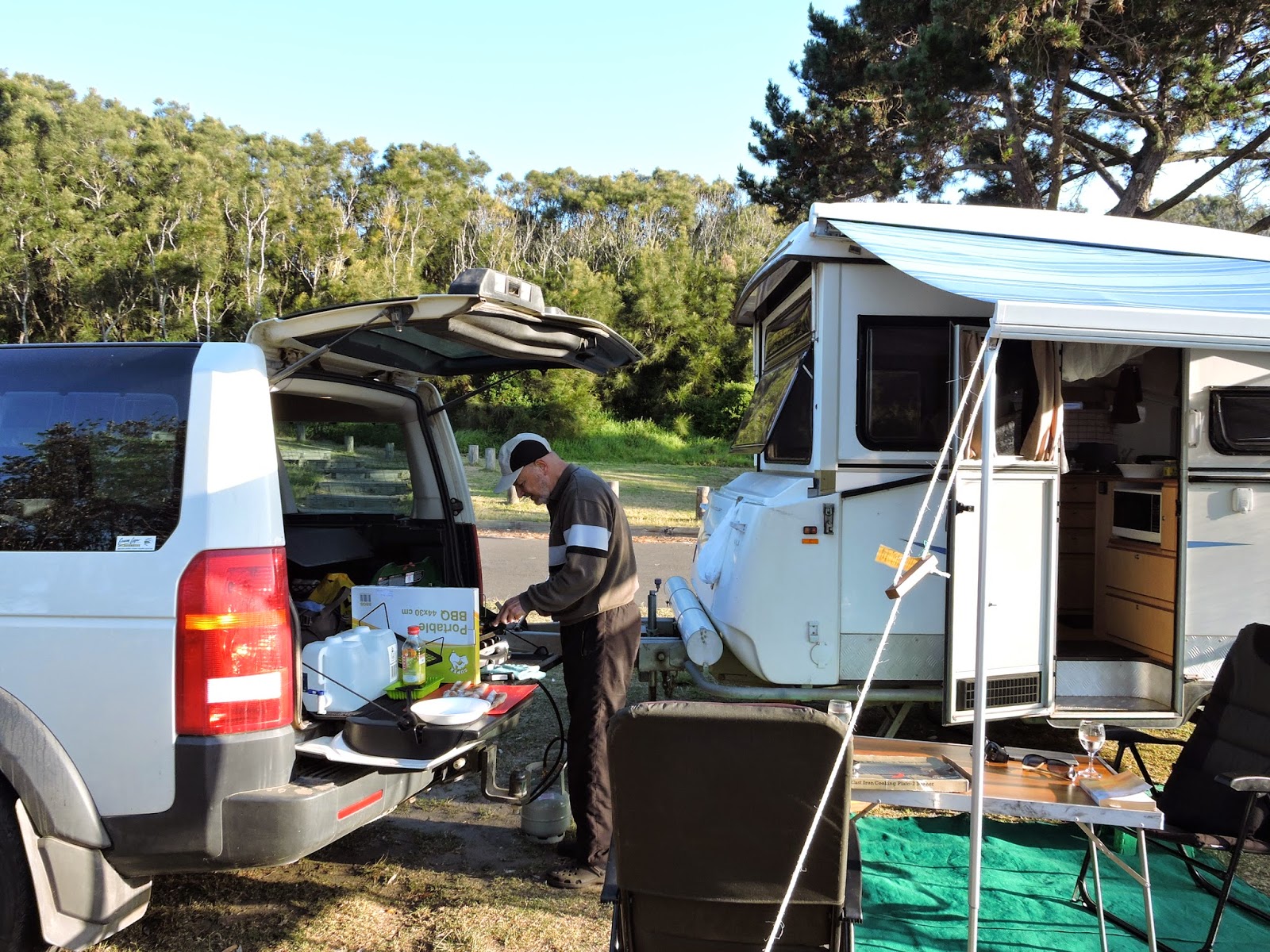
On Wednesday 28 January we drove into Melbourne and took the van to Caravan Court in Spingvale. By lunchtime we had everything organised about the repair work, and had a free afternoon before boarding the ferry. We had a picnic lunch in a park, then a coffee in a cafe, then it was time to go to Station Pier for check-in. Although it turned out that we went there far too early, we had to wait a long time before we could actually board the ferry. It was an enjoyable trip, after dinner in the self-service restaurant we had a good sleep in our comfortable little cabin. There was a bit of a swell during the night but we had no problem sleeping. By the time we woke up, the ferry was already tied up in Davenport. It was only 6 am, and we had time for a quick breakfast before disembarkation.
 |
| Melbourne CBD |
Ez az utunk kicsit más mint a korábbi, mert most nagyobbrészt a lakókocsi nélkül utaztunk. Az ötlet onnan jött, hogy vissza kellett vinnünk a lakókocsit Melbourne-be garanciális javításra, ami több mint egy hétig tart. És ha már addig lementünk, otthagyjuk a lakókocsit a szervizben, és továbbmegyünk hajóval Tasmániába egy kicsit túrázni és közben meglátogatjuk Marciékat Hobartban.
Január 26-án indultunk Sydney-bol, és kényelmesen 2 nap alatt értünk le Melbourne-be. Elso este Oura Beach-nél álltunk meg a Murrumbidgee folyó partján.
(https://goo.gl/maps/AuYBp) Ez egy kis kitérő a foútról, de egy nagyon kellemes hely ahol már jártunk 2013 októberben. Most sem csalódtunk benne, nagyon kellemes estét töltöttünk itt a folyóparton, meleg napos időben.
 |
| A Toolangi erdőben |
Másnap átértünk Victoria államba, de megint letértünk a főútról dél-kelet felé a Yara folyó völgyébe, ahol már szintén jártunk korábban. Melbourne közelében akartuk tölteni az éjszakát, hogy másnap elég korán odaérjünk a szervizbe a Caravan Court-hoz. Kinéztünk egy szabad kemping-helyet a Kinglake Nemzeti Parkban, de a bevezető út túl szűk és meredek volt a lakókocsinknak, így végül megint a Toolangi melletti szabad kempinghelyen töltöttük az éjszakát (https://goo.gl/maps/fuc1R). A városka (3öö-nél kevesebb lakos) neve Aboriginal nyelven azt jelenti hogy "magas fák", nem véletlenül, egy szép erdőség közepén áll, teli igen magas fákkal. A 2009-es nagy erdőtűzben itt is 2 ember meghalt és 18 ház leégett. Este végigsétáltunk a főutca hosszában, elég elhagyatott szomorú kis helynek látszott, sehol egy lélek, bár a környező házak és kertek szépen ápoltak. Átsétáltunk a Singing Gardens-en, a néhai C. J. Denis költő hajdani kertjén is. A költő háza régen leégett, de a kert most is szépen rendben van tartva és egy teaház működik benne. Este a lakókocsiban a számítógépemen mobile broadband-el egyenes adásban néztem az Ausztrál Open tenisz-verseny negyeddöntőjét - fantasztikus hogy már ezt is lehet!
 |
| Victoriai táj |
 |
| Kabinunk a hajón |
Szerdán, jan. 28-án bementünk Melbourne-be, és leadtuk a lakókocsit a Caravan Court-nál. Délre már meg is beszéltünk mindent a javításokkal kapcsolatban, így volt egy szabad délutánunk a hajó indulása előtt. Egy városi parkban piknikeltünk, majd egy kávéházban kávéztunk, olvasgattunk, aztán már menni kellett a kikötőbe az induláshoz. Ugyan kiderült, hogy nem volt érdemes olyan korán menni, még jó sokáig csak vártunk mielőtt feljutottunk volna a hajóra autóval együtt. De végül ez is megtörtént, és egész kellemes utunk volt. Megvacsoráztunk az étteremben, és jól aludtunk a kényelmes kis kabinunkban. Volt ugyan egy kis hullámzás az éjszaka, de nem zavart egyáltalán. Mire felébredtünk, a hajó már kikötött Davenport-ban. Még csak 6 óra volt, meg is tudtunk reggelizni kiszállás előtt.
To Hobart
 |
| Launceston |
 |
| James Boag Brewery in Luanceston |
We left Davenport in a clear but chilly early sunshine, but the sky turned cloudy pretty soon and we did not see the sun in the next 4 days. We had the whole day for the trip to Hobart, and we made several stops on the way. First we drove in to Launceston and had a walk tour around the centre for a few hours. Launceston is Tasmania's second largest city, more than 100,000 population, and one of Australia's oldest towns, and is home to many historic buildings.
 |
| Typical Tasmanian landscape |
 |
| Clarendon House |
From Launceston we turned South, and after passing through Evandale, visited Clarendon House, one of the grandest colonial houses in Australia. (https://goo.gl/maps/XHYYG) Set in 7 hectares on the banks of the South Esk River, Clarendon was the centre of a large pastoral enterprise developed by James Cox. Complete with servants wing and many farm buildings the House is surrounded by extensive gardens and parklands. The lavish interieur furniture and decorations are amazing, although they are not original.
 |
| Clarendon House |
 |
| Clarendon House |
 |
| Clarendon House |
 |
| Ross |
We had lunch at a pub in Ross (https://goo.gl/maps/X4brw), followed by a little siesta at the bank of the Macquarie River, just beside the historic bridge built by convicts in 1836 (second oldest in Australia). There are quite a few other old historic sandstone buildings in the town.
 |
| Historic Bridge, Ross |
 |
| Historic Bridge, Ross |
 |
| Callington Mill in Oatlands |
Our next stop was in Oatlands (https://goo.gl/maps/yeHss), another historical village on the shores of Lake Dulverton, where we had coffee and tea in a nice little tea house. Oatlands also has many old sandstone buildings, most of them built by convict labour. It is also famous for the Callington Mill built in 1837 and beautifully restored to working order in 2010.
From here, we drove directly to Hobart to Marty & Jodi's house. The house is right at the foot of Mount Wellington, but we did not see the top of the mountain until 4 days later. On arrival they did not leave us much time to settle down, as they invited us to watch their regular Thursday evening beach frisbee game at Kingston Beach.
 |
| Frisbee on the beach |
By then the weather was pretty cold, around 11-12 degrees, and a strong Easterly breeze blew from the sea, but that did not deter the groups of hot-blooded youths to play the game. While they were playing, we climbed up to the Alum Cliffs behind the beach, to warm up a bit in this unwelcoming Tasmanian "summer" and to enjoy the scenery. The day ended with a nice dinner at home and the heating, as well as a few glasses of wine and the lively chat helped to warm up our bodies unused to this climate.
 |
| Mawson's Hut Museum |
Friday (30 January) was a miserable day, cold, windy and rainy. In the morning we went down to Battery Point, walked around Salamanca Place, then, looking for some indoor activity, visited Mawson's Huts Replica Museum. Douglas Mawson was the leader of the Australian Antarctic Expedition in 1912, and with 17 other men they built the huts at Cape Denison on Commonwealth Bay and lived and worked there for two years. Not all of them came back. The original huts are still standing, and the replica huts museum opened in 2014, furnished with many genuine early 20-century items and authentic replicas, as well as lots of photos and information displays. It is an amazing insight into the life of the early Antarctic explorers.
 |
| Mawson's Hut Museum |
Next, we walked through a photo exhibition in the Salamanca Art Centre, showing stunning nature photos by some famous artists including Wolfgang Glowacki, Matthew Newton, Jonathan Esling and others. There were some amazing photos indeed, but some of them we found too artificial, a bit over-done by colours and effects.
We had lunch with Marty in a little coffee on Battery Point. In the afternoon we went shopping then home as we were in charge of dinner while Marty was in his office and Jodi was working on her assignment.
 |
| The Matron's Quarters, Cascade Female Factory |
On Saturday the weather was just as terrible as the day before. In the morning we visited the Cascades Female Factory, very near to Marty's place. The site originally developed for an alcohol distillery, was later transformed as one of the five prisons for women transported to Tasmania, operating between 1828-1856. Women were incarcerated at the Female Factory as punishment for petty crimes or for getting pregnant, to be "reformed", or while waiting to be assigned as servants to free settlers.Thousands of women and children lived and worked here in dire conditions. The site had 5 yards, with many buildings, but now only 3 yards remain as a museum with one small building, the Matron's Quarters, standing.
 |
| Cascade Female Factory |
The rest of the buildings are only recognisable from the foundations and the site maps and display panels. To complement the weak visual experience, a dramatised guided tour is offered, played by two actors in authentic clothes, that brings to life the extraordinary story of the convict women and their children who were incarcerated at the site.
 |
| Cascade Female Factory |
 |
| The dramatised tour, Cascade Female Factory |
In the afternoon we went to MONA with Marty for an open-air jazz concert, but it was cancelled due to the weather. Then we did some shopping in preparation for the next days' trip to Maria Island. In the evening we had dinner at the Flathead Seafood Restaurant with Marty and Jodi.
 |
| In the Flathead restaurant |
Davenport-ban szép tiszta napkeltében szálltunk ki, de hamarosan elborult az ég, és aztán nem láttuk a napot 4 napig. Csak estefelé akartunk Hobart-ba érni, több helyen megálltunk útközben. Először bementünk Launceston-ba és vagy két órát sétálgattunk a központban. Launceston Tasmania második legnagyobb városa, több mint 100 ezer lakossal, és az egyik legrégebbi város egész Ausztráliában. Sok régi szép épület áll még.
 |
| Portrait of James Cox, owner of Clarendon House |
Innen délnek fordultunk és Evandale után meglátogattuk Clarendon House-t, az egyik legnagystílűbb vidéki kúriát egész Ausztráliában. (https://goo.gl/maps/XHYYG). A South Esk folyócska partján Clarendon egy nagy állattenyésztő gazdaság központja volt. A főépület mellett több gazdasági és munkás-lakóépület is áll tágas kertek és park mellett. A kúria legtöbb belső termében és emeleti szobáiban fényűző berendezést és dekorációt láttunk, ugyan a legnagyobb része nem eredeti.
 |
| The servants wing, Clarendon House |
Következő állomásunk ebéd volt Ross-ban (https://goo.gl/maps/X4brw), majd egy kis pihenő a Macquarie folyó partján a műemléki híd mellett amit fegyencek építettek 1836-ban (a második legrégebbi Ausztráliában). Sok más szép régi homokkő épület is áll még a városkában.
Kávézni Oatlands-ban álltunk meg (https://goo.gl/maps/yeHss), egy másik régi kis faluban a Dulverton tó partján. Itt is sok régi homokkő épület található, a legtöbbet fegyencek építették. Leghíresebb emléke az 1837-ben épült Callington Mill szélmalom, amit 2010-ben teljesen restauráltak és ma is működik.
Innen már egyenesen Hobart-ba mentünk, Marciék házához. A ház a Mount Wellington lábánál fekszik, de a hegyből semmit sem láttunk a következő napokban az alacsonyan úszó sűrű felhőtakarótól. Érkezésünk után Marciék nem sok időt hagytak nekünk a letelepedésre, meghívtak hogy menjünk velük a szokásos csütörtök esti tengerparti frisbee-meccsükre a Kingston Beach-en. Estére jól lehűlt az idő, 11-12 fokra, jó erős szél is fújt a tenger felől, de ez nem riasztotta el a forróvérü fiatalokat a játéktól. Míg ők játszottak, mi felmásztunk a beach mögötti Alum Cliffs meredek szirtjére, jól kimelegedtünk és élveztük a kilátást. A játék után otthon befűtöttek a kedvünkért, jól esett a vacsora és a beszélgetés néhány pohár bor mellett.
Pénteken, jan. 30-án hideg szeles esős nap volt. Délelőtt beautóztunk a Battery Point-ra, lesétáltunk a Salamanca térre, majd az eső elől menekülve megnéztük a Mawson's Hut múzeumot. Douglas Mawson az Ausztrál Antarctic expedíció vezetője volt 1912-ben, 17 társával együtt 2 évig élt és dolgozott Antarktiszon Cape Denison fokon a maguk építette faházban. Több társa nem tért vissza élve az útról. Az eredeti épületek még állnak a helyszínen, a másolatot 2014-re építették fel Hobart-ban mint múzeumot. Sok eredeti korabeli berendezési tárgy és eszköz és rengeteg képes információ látható benne. Érdekes képet mutat a korai Antaktisz-kutatók életéről.
Ezután egy tasmániai tájkép fotókiállítást néztünk meg a Salamanca Art Centre-ben, jól ismert fotóművészek képeit. Sok gyönyörű képet láttunk, de egyik-másikat túl természet-ellenesnek találtuk, mintha túlszínezték volna különböző Photoshop effektekkel.
 |
| Marci itt dolgozik |
Marci munkahelye közvetlenül a Salamanca Place mellett van, kijött velünk ebédelni egy kis kávéházba a Battery Point-on. Délután bevásároltunk és hazamentünk vacsorát készíteni.
Szombaton is olyan rossz idő volt, mint előző nap. Délelőtt megnéztük a Cascades Female Factory-t, ami egész közel van Marciék házához. Ezen a helyen eredetileg alkohol lepárló üzemelt, később átépítették és női börtön lett belőle 1828-tól 1856-ig. Nők és gyerekek ezrei éltek itt évekig különböző apró "bűnök" miatt elítélve (lopás, vagy teherbe esés miatt), várva hogy "megjavuljanak", vagy hogy kiutalják őket szabad telepesek mellé szolgálni. Az egykori 5 udvarból már csak 3 működik mint múzeum, és csak egy épület áll, a Matron's Quarters (a főfelügyelő lakóhelye). A többi épület helyét csak a kő-alapzat mutatja és néhány helyszínrajz és fénykép. A látható emlékek hiányát egy dramatizált előadással pótolják, két színész eredeti ruhákban adja elő egy fegyencnő és gyerekei történetét.
 |
| MONA |
Délután elmentünk Marcival a MONA-ba (Museum of Old and New Art) ahol egy szabadtéri jazz-koncert volt meghirdetve, de sajnos az előadást a rossz idő miatt elhalasztották, hiába mentünk. Aztán be kellett vásárolni a következő napokra tervezett közös kirándulásunkra. Este Marciékkal együtt a házukhoz közeli Flathead Seafood étteremben vacsoráztunk.
Maria Island
https://goo.gl/maps/Pbb35
 |
| Ferry wharf, Maria Island |
 |
| Walking to the Penitentiary |
Sunday morning (1 February) we got up early and drove to Triabunna on the East coast, about an hour drive from Hobart, to catch the ferry to Maria Island. Vehicles are not allowed on the island, we had to unpack all the gear and leave the car on the shore. Marty and Jodi also came with us on this trip. The ferry took about 20 minutes to get to the island, then a 500 m walk to the Penitentiary at Darlington, where we had a room reserved for 2 nights.
The island has a rich history of various enterprises, all ending in failure. For two periods during the first half of the 19th century, Maria Island hosted convict settlements. They failed because the island was close to the shore and it was too easy for the convicts to escape. Later a cement factory was built using the limestone deposits at the Fossil Cliffs as the raw material. It had some success first in the early 20th century but then went bankrupt during the Great Depression. After that, farming was dominant until the 1960s, but it proved to be unproductive. Eventually the State resumed all of the island's freehold land and established the National Park, which was proclaimed in 1972 and extended in 1991 to include part of the surrounding sea. Since then tourism seems to be a successful venture.
 |
| The old Penitentiary complex |
 |
| Cape Barren geese |
Our accommodation was in the Penitentiary, completed in 1828 as a convict residence, while Marty and Jodi put up their tent in the camping area. There is an abundance of wildlife on the island, most of them re-introduced from the mainland. We saw flocks of Cape Barren geese and triabunna (Tasmanian nativehen) around the courtyard. We also saw lots of wombats all around the island and a few wallabies. Tasmanian devils are also living on the island but they are nocturne and we did not go after them.
 |
| Wombat family |
 |
| Fossil Cliffs |
 |
| Fossil Cliffs |
After unpacking and morning tea, we packed some lunch and went on a walk to the Fossil Cliffs on the NE-side of the island. It is an easy level walk which was just as well for my aching lower back. After about half an hour across open grassland we reached the spectacular sea cliffs which plunge sheer to the sea, and includes a world/class fossil site. In the 1920 this was mined as raw material for the cement factory, but now a protected site. The whole cliff face is full of fossilized shells. We took some time to admire the fossils, then set down for a picnic lunch.
 |
| Lunch at Fossil Cliffs |
 |
| The view towards Bishop and Clerk |
After lunch we continued along the East coast towards the peaks called Bishop and Clerk. The terrain became steeper and steeper, and after a while Kate and I had enough, we set down for a bit of rest, while Marty and Jodi went on a bit further up. We turned back towards Darlington, following the inland forest route, where ruins of various early buildings still stand. Later Marty and Jodi joined us, and went back to the camp together.
 |
| The ruins of Engineering House |
In the evening it was pretty cold outside, but we had a good fireplace in our room. Jodi made sushi for dinner and we enjoyed some wine and cards after dinner.
Next morning we were awaken by the terrifying strange noise of the triabunna males fighting and chasing each other in the courtyard. But finally we had a clear sunny morning. The original plan was to rent bicycles and ride down along the West coast to Frenchs Farm, but we quickly found out that it is too difficult a task for my aching back and for Kate's untrained legs. So we started out along the West coast track on foot instead.
 |
| Painted Cliffs |
 |
| Painted Cliffs |
Our first stop was at the Painted Cliffs, the second main attraction on the island. These are sandstone cliffs reaching down to the water's edge with amazing coloured patterns caused by groundwater seeping through the sandstone leaving traces of iron oxides. It was hard to stop taking photos of these fantastic natural artworks.
We continued Southward following the West coast track until about lunchtime, when we stopped at one of the small pristine beaches.(https://goo.gl/maps/rVt0R)
 |
| Lunch beside the beach |
Marty and Jodi had a dip in the very inviting (about 18 C) water, we did not follow them. We had freshly made sushi for lunch beside the beach, then I took a little nap while the others made a discovery tour along the nearby creek.
 |
| The creek |
In the afternoon we returned to the camp along the same route. The day finished with another excellent dinner made by Jodi in our room.
 |
| Dinner in our room |
 |
| Back to the main island |
Tuesday morning we had to pack and return to the mainland. In the meantime Marty got a call from the Hobart police with some bad and good news: on Sunday evening their house was broken into and a lot of gear (3 laptop computers, including mine, a photo camera, etc) were stolen. The good news was that the police immediately recovered all the gear from the burglar's abandoned car - what an amazing lucky break! So we had to return quickly to the house, where we met the police detective who returned our stuff. While looking around to assess the damage, we found that there are a few more items missing that were not recovered: our two Kobo e-readers disappeared from our bedroom. But the loss of these is nothing compared to losing my computer with all my personal files and information on it, so we still consider ourselves very lucky.
Later, a forensic expert came from the police and worked through the house to take photos and fingerprints to be used as evidence if they manage to find the burglar.
The next day we planned to go to Bruny Island for 2 days, so we went shopping and made some preparations in the afternoon.
Vasárnap (feb. 1) korán felkeltünk és Marciékkal együtt 8 után már Triabunna-ban voltunk a keleti parton, kb- egy órányira Hobart-tól. Innen indult a kishajó Maria Island-ra, ami egy nemzeti park, autók nem járhatnak rajta. A hajóút csak 20 percig tartott, aztán kb fél km-t kellett gyalogolni az összes cuccal a Darlington nevű kis központig ahol szállást foglaltunk 2 éjszakára.
A szigetnek érdekes múltja van, többféle vállalkozás működött itt és mindegyik kudarcba fulladt. A 19. szd. első felében itt is fegyenctelep működött. Az akció nem volt sikeres, a sziget túl közel volt a szárazföldhöz, túl könnyű volt megszökni. Aztán egy cementgyárat létesített egy vállalkozó a helyi mészkő alapanyag feldolgozására. Ez a kezdeti sikerek után az 1930-as gazdasági válságba bukott bele. Később farm-gazdaság működött az 1960-as évekig, de nem volt nyereséges. Végül a tasmániai állam visszavette az összes földet és nemzeti parknak nyilvánította. Azóta a turizmus az egyedüli tevékenység, ami sikeresen működik.
 |
| Pihenő a Penitentiary teraszán |
Mi Katival a Penitentiary-ben, a valamikori fegyenctelep 1928-ban épült hálóépületében laktunk egy tágas 6-férőhelyes szobában, emeletes ágyakkal, fafűtéses kályhával, nagy asztallal és polcokkal de víz és villany nélkül. Marciék a szomszédos kemping területen verték fel a sátrukat. Az telep udvarán sok vad madarat láttunk, Cape Barren libákat és triabunna-kat, a Tasmániában őshonos vad tyúkfélét (ugyan elég szelídnek látszottak). Később sok wombat-ot is láttunk és néhány wallaby-t (kisebb kenguru). Azt hallottuk hogy tasmániai ördög (Tasmanian devil) is él a szigeten, de ezek csak éjszaka mozognak, nem láttunk egyet sem.
Az első napi program az egyik fő látványosság, a Fossil Cliffs meglátogatása volt. Elég könnyű gyalogút vezet oda a sziget északkeleti oldalán. Hamar odaértünk a tengerből felmeredő függőleges sziklafalakhoz. A sziklák jórészt megkövesedett tengeri kagylókból állnak. Az 1920-as években innen bányászták a mészkövet a cementgyár részére, ma nemzetközileg elismert védett terület.
 |
| Régi temető a Fossil Cliffs felé |
Itt letelepedtünk megebédelni, aztán tovább mentünk dél felé a Bishop and Clerk nevű hegycsúcsok felé. A terep egyre meredekebb lett, mi Katival leültünk pihenni és nézelődni, Marci és Jodi még egy kicsit tovább másztak.
Visszafelé a belső erdei úton mentünk ahol több régi épület romjait láttuk. Később Marciék is csatlakoztak hozzánk, együtt értünk vissza Darlingtonba.
Este jó hideg lett odakint, Marci befűtött a kályhánkba, Jodi sushi-t készített vacsorára, jót beszélgettünk, kártyáztunk néhány pohár bor mellett.
 |
| Painted Cliffs |
Másnap kora reggel az udvaron egymással viaskodó triabunna kakasok éktelen ricsajára ébredtünk, kiderült hogy tudnak ezek egészen vadul is viselkedni, szerencsére csak egymással szemben. Viszont végre újra előbukkant a nap, tiszta felhőtlen égboltot láttunk. Az eredeti terv az volt, hogy biciklit bérelünk és lemegyünk a sziget déli felébe, de hamar kiderült hogy az én fájós derekamnak és Kati gyakorlatlan lábainak nem tenne jót ez az út, így inkább gyalog vágtunk neki a nyugati parti ösvénynek.
 |
| Painted Cliffs |
Első megállónk a sziget másik fő látványosságánál, a Painted Cliff-nél volt. Itt a tengerbe nyúló homokkő szirtekbe fantasztikus színes mintákat formált a talajvízzel beszivárgó vasoxid. Sokáig elnézegettük a természet műalkotásait, nehéz volt abbahagyni a fényképezést.
 |
| Készül a sushi a tengerparton |
Továbbmentünk dél felé a tengerpart mentén. Déltájban megálltunk egy kis elhagyott homokos partszakasznál. Marciék fürödtek egyet a kb. 18 fokos tengerben, mi lemondtunk erről az élvezetről. Megint frissen készült sushi-t ebédeltünk Jodi jóvoltából, aztán én kicsit elnyúltam pihenni, a többiek meg elmentek a közeli patak mellett felfedező útra.
Kedd reggel már felpakoltunk és visszatértünk Hobart-ba. De még reggel Marcit felhívta a rendőrség azzal a hírrel, hogy vasárnap este betörtek a házukba és elvittek egy csomó cuccot, 3 számítógépet (köztük az enyémet), egy fényképezőgépet, stb. A jó hír viszont az volt, hogy a rendőrök visszaszerezték a lopott holmit a betörő elhagyott autójából – micsoda szerencsés fordulat! Gyorsan vissza kellett mennünk a házhoz, ahol a rendőrök visszaadták az elvitt holmikat, jegyzőkönyvet vettek fel, később egy másik rendőr ujjlenyomatokat gyűjtött a házban. Sajnos közben rájöttünk hogy nem sikerült mindent visszaszerezni, a mi két e-readerünk eltűnt. Sajnáltuk, de még így is nagyon szerencsések vagyunk, hogy a számítógépek megkerültek.
A délután többi része bevásárlással telt és készülődéssel a másnapra tervezett kirándulásunkra.


