The Fleurieu Peninsula is the area of South Australia located south of Adelaide. It was named after Charles Pierre Claret, Comte de Fleurieu, the French Navy Minister, by the French explorer Nicolas Baudin as he explored the south coast of Australia in 1802. The name was adopted by the South Australian Government in 1911. It is an area of rolling hills, farmland, vineyards and national parks, fringed on two sides by sandy beaches and rugged coastlines. It is the home of several distinct wine regions, including McLaren Vale, the most famous of them. It is where the Murray river reaches the sea after meandering through 2,500 km from the Australian Alps. And this is where the ferry service to Kangaroo Island leaves from the South-Western tip of the peninsula.
 |
| McLaren Vale from the Maxwell winery |
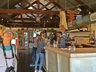
From the visitor centre we obtained a map showing the wineries and other interesting sites. There was plenty to chose from: more than 75 cellar doors open to the thirsty visitors, so it was not an easy choice. We picked a few of the most famous ones, plus stopped at others that happened to be on our way. The first one was just a short drive from our camping: Maxwell winery. It is not the most well-known, but the wines we tasted were fairly good. You can taste sometimes up to a dozen different wines if you can keep your head up. We were not so brave, only tried no more than 4-5 types at one place. Fortunately we are mostly interested in the red varieties, which this region is mot famous for. The experts usually spit out the wine, a shameful act in my opinion that I could not do... but I had to be careful to remain under the legal limit...
 |
| Beresford wines |
Our next stop was at the Beresford Wines, a more elegant and modern establishment. The wines were also better - and more expensive -, but again, we left with two bottles in the boot. Fortunately we had a good reason not to buy more: not enough space in the car...
 |
| Maslin beach |
 |
| Uniting Church, McLaren Vale |
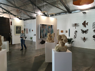
On the way back we ended up in another winery: Tintara. After tasting a few wines, we visited the large production warehouse and its information boards about his famous owner, Thomas Hardy (not to be confused with the British writer). He purchased the Tintara winery in 1876 and his descendants are still in the family business. There is also another large warehouse with an art gallery and work studios for some local and visiting artists.
 |
| Tintara winery |
In the afternoon we went on a tour of the region to explore more heritage architecture. Clarendon is a pretty little village about 20 kms North-East of McLaren Vale, still part of the Adelaide Hills. Most of the buildings are well maintained late 1880's colonial buildings, like in an old English village.
 |
| Clarendon Community Hall |
 |
| Old Reynella Horse Changing station |
 |
| Christies Beach |
On the way back to McLaren Vale we made a detour towards the sea, to see a few more beautiful beaches. We stopped at Christies beach, a famous surf beach, then at Port Noarlunga, at the mouth of the Onkaparinga river. The river meanders through a wide green park before reaching the sea between the sandy beach and the high sandstone cliffs, an interesting view.
 |
| The Onkaparinga river at Port Noarlunga |
 |
| The river at the bottom of the valley |
This turned out to be one of the most difficult walks we ever did. In the first part going down was not too bad, except that there were hardly any signs, we had to use the GPS on the phone to find our way based on the map - fortunately there was reception in the upper part of the valley. Also, there was no track as such (or we missed it), it was hard to walk in the thick tall grass. Then, the second half of the gully was indeed very steep, difficult to walk on even downwards. When we reached the bottom of the valley, found the river which was just a small creek at this point and nothing special. After a short rest we started to climb back up, which was much harder on the steep sections. We had to stop several times to catch our breadth and give a rest to our aching legs. It was a warm, humid, overcast day, we were soaked in sweat by the time we got back to the car. I measured with the GPS that we did 280 metres up-and-down, which certainly was not worth for what we saw down there. But at least we did a bit of physical exercise and learned the lesson to pay more attention to the warning signs. But the trouble with those is that generally they do not show the vertical distance.
 |
| d'Arenberg winery |
 |
| The Cube |
 |
| The d'Arenberg family winemakers in bronze |
 |
| Wirra Wirra Estate |
The last winery we visited was the Wirra Wirra estate, another leading company in the region. Apart from the good wines, the most interesting feature here was the property fence made of huge tree-trunks.
On Thursday, 2 Nov, we moved down to another caravan park in Victor Harbor at the Southern coast of the peninsula. This was again just a short drive, so we had time for a walk around the town centre in the afternoon.
Captain Matthew Flinders was the first non-Aboriginal to pass through this bay in 1802 on his way to circumnavigate the continent. He met the french explorer Nicolas Baudin in this area and named the bay Encounter bay after the meeting. Victor Harbor was named after the ship of another early visitor who found shelter beside Granite Island. This place was used by whaler ships from the 1790's, and later it became an important transfer port for the Murray river ships.
 |
| Victor Harbor, the Savings Bank from 1848 |
 The historic town centre is located near the coast behind Granite Island, a popular site for visitors. It is connected to the mainland by a short horse-drawn tram/pedestrian causeway. Victor Harbor is quite a large town, more than 10 thousand residents, yet the centre seemed fairly abandoned. Nice, well maintained buildings, big palm trees but hardly any people on the street. Maybe because the weather was quite cold and windy.
 Next day, we spent at the nearby town of Goolwa. Goolwa is a river port in a sharp bend of the Murray river (the name means "elbow" in the local Aboriginal language), close to the river mouth. The mouth was always difficult to navigate due to the shifting sand bars and shallow waters. Many ships were lost near the mouth. A horse-drawn tramway was built from Goolwa to Victor Harbor in 1863, allowing goods to move from river boats to sea boats, so that neither had to negotiate the Murray Mouth.
 |
| Goolwa, river port |
Hindmarsh Island is just on the other side, now connected by a huge bridge over the river. We crossed over and drove out to the place where the river mouth can be seen from acros the river. There are dredging machines working continuously at the shifting narrow channel to keep it open. Although bigger ships rarely pass through nowadays, the water flow must be maintained to ensure the health of the river.
 |
| The river mouth from Hindmarsh island |
Saturday, 4 Nov, we drove to Cape Jervis at the South-West tip of the peninsula and spent the night there to be close to the ferry terminal for our early trip to Kangaroo Island the next morning.
----------------------
Fleurieu félszigetnek hívják az Adelaide-től délre fekvő területet. A nevet Nicolas Baudin francia felfedező adta 1802-ben amikor Ausztrália déli partvidékén hajózott. Charles Pierre Claret, Comte de Fleurieu volt Baudin patrónusa, francia tengerészeti miniszter. A nevet Dél-Ausztrália kormánya 1911-ben adoptálta. A félsziget szelíd dombos táj, farmok, szőlő-ültetvények és nemzeti parkok borítják, két oldalán homokos tengeröblök és sziklás partszakaszok határolják. Itt található több ismert borvidék, köztük a leghíresebb, McLaren Vale. Itt éri el a tengert a Murray folyó, 2500 km-es kanyargás után az Ausztrál Alpok hegyeiből. És a félsziget dél-nyugati csúcsáról indul a komp a Kangaroo szigetre.
Hétfőn, okt. 30.-án indultunk tovább Adelaide-ből, és alig egy óra múlva megérkeztünk a következő álomásunkra, McLaren Vale-be. Ebéd és egy rövid szieszta után (ami nekem mindig a nap fénypontja:) elindultunk "dolgozni" - vagyis meglátogatni egy pár borpincét...
 |
| McLaren Vale, a Rosemount Estate szőlő-ültetvényei |
 |
| Maxwell pince: Kati is megkóstolta... |
 |
| Beresford Estate |
Következő állomásunk a Beresford Wines "pincéjénél" volt. Ez egy elegánsabb cég és modernebb épület volt, a borok is jobban ízlettek, de persze drágábbak is voltak - de azért innen sem távoztunk pár üveg bor nélkül. Szerencsére volt egy jó érvünk hogy miért nem vehetünk többet: nem fér el az autóban a sok cucc mellett.
 |
| Maslin beach |
 |
| A régi vasuti kocsikban ma étterem működik |
 |
| Tintara galéria |
 |
| Clarendon, Anglikán templom |
 |
| A régi Reynella-ból már csak képek maradtak |
 |
| Christies Beach |
 |
| Az Onkaparinga folyó torkolata |
 |
| Ez még a könnyebb szakasz, a domb-él után jön a meredek |
Következő nap (nov. 1) gyalogtúrát terveztünk. Az Onkaparinga nemzeti park közvetlenül McLaren Vale-től északra fekszik, a tájékoztató több gyalogutat mutat. Elautóztunk a legközelebbi bejárathoz, és kiválasztottunk egy utat ami levezet a folyóhoz. Volt ott egy útmutató tábla, ami szerint az út 3 és fél km, 4 óra, ami elég hihetetlennek tűnt. Volt ott egy figyelmeztetés is: "Az út néhány szakasza nagyon meredek és fizikailag megerőltető", de erre nem figyeltünk oda.
 |
| Ezt láttuk a völgy alján |
 |
| d'Arenberg borpince |
A gazdaság bejáratánál lévő szobrok inkább tetszettek. A két kéz ujjai az Osborne dinasztia fő alakjait mutatják kicsit elnagyolt karikatúra formában.

Még egy pincészet volt a listánkon, Wirra Wirra estate, ez is a híresebbek közé tartozik. Itt is finom borokat kaptunk, szép környezetben, amiből a legérdekesebb a hatalmas fatörzsekből összerakott kerítés volt, mintha a Flinstone-család díszletéből vették volna.
Csütörtökön (nov. 2) továbbmentünk a félsziget déli oldalára, Victor Harbor városkába. Ez megint egy rövid út volt, a délutánt már a városközpontban töltöttük.
 |
| Victor Harbor - lóvasút a Granite szigetre |
A régi városközpont a part mellett fekszik a Granite sziget mögött. A szigetet gát köti össze a szárazfölddel, amin lóvasút szállítja a turistákat. Victor Harbor elég nagy város, több mint tízezer lakossal, a központ mégis elég kihaltnak tűnt. Szép, jól karbantartott épületek, pálmasorok de alig pár embert láttunk az utcákon. Talán a kellemetlen hűvös, szeles idő miatt.
 |
| Egy kihalt utca a régi központban |
 |
| A turista-hajó, Oscar "W" |
A régi folyami kikötő ma már csak turista látványosság. Van egy öreg lapátkerekes hajó is, amin körül lehet járni a folyón, már amikor vannak turisták.
Hindmarsh sziget a folyó túloldalán fekszik Goolwa-val szemben, ma egy hatalmas híd köti össze a két oldalt. Átmentünk rajta és elautóztunk addig a pontig ahonnan látszik a folyó torkolata. A folyó tenger melletti szakaszát egy hosszú keskeny homokpad választja el a tengertől, ezen kell a víznek áttörni hogy a tengerbe jusson. A torkolat pontos hely állandóan változik, és kotrógépek folyamatosan dolgoznak rajta, hogy az áramlást fenntartsák. Ma már nagyobb hajók ritkán járnak rajta, de a torkolatot nyitva kell tartani a folyó egészsége érdekében.
 |
| Pelikán és fekete hattyúk a Murray torkolatánál |
Szombaton, nov. 4.-én továbbmentünk Cape Jervis-be a félsziget délnyugati csücskénél. Itt akartuk tölteni az éjszakát, mert másnap reggel korán kellett indulnunk a Kangaroo szigetre.


