Wednesday 25 July 2012

Exmouth and the Ningaloo Reef


(Magyar összefoglaló a végén)


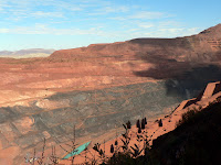
Thursday, 19 July, Barradale Rest Area - We left Tom Price and travelled most of the day towards Exmouth. This road is called the Warlu Way, a scenic tourist drive going through Paraburdoo, another mining town with an airport used mostly by the miners on a fortnightly fly in - fly out shift schedule. The landscape is interesting, rugged red rock hills following the road on both sides. Very little traffic. We reached the main road following the West Coast at the Nanutarra Roadhouse. After filling up the tank we went on another 70 kms and stopped for the night at the Barradale Rest Area near the Yannarie river, a vast flat dusty place near the road. A popular place, many other campers around, but enough space for everyone. After a good shower again we had a nice quiet evening and night, apart from the rumbling of the occasional road trains passing by.
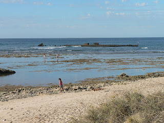

The SS Mildura
Friday, 20 July, Exmouth - In the morning we drove in to Exmouth, about a further 200 kms, and set up the van at the pre-booked Cape Holiday Park. We went to the visitor centre and booked a full-day boat tour for tomorrow, hopefully to see some whale sharks. After lunch we went on a tour around the area, up to the West side. We stopped at the lighthouse to enjoy the views, then at the Northernmost point of the peninsula where the ruins of the SS Mildura are visible on the coral shore. Back in Exmouth, we saw the calm waters at low tide at Town Beach, and made a tour of the Marina. Most of the town is very recent, and a lot of new residential buildings, apartments, holiday homes are in construction. Looks like business is booming in this town.


Going snorkelling
Saturday, 21 July, Exmouth - Today we went on an all-day "whale shark" tour. We had to get up early, to be picked up at 7.10 am, but then we were taken to the dive centre shop, and had to wait a lot before any action took place. We had to select our gear, wet suits, fins and face masks, and wait for the other group members to arrive. Then we were taken by a small bus to the other side of the peninsula, where we boarded the boat. The boat was much smaller than I expected. First we went out just inside the reef and did a bit of snorkelling, to make sure that everyone is comfortable with their equipment, and for the tour guides to ensure that we are able to swim. The coral was interesting, as always, but not as colourful as on the East coast around Cairns. We saw some nice little fish. 
Swimming with a whale shark
Then came the main attraction: we went outside the reef, looking for whale sharks. These big fish (the largest fish on the planet, it can grow up to 20 m long) are spotted by helicopters and their location is reported to the tour operators. There are always many of them here around this time of the year. When they have located one for us, our boat went there, and we could jump in and swim beside these huge, amazing creatures. Usually it does not take long before we lose them, either they are swimming too fast, or they dive deeper. 
Face to face
A manta ray
We jumped in twice and saw one each time, quite close, a few matres away as they slowly move forward with their mouth open feeding on the plankton. The first one was about 4 m long, the second much larger, 5-6 m. On the way we also saw a few humpback whales breaching a few times not too far away, and later on some manta rays. It was a unique experience indeed, but we had to suffer a lot for it. Not so much in the water, with the wetsuits on and swimming as fast as we could it was ok, but when we came out of the water, sitting in the open, windy boat we were very cold. And unfortunately the weather was not ideal today, partly cloudy, strong winds, the sea was very choppy. Also, the boat was very small for that many people, hard to move around. So overall, it was not as good as we expected, especially for the amount of money it costed. Unfortunately most of the action occurred under water, so we could not take any photos. The ones included here were taken by our guide.
We came back around 3.30 pm, had a long hot shower to warm up, then a relaxing evening. 


Shothole Canyon
Sunday, 22 July, Exmouth - This morning we woke up to rain quietly pattering on the top of the van. This is how the weather remained all day, no wind, fully overcast, about 20 degrees, and light intermittent rain. They say Exmouth has about 320 days of sunshine every year, so today was one of the other 45 days. A pity, but again we are lucky it did not happen yesterday, it would have been even colder out on the boat.
Charles Knife Canyon
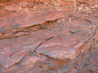
Nevertheless, we went out on a tour of the East side of Cape Range NP, about 20 km further South. First we drove along the Shothole Canyon road, a gravel road meandering along the floor, a scenic drive among the colourful rock layers of the sheer canyon walls. Then, another few kms further, the Charles Knife road climbs up the side of the Cape Range ridge in between two parallel gorges, offering fantastic views into the gorges. The road ends at the Thomas Carter lookout, with views of the whole peninsula and the ocean around it, very impressive even in this overcast grayish weather. On the way back we stopped at Pebble beach where Kate could not resist picking up a few memorabilia. 
Back in the van, we had lunch and a rest. In the afternoon we went shopping and hired two wetsuits for our planned snorkeling during the next two days on the West coast of the peninsula.


Our campsite at Pilgramunna
Monday, 23 July, Cape Range NP, Pilgramunna campsite - Two days ago we managed to book a place at this DEC-managed campsite, after some unsuccessful attempts earlier. So this morning we drove out here, at the other side of the peninsula, about 80 kms from Exmouth. The sky was still overcast when we left Exmouth but it cleared out by the time we got here. And this turned out to be a wonderful place, just beside the beach, in a small bay, only 9 campsites, all natural environment, sand dunes, and coral reef right here at the beach. We set up camp, and stayed here all day, enjoying the environment. 


A flock of cockatoos at the campsite
After lunch we went snorkelling. With our borrowed wetsuits the water was quite enjoyable, and the reef was fantastic. Here also, the coral is not as colourful as on the East coast, but the abundance and variety of the fish we saw very close was amazing. We stayed in the water for about 1.5 hours. Then we came back to the camp, and just rested, reading, walking around, cooking dinner, etc. The weather was ideal, sunny, warm but not hot, light breeze, just perfect. And again, a beautiful sunset in the ocean.


Yardie Creek Gorge
Tuesday, 24 July, Cape Range NP, Pilgramunna campsite - During the night we woke up to the noise of strong wind-gusts, and it remained very windy all day. In the morning we went to check out the other parts of the NP. First we drove South to the end of the sealed road at Yardie Creek. We walked up along the top of the escarpment of the gorge with nice views down to the creek and the red rock walls. Sometimes it was hard to stand agains the windgusts. 
Then we drove back Northbound to see some of the other beaches and bays along the coast. We stopped at the Oyster Stacks, another good place for snorkelling at high tide. 
Turquoise Bay
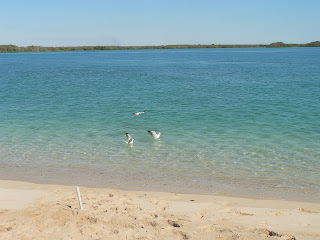
Then at Turquoise Bay, which seems to be the most famous and popular place, all the organised tours come here. The colour of the water is really turquoise and calm, and the whole area is really beautiful. It is also a good place for snorkelling. We were tempted to try it out, but did not have all the gear with us, so we went home.
After lunch we went snorkelling again. The water was a bit choppy and not as clear as yesterday, but we still saw a lot of different fish and corals. The rest of the afternoon we spent at the camp reading and resting. Later the sky became cloudy and by sunset it was almost fully overcast again. Just so that tomorrow morning we won't regret so much leaving this wonderful place...


Wednesday, 25 July, Carnarvon - Another frustrating windy night. The wind blew away the clouds, but woke us up many times. We packed up in the morning and went back to Exmouth, then continued our journey Southbound. We left with very good memories of this area, with the only regret that we did not see any emus, although the Exmouth tourist guide introduced them as "our reception committee".
Coral Bay
At lunchtime we stopped at Coral Bay, another small seaside resort at the Southern end of the Ningalo Reef. It is at the tip of a small headland, surrounded by white sandy beaches and sparkling blue and turquoise water, a beautiful place in the clear sunshine. We walked up to a lookout, went down to test the water, then had lunch and coffee.
Then off again, and a bit later we crossed the Tropic of Capricorn - unfortunately in the wrong direction... We have to say goodbye to the nice warm tropical days. The coutryside has also changed,  the almost barren plains that we saw earlier gradually got more and more vegetation, and a bit later we were surrounded by banana and other fruit plantations, the first cultured land since the irrigated santalwood blocks beside Kunnunurra. Soon we arrived to Carnarvon, the agricultural centre of the region, and checked into a van park. We got the first taste of cold weather, overcast, windy and 18 degrees, which felt as a shock after the last few months. We'd better get used to it.


Our itinerary can be seen at the following Google Map:
http://g.co/maps/wcwv8 
(Note that to see the route after Bowen, you need to move down to the bottom of the right panel, and select the following pages!)


Az elmúlt hetet Exmouth-ban és környékén, a Ningaloo Reef közelében töltöttük. Ez hasonló a Great Barrier Reef "Nagy korallzátony"-hoz a keleti partvidéken, de nem olyan hosszú, de legalább olyan érdekes és híres, ez is Világörökségi terület. 


Múlt csütörtökön (jul. 19) jöttünk el Tom Price-ból, másfél napot utaztunk Exmouth-ig, kb 650 km. A csütörtök éjszakát egy útmenti pihenoben töltöttük, elég kellemes volt. Pénteken (jul 20) délelott értünk Exmouth-ba, ahol elore foglaltunk szállást 3 éjszakára egy kempingben. Exmouth egy észak felé kinyúló félsziget keleti oldalán van, és a csúcsán meg végig a külso, nyugati oldalán van a korallzátony, tengeri természetvédelmi terület, a nyugati parton pedig végig az ún. Cape Range nemzeti park. Elso fontos dolgunk az volt, hogy helyet foglaljunk egy "whale shark" túrán, ami itt a legnagyobb szenzáció, szerencsére sikerült. Aztán délután körülnéztünk a környéken. Megnéztük a közeli beach-eket, a yachtkikötot, a félsziget csúcsán egy világítótornyot, és egy 1907-ben zátonyra futott hajó roncsait. Az egész város nagyon újnak tunik, rengeteg új üdülo és egyéb épület és további építkezések, láthatólag jól megy a turista-biznisz.


Szombaton (jul 21) mentünk a whale shark hajótúrára. A whale shark (bálna-cápa) a világon a legnagyobb halfajta, 20 m-re hosszúra is megno, pedig csak planktonnal táplálkozik. Július táján mindig sok van ezen a vidéken, ez itt a fo turista-attrakció. A cápát repülorol keresik meg a vízben, és a helyzetét megadják a hajónak. Amikor a közelébe érünk, a hajót a cápa haladási irányában kicsit eléje kormányozzák, ekkor egy vezeto-búvár (spotter) beugrik a vízbe és ha sikerült meglátnia a cápát (ezek általában közvetlenül a felszín alatt úsznak lassan, nyitott szájjal, és így szurik ki a vízbol a planktont), feltartja a karját a víz fölött, akkor lehet a magunkfajtáknak is beugrani a szemüveggel, pipával és úszótalpakkal, és a cápa mellett úszni, követni amíg bírjuk. Általában nem sokáig lehet követni, vagy túl gyorsan úszik, vagy lebukik mélyebbre, de addig a rövid ideig is fantasztikus látvány egy ilyen tengeri óriást közelrol látni a természetes környezetében. Ezt többször is meg lehet ismételni. Nekünk kétszer sikerült, persze ezek nem voltak olyan óriásiak, csak kb 5-6 m hosszúak, de egész közelrol nagyon nagynak látszanak. Valóban egydülálló élmény volt, de elég sokat kellett szenvedni érte. A túra majdnem egész napos volt, egy elég kicsi nyitott hajóban, eros szél fújt és nem volt nagy meleg, sokat fáztunk útközben a vizes búvárruhában. Útközben azért volt még más attrakció is. Eloször a korallzátonyon belül mentünk egy kicsit snorkel-olni, sok érdekes halat meg korallt láttunk, bár itt a korall nem olyan színdús, mint a keleti parton, de azért jó volt. Késobb, útközben láttunk bálnát is amint kiugrott a vízbol, de elég messze volt. A vége felé meg hatalmas manta rájákkal is találkoztunk, azok mellé is be lehetett ugrani, de már nekünk elegünk volt az akcióból. Sajnos ezen az úton a legérdekesebb dolgok a vízalatt történtek, így saját felváteleink nincsenek róla, de a vezeto búvárnak volt víalatti kamerája, tole kaptuk a blogra feltett képeket. 
Vasárnapra (jul 22) kicsit elromlott az ido, csepergett az eso, felhos volt, de azért kihasználtuk az idot. A félsziget keleti oldalán meglátogattunk két újabb kanyont, a Cape Range nemzeti parkban. Földúton kellett belemenni, az egyik (Shothole Canyon) a kanyon aljában haladt, a másik meg (Charles Knife) a felso peremén, mindkettonél sok szép vadregényes sziklás tájakat láttunk. 


Hétfon átköltöztünk a félsziget nyugati oldalára, a Cape Range nemzeti park egyik táborhelyére. Ezeket a táborhelyeket elore le lehet foglalni egy weboldalon, de ilyenkor nagyon nagy a kereslet, nehéz helyet találni. Eloször nekünk sem sikerült, de másodszorra találtunk egy helyet a Pilgramunna nevu táborhelyen. A számozott táborhelyek közvetlenük a tengerparton vannak, csak kis csoportokban, max 8-10 hely, az egyedüli szolgáltatás egy pottyantós wc, de ide minden felszereléssel együtt szokás jönni. A táborhelyünk nagyon szép volt, közvetlenül a parton egy kis öböl mellett, és egész közel a parthoz már ott a korall, lehet snorkelolni. Még vasárnap béreltünk búvárruhát Exmouthban, mert azért a víz nem olyan meleg, kb 22-23 fokos lehet. Két napot töltöttünk itt, mindkét napon mentünk snorkelolni, sok szép halat és korallt láttunk. Hétfon nagyon szép ido volt, napsütés, meleg, csendes, nagyon élveztük. Éjszaka aztán feltámadt a szél, és egész kedden erosen és egyenetlenül fújt, a hullámzás is nagyobb lett, a víz nem volt olyan tiszta, de így is jó volt azért. Kedden elmentünk egy kicsit körülnézni is a park többi tengerparti szakaszán. A Turquoise Bay a leglátogatottabb hely, idehozzák a turista-buszokat napközben, egész valószínutlen világoskék színu a víz benne. A park déli végében még egy kanyont is megnéztünk, még nem untuk meg.


Ma, szerda (jul 25) reggel indultunk tovább onnan, újabb kb 300 km-el délebbre, sajnos egyre huvösebb tájak felé. Délben még megálltunk a Coral Bay-ben, egy másik kis turista-település a Ningalo Reef déli végében, szintén valószínutlenül kék tenger és fehér homok szegélyezi, aztán kicsit késobb átléptünk a Baktérítot, és nemrég megérkeztünk Carnarvon-ba. Ahogy közeledtünk, banán-ültetvények meg szoloskertek jelentek meg, hosszú ideje most eloször láttunk megmuvelt földet, ez egy fontos mezogazdasági központ. És meglepoen hideg, felhos szeles ido fogadott, a 18 fok elég sokkoló volt, de most már ehhez sajnos hozzá kell szoknunk, végül is itt most tél közepe van. 


Az útvonalunk a következo Google Map-on látható:
http://g.co/maps/wcwv8
(A Bowen utáni szakaszokhoz le kell menni a jobboldali panel aljára, és a következo oldalakra kattintani!!)

Wednesday 18 July 2012

The Pilbara - Karijini NP


(Magyar összefoglaló a végén)


Saturday, 14 July, Auski (Munjina) Roadhouse - This morning we had to go shopping once more in South Hedland for those things we forgot yesterday. Then we left and drove down to this roadhouse (whatever its name), about 250 km from South Hedland. This is  at the edge of the Karijini National Park, so we can get there early tomorrow, and hopefully we will get a place to stay at the campground. The landscape has changed as we came closer, interesting rocky ranges, dark brownish red, sometimes even pinkish. Lots of big long road trains and service ute-s on the road, a few oversized vehicles carrying prefabricated houses, huge machinery or whatever. Not as many caravans as before. A lot of mining and construction activity in the area.
Auski Roadhouse
The roadhouse also looks more like a big construction site. There is a caravan park, but most of it is occupied by the people working in the area. It's not very nice, but we got power and water, only mobile reception is missing. We had a quiet afternoon, resting and cooking, and reading a weekend paper, the first time in 3 months. Actually, we have just finished the 3rd month on the road today. We are almost at the half-way mark in time and close to the point furthest from Sydney. 


Dales campground
Sunday, 15 July, Dales campground, Karijini National Park - We left the Auski Roadhouse early, around 8 am and drove into the Karijini National Park, about 80 km away. It was important to get here early to have a better chance to get a campsite. At the visitor centre we were told to go to the Dales campground and join the queue and if we can't get a place, go to the overflow camp area. We went to the campground - and there was no queue at all, we could directly get a nice site for 2 nights. We set up the van, and immediately went on to see the gorges.
Dales Gorge
Our first stop was at the Dales Gorge parking area. Only a few steps from there we got the first sight of the gorge, again very different from all the others we have seen before, and again very impressive. We climbed down to the bottom and walked to Fortescue Falls, then on to Fern Pool, both very attractive. 
Fern Pool
Zebra rocks in Dales Gorge
Circular Pool
There is a walk along the bottom of the gorge, but that would have been too much for us, so we climbed back up, and drove further to the other car park at the end of the gorge. There are two lookouts close to this car park. From one we could see down to Circular Pool, between 100 m high vertical dark red rock walls, that's where the gorge ends and apparently it has not outflow at either ends (?). The other lookout is called Three Ways lookout, where there is a bend in the gorge at the junction with another side gorge. The rock walls are amazing with their colourful layers of various types of rocks.


Kalamina Gorge
We went back to the van for lunch and a bit of rest. This was again a beautiful clear sunny day, but windy and cool, no more than 18-20 degrees at noon. In the afternoon we drove out to the next closest site (about 35 kms, 24 on dusty gravel), Kalamina Gorge. Here also we climbed down to the bottom, there is a little waterfall and pool (the water was quite disgusting, something frothy got into it), and then walked along the creek for a while. The whole place is amazing but the rich variety of the rock layers is the most interesting. This was enough for today, we drove back to the van by sunset, around 5.30 pm. Now we are preparing ourselves for a cold night, around 6 degrees is the forecast.
The view above one of the gorges
Flowering tree
Monday, 16 July, Dales campground, Karijini National Park - The forecast was not perfect. At 6 am it was 3 degrees inside our caravan, it must have been even less outside. The night was not very enjoyable, and the early morning was even less, but we survived. The sun came up only around 7 am here because of the mountains, then it quickly started to warm up. 
Junction Pool from above
After breakfast we packed a picnic and went over to the Western side of the park, about 55 km from here, mostly on gravel. First we went to the Junction Pool lookout then on to Oxer lookout, they are very close to each other. The views from there are extraordinary. It is the junction of 3 gorges: Joffre, Hancock and Red Gorge. The bottom of these gorges is about 100 m below the cliff, the red rock escarpments provide a fantastic view. Then we went back to the Weano car park and headed into Weano Gorge. We got in about half way, but there we had to scramble through a creek of dirty, smelly water several times and at the second crossing we had enough and turned back. On the way I saw a long snake gliding into the bush in front of us. Most likely it was an olive python. 
Red Gorge from Oxer Lookout
The rock face in Hancock Gorge
Just so that we don't leave without a gorge experience, we climbed down into Hancock Gorge, through a quite steep and difficult rock escarpment and a ladder at the bottom. We had a look around, did not go too far but it was worth the effort.
We had our lunch at the car park picnic area, then drove back to the Karijini Eco Retreat for a good plunger coffee. 


Joffre Gorge (see the people on the rock face?)
On the way home we stopped at the Joffree Falls lookout, and watched from above as a group of people climbed down to the bottom on the other side. Then on to Knox Gorge lookout, to complete the list of gorges joining at this junction. Both of these lookouts offer unbelievably beautiful views, hard to leave them. We were very lucky to have clear sunshine and in both cases we were the only persons at the lookout, we could enjoy the views undisturbed for quite a while.
Joffre Falls
Knox Gorge
Sunset at Dales campground
We came home a bit earlier today, still in warm sunny weather, so we put out the shower tent and had a good hot shower before sunset. By that time thin cloud strips appeared in the sky, making it a beautiful sunset. Hopefully it will also make the night less cold than yesterday.


Tuesday, 17 July, Tom Price caravan park - Yes, the night was better, 8 degrees at sunrise in the van, although the sky was not fully clouded, just a few patches on the East side. The five degrees more made a big difference, but also I put on a few more layers for the night. Then after 7, as the sun went higher, the air has warmed up quite quickly.
Mount Nameless near Tom Price
We packed up the van and drove to Tom Price. It is about 90 km from the campground, a young little town, established in the 1960-s, as a mining centre. There is a Rio Tinto open-cut iron ore mine just beside the town. Its other claim to fame is that it is the highest twon in WA, we found out on the internet that its elevation is about 750 m above sea level. 
There was a big queue of caravans waiting to get into the park, it was a bit chaotic but finally we got a site and set up the van. It was time again for some household works. Kati did the washing, and I went to wash the car. It was a big job, took 1.5 hours to get rid of all the red dirt in- and outside, but now again we can get in the car without getting dirty. 
The Rio Tinto mine from the top of Mount Nameless
After lunch we went on a little tour of the surroundings. First we wanted to check out the only touristic attraction, the lookout from Mount Nameless (or Jamdrunmunhna), a 1128 m high peak just beside the town. There was a warning that "4WD vehicle access only", but we were surprised how difficult the track was. Very steep, very rough, very narrow, lots of sharp rocks, a bit scary. Fortunately our magnificent car has made easy work of it, no problems at all - except that the back of the car is a bit dirty again... But the views from the top were amazing, it was worth it. On one side we can see the open-cut mine, on the other the township and the reddish hills of the Hammersley Ranges. Having safely returned to level ground, we went to the town, visited the visitor centre and did a bit of shopping at Coles. We drove around the town centre to get a feel of life here, then came back to the park. Now that we have internet connection again, we have a lot of work to do in the evening.


Wednesday, 18 July, Tom Price caravan park - The night was much warmer than the previous ones, it was 18 degrees in the morning. Not sure why, as we are at about the same elevation. But we don't complain about that.
A big truck
This morning we went on a mine tour. It was a 1.5 hour guided bus tour, although we did not catch much of what the guide said with its broad and poorly articulated aussi accent, but it must have been humorous as others in the bus laughed a lot. We went through the mine, stopped at a lookout to the big pit, a large hole in the ground where originally a big hill was standing, now only small parts of it exist on the side. Huge machines are working in and around, trucks as big as 3-storey buildings, mostly driven by female drivers. More than 50% of the rock is pure iron ore. 
The main pit
The whole region has its reddish colour due to the oxidated iron in the earth, but it is not worth excavating if the concentration is below 50%. We drove through the processing plants where the ore is crushed and classified based on its iron concentration, then loaded into rail carriages and transported to the ports in Dampier and Karratha. The mine control centre is near Perth airport, several thousand kms from here. Actually, there are 13 different mine sites around here, all controlled from there, an amazingly complex operation. 
The processing plant
This was our only program for today. In the afternoon we are enjoying the internet connection, working on the blog, and preparing for the next stage of our trip. Our next destination is Exmouth and the Ningaloo Reef area.


Our itinerary can be seen at the following Google Map:
http://g.co/maps/wcwv8 
(Note that to see the route after Bowen, you need to move down to the bottom of the right panel, and select the following pages!)


A Pilbara az egy nagyobb tájegység neve Western Australia-ban, a Port Hedland tengerparti vidéke is hozzá tartozik, beljebb pedig a Hammersley Range (hegység). Ez a hegyvidék az ország egyik legfontosabb bányavidéke, foleg vasércet, de mindenféle mást is bányásznak itt több helyen, aztán hordják vasuton és nagy teherautó-konvojokon (road trains) a kikötokbe, onnan meg a világ minden tájára, de mostanában foként Kínába. Emellett sok különleges természeti szépség is van itt, több nemzeti parkban, ezekbol a legnagyobbat látogattuk meg, a Karijini nemzeti parkot.
Szombat reggel indultunk South Hedland-bol, és lejöttünk 260 km-el délebbre, egy Auski (vagy aboriginal nevén Munjina) Roadhouse-hoz, ahol van egy kis kemping is. Az úton rengeteg nagy road train-nel találkoztunk, meg idonként "túlméretes" szállítmányokkal is, amikor le kell húzódni az út szélére amíg elmennek mellettünk. Az egész vidéken látszik hogy milyen intenzív gazdasági és építomunka folyik itt. Délre már odaértünk a roadhouse-hoz, és délután csak ott pihentünk, foztünk, készültünk a következo napokra.
Vasárnap jó korán reggel elindultunk tovább, és bementünk a nemzeti parkba. Korán kellett odaérni hogy nagyobb legyen az esélyünk helyet kapni. Itt a park gondozásában van egy táborhely, ahol érkezési sorrendben lehet bejutni. Azt mondták, hogy sorba kell állni és megvárni amíg ürülnek a helyek. Odamentünk, és nem is volt sor, egybol bejutottunk, kaptunk egy szép táborhelyet. Itt jó tágas helyen megközelíto hurok utak mentén vannak kijelölve számozott táborhelyek jó távol egymástól. Persze ez nem egy kemping, az egyetlen szolgáltatás a wc (pottyantós de nagyon rendes), de minden mással fel vagyunk szerelve. Felállítottuk a lakókocsit, és mindjárt tovább mentünk nézelodni. Ez a vidék (is) a gorge (szurdok? kanyon?)-jairól híres, de egész más mint amiket korábban láttunk. A kozet nagyon érdekes, többnyire tiszta vörös, réteges, fantasztikusak a különbözo színu rétegzodések, ebben vannak az értékes ércfajták. A kozet nagyon régi, 2500 millió éves, és nagyon kemény, de a víz ebbe is mély kanyonokat vágott az idok során, ezek itt a fo látnivaló. Délelott a közeli Dales Gorge-hoz mentünk. Itt egy kilátó pontról láthattunk bele a kanyonba, a rétegezett függoleges sziklafalak közé. A végén volt egy kis vízesés, Fortescue Falls, oda lemásztunk, közelrol is megnéztük, és tovább mentünk a Fern pool-hoz, egy kis természetes tavacskához, amit egy forrás táplál. Aztán felmásztunk, és továbbmentünk a következo kilátó pontig, ahonnan a Circular Pool-ba lehet lelátni. Ez egy köralakú tavacska a kanyon másik végén, több mint 100 m magas függoleges sziklafalak között, fantasztikus látvány. A kanyon fenekén is végig lehet mászni idáig, de azt inkább kihagytuk.
Ebéd után elautóztunk egy másik kanyon-hoz, Kalamina Gorge, itt is lemásztunk az aljára, és jó hosszasan elsétáltunk a fenéken, ez nem volt olyan nehéz, csak egy helyen kellett a vizen átlépkedni. Nemcsak a szuk kanyon, de maga a sziklafal is nagyon érdekes a különbözo színu vizszintes rétegeivel.
Éjszaka nagyon hideg volt. Reggel a lakókocsiban 3 fokot mutatott a homéro. Jól felöltöztünk, de azért így is fáztunk egy kicsit, és felkelni volt a legnehezebb. Aztán 7 óra felé feljött a nap, és elkezdett melegedni. 9-re már megint egy szál ingben lehetett járni.
Hétfon elautóztunk a park másik végébe, kb 60 km földúton, jó poros és rázós, de mit lehet tenni, legalább a lakókocsit nem kellett vinni. Itt 4 kanyon fut össze majdhogynem egy pontban, ezeket néztük meg, többnyire fölülrol. Mindegyik vagy 100 m mély, fantasztikus színes, de dominánsan sötétvörös rétegezett sziklafalak között. Több kilátópont van, amik autóval és egy kis sétával könnyen elérhetok. Azért az egyikbe (Hammresley Gorge) lemásztunk hogy alulról is láthassuk. Déltájban itt egy piknik-helyen ebédeltünk, és egy Eco Retreat nevu intézményben kávéztunk. Délután további két gorge-ot néztünk meg itt, nekem a Joffre Gorge tetszett a legjobban. Itt vagy félórát bámultuk ahogy egy csoport ember lemászott a kanyon másik oldalán a vízeséshez, onnan föntrol nagyon veszélyesnek látszott. Még napnyugta elott visszaértünk a lakókocsihoz, és felállítottuk a zuhanyozó-sátrunkat és jót zuhanyoztunk a saját melegvizünkbol. Ritkán van rá szükség, de akkor nagyon jól jön.
A hétfo éjszaka nem volt annyira hideg, reggel 8 fok, és jobban fel is öltöztünk, nem fáztunk. Kedd reggel összepakoltunk és továbbindultunk. Megint nem messzire, csak 80 km, egy Tom Price nevu kisvárosba. Ez egy bányászati központ, a 1960-as években építették, közvetlenül mellette van egy nagy nyíltszíni bánya. Itt vagyunk most egy kempingben, megint van villany, víz, és fóleg mobil vétel. Kedden foleg háztartási munkákkal voltunk elfoglalva, Kati mosott, és meg lemostam az autót kívül-belül, jó nagy munka volt, de most megint hozzá lehet nyúlni anélkül hogy mindenünk vörös maszatos legyen. Délután kis pihenés után elmentünk kicsit körülnézni. Közvetlenül mögöttünk van egy nagyon impresszív meredek hegy, a Mount Nameless, 1128 m magas, és terepjáróval fel lehet menni a tetejére. Hát, felmentünk, de elég nehéz volt. Nagyon meredek, nagyon keskeny és nagyon egyenetlen, tele éles kövekkel, kicsit izgi volt, de baj nélkül felértünk, és a kilátás valóban nagyon szép, érdemes volt küszködni. Egyik oldalon a nyíltszíni bánya, a másikon a kisváros és további látványos hegyvonulatok. Lefelé még ijesztobb a meredeken, de minden rendben ment, szerencsére az autónk nagyon jól szuperál. Aztán bementünk a városkába, nézelodtünk a turista irodában, és vásároltunk egy kicsit.
Este és éjszaka sokkal melegebb volt mint elozoleg, reggel is 18 fok volt, pedig itt is kb olyan magasan vagyunk, mint a nemzeti parkban, kb 750 m-en. Ma, szerda (jul. 18) délelott elmentünk megnézni a bányát. Egy másfél órás busz-túrával, sok magyarázattal, amibol nagyon keveset értettünk, a vezeto elég elnagyolt artikulálásából, no meg közben a környezetet is kellett figyelni, de nagyon érdekes volt. Óriási gépekkel dolgoznak, eltörpült mellette a buszunk. Hatalmas mély lukat vájtak egy régen volt hegy helyén, negyven éve folyik a kitermelés és még kb húsz évre van mit kiszedni. A kitermelt kozet több mint ötven százaléka tisza vasérc. Azt monta a vezeto, hogy az egész Pilbara vidék az eloxidált vasérctol olyan vörös, mindenhol az van, de ahol kevesebb mint 50% ott nem érdemes kitermelni. Megnéztük a nagy lukat (pit), aztán végighaladtunk a feldolgozó részlegen, ahol zúzzák és osztályozzák a kozetet, aztán vagonokba töltik és viszik a kikötobe. Az egész hatalmas bányamu irányító központja Perth mellett van, innen többezer km-re, onnan kellett a buszvezetonek is engedélyt kérnie az egyes területekre behajtásra. Ez volt a mai összes program, most délután pihenünk, készítem a blogot, és készülünk a következo napokra. Következo uticélunk a tengerparton az ún. Ningalo Reef környéke, egy újabb korall-zátony.


Az útvonalunk a következo Google Map-on látható:
http://g.co/maps/wcwv8
(A Bowen utáni szakaszokhoz le kell menni a jobboldali panel aljára, és a következo oldalakra kattintani!!)

Friday 13 July 2012

Down the West Coast to Porth Hedland


(Magyar összefoglaló a végén)


Monday, 9 July, Port Smith caravan park - This morning again I worked on the blog and managed to finish the last missing bit and upload it. Then we packed up and left Broome. We went down South-West along the main coastal highway towards Port Hedland. According to the map on our left hand side was the Great Sandy Desert, but it had far too much vegetation to look like a desert. But there was sand all right, we saw it in a parking area which was not sealed. It was dark-red fine grain dust. 
Cleaning the day's catch
We only travelled about 150 kms, then turned towards the sea, and on a 23 km stretch of red dusty road we came to Port Smith caravan park. It is a very different environment from what we saw in Broome and all in the Kimberley. There are no foreigners here, only aussies, mostly fishermen and their families. A very friendly, quiet laid-back  place, a nice change after the tourist-centered life in Broome. We came here to have a bit of rest, to do nothing for a few days. And that's what we did in the rest of the day. I mentioned to a cleaning lady that we are not fishermen but would be interested in some fish if there was some available. Around 6 pm she called me and took us to the place where all the fishermen were busy cleaning and filleting their daily catch. There were a few big cods and other fish I don't know the name of. After a bit of wait we were given some nice pieces of fillets for free - so we also had a good catch today.


He got a good size pike
Tuesday, 10 July, Port Smith caravan park - We stayed here for another day, and we did not regret it. In the morning we just sat outside the van in the shade, reading and resting. It felt good not doing any sight-seeing for a change. At noon we took advantage of a free (or rather for a small donation to the Flying Doctor Service) boat ride to the adjacent lagoon. We were picked up first by an open 4WD in groups of 6 and taken to the muddy shore in the mangroves. It's a popular activity for the guests, we had to wait half an hour to get in with the 3rd group. Then a small dinghy took us across the lagoon to a nice sandy beach which can only be accessed this way, so there were only the people from this caravan park on it, mostly fishermen and a few like us, just enjoying the scenery. It was a beautiful spot, and the water again had such amazing light blue to opaque colours. The air was quite warm, we also had a swim but the water was just as cold here as in Broome so we came out quite quickly. Then we had a walk along the beach and collected some nice shells, ate our picnic lunch and drank our pre-brewed coffee, and just rested, reading and enjoying the scenery. At 4 pm the boat came back to pick us up, group by group and we were back at the camp by around 5 pm. At home we had a nice dinner from the fish we got yesterday. It was an interesting experience and a very nice day. 
Port Smith Lagoon
A small part of 80-mile Beach
Wednesday, 11 July, 80-mile Beach caravan park - We came further down South-West about 220 kms, and booked into the 80-mile beach caravan park. This park is just behind the dunes of this very long stretch of white sandy beach. It is a very popular place at this time of the year, especially for fishermen, we could only get an unpowered site but we are reasonably self-sufficient with power, as long as there is enough sunshine for our solar panel. And so far there is no shortage of sunshine, although today was the fist day for a very long time that we have seen some clouds on the way here, but they disappeared by the time we got in here. But the temperature is getting a bit cooler, we can feel that we are on the way out of the tropics already. A pity, but what can we do if we want to see the Southern part of the country as well?...
We did not do much in the afternoon, just relaxed, had a long walk along the beach, fossicking for pretty shells, watching the birds and the sea. And then, of course, the sunset over the sea that can't be missed while we are at the Western shore. We even managed to call our children in the evening from the top of a dune, the only spot with weak but working mobile reception, with a bit of luck...


Sunset in the Indian Ocean
Thursday, 12 July, 80-mile Beach caravan park - We stayed here for another day. Although in the morning the sky became fairly cloudy and we were hesitating whether to stay or go, but ended up staying and the sky has cleared out by noon. In the morning we rested reading under the awning of the van. In the afternoon we took our chairs out on the other side of the dune, and watched the beach life and the sea. It was high tide at 4 pm, all along the water's edge the fishermen were out as long as we could see in both direction. Byt 5 pm they started to leave, but they did not catch too many fish, if any. Then of course, we had to wait for another sunset, perhaps even prettier than yesterday.


Salt hills at Port Headland
Friday, 13 July, South Hedland caravan park - We left the 80-mile beach park quite early, heading further South-West. The landscape around us was not very interesting, flat, little vegetation, almost no sign of life. As we came closer to Port Hedland, the land became more undulated, with rocky outcrops, and mine sites appeared on both sides. We got to Port Hedland around noon. It is a very busy industrial and port centre, lots of big road trains and other traffic. We went to the caravan park, but we could not get in, it was completely full. We are now in the first week of the school holidays here, we can expect more similar problems in the next week unfortunately. 
The port
After some searching around we found a place at the adjacent South Hedland, 12 km from Port Hedland. We set up the van, had lunch, then went back to Port Hedland, mostly to check out the visitor centre, but also to have a look around the town and the port. We found the visitor centre (it was not easy, with all the construction works around it), but were not overjoyed with the info we got: it looks like all the campsites are fully booked in there, too. Anyway, we have not much choice, we will go down there and hope for the best.
We drove around the town centre, had a stop at a lookout to the port. An interesting sight, big cargo ships, and loading facilities. Not much else to see. Then we went shopping to refill our stocks. 
Back in the caravan park, this evening we can take advantage of the good mobile internet reception; we have a lot of emails and communications to catch up with.


Our itinerary can be seen at the following Google Map:
http://g.co/maps/wcwv8 
(Note that to see the route after Bowen, you need to move down to the bottom of the right panel, and select the following pages!)


Sok érdekes nem történt ezen a héten, az elmúlt hetek exotikus látnivalói után ez egy csendesebb idoszak volt. Hétfo reggel, miután befejeztem az elozo blog-ot, felpakoltunk és elindultunk dél-nyugat felé Broome-ból. Nem mentünk messzire, csak kb 150 km-re, egy Port Smith nevu helyre. Ez az Indiai óceán partján van, 23 km földút vezet le hozzá, de nem volt nagyon rossz. Más nincs az egész környéken, csak egy kemping, ami nagyon népszeru foleg a horgászok körében. Itt töltöttünk 2 éjszakát. Nagyon barátságos hely, és teljesen más, mint a korábbi környezet. Broom és följebb az egész Kimberley régió tele volt turistákkal, rengeteg külföldi, foleg európai utazó. Itt meg csak helybéli "ozzi"-k, és a kemping üzemeltetoi egész családiasan kezelik az ittlevoket. Rendeznek mindenféle összejöveteleket, szórakoztatják a népet. A második nap elmentünk mi is egy ilyen szervezett akcióra, déltájban kis motorcsónakkal kivittek minket (a többi jelentkezovel együtt) a kemping melletti laguna külso oldalára, egy szép homokos tengerparti szakaszra, ott letettek, és du 4-kor jöttek értünk, visszavittek. A legtöbben itt is horgásztak, mi meg csak letelepedtünk a parton, olvastunk, nézelodtünk, fürödtünk is egyet, de csak röviden mert a víz itt is elég hideg volt. Nagyon kellemes volt. Bent a kempingben is ezt csináltuk, foleg pihenni jöttünk ide, jó volt egy kicsit lazítani, jó volt hogy nem kell látványosságok után járni pár napig. Az elso este kaptunk is egy adag firssen fogott és kifilézett halat a helyi horgászoktól, így még finom halvacsoránk is volt.
Szerdán reggel tovább indultunk dél felé, de megint nem messzire, kb 220 km-re a "80-mile beach" caravan parkba. Ez is közvetlenül az óceán partján van, mindjárt a partot szegélyezo homokdune mögött, és egy 80 mérföld hosszú folyamatos homokos tengerpart közepén. Ez még népszerubb és ismertebb hely mint az elozo, csak áram nélküli helyet tudtunk kapni, de annak is örültünk. Itt sem lehet sokat csinálni a tengerparton kívül, de az nagyon szép. Fürödni nem ajánlatos, mert cápák és krokodilok is lehetnek, a horgászat a fo szórakozás. Nagy az apály-dagály különbség és lapos a part, apálykor jó messze van a víz széle, foleg dagály idején horgásznak, olyankor tíz méterenként áll a parton egy-egy horgász véges-végig, ameddig a szem ellát. Le lehet jönni a partra terepjáróval is, így jó messze el tudnak menni. Mi megint csak pihentünk, olvastunk, sétáltunk a parton, kagylókat válogattunk, vagy csa üldögéltünk és élveztük a látványt, no meg a naplementét az óceánba, ez itt a fo attrakció, olyankor megtelik a part a nézelodokkel, mindenki fotózik, mi is... 
Szerencsére eddig az ido végig szép napos és meleg volt, de már messze nem olyan meleg, mint korábban, napközben csak 26 fok körül, és ejszaka 14-15-re lehul a lakókocsiban. És már kezd néha elfelhosödni, tegnap láttunk eloször komolyabb mennyiségu felhot, kb 3 hónap óta eloször. Ma reggelre meg komolyan elfelhosödött, és eros szél fújt, nem is bántuk, hogy tovább indultunk. De azt bánjuk egy kicsit, hogy kifelé megyünk a trópusi télbol, vissza a szub-trópusi télbe, ami már nem olyan kellemes, foleg ha felhovel-esovel is párosul. Ugyan eddig erre még nem került sor, de már elore fázom tole...
Ma lejöttünk tovább délre Port Hedland-ba. Ez egy nagy ipari kiköto, itt hajózzák be a vasércet és más bányatermékeket a környezo bányákból, viszik mindenfelé, foleg Kínába. Más érdekessége nincs, csak éppen útba esett a következo célpontunk, a "Pilbara" felé. Itt akartunk megszállni, ami nem ment könnyen, itt most 2 hét iskolaszünet van, minden tele van, és ezzel még lesz gondunk a jövo hét végéig. Végül sikerült helyet kapnunk 12 km-el arrébb, South Hedland-ben. Visszamentünk a városba, körülnéztünk a kikötoben, voltunk a turista-központban, ahol semmi jóval nem bíztattak, a Pilbara-ban is minden szálláshely tele van állítólag. De sokat nem tehetünk, bízunk a jószerencsében. Bevásároltunk és hazajöttünk. Most kihasználjuk a jó mobil-vételt, aztán holnap indulunk  Pilbara felé.  


Az útvonalunk a következo Google Map-on látható:
http://g.co/maps/wcwv8
(A Bowen utáni szakaszokhoz le kell menni a jobboldali panel aljára, és a következo oldalakra kattintani!!)

Sunday 8 July 2012

Derby, Horizontal Falls and Broome


(Magyar összefoglaló a végén)


Wednesday, 4 July, Derby - Today we spent the whole day on the cleaning job, despite the sign at the entrance to the caravan park specifically warning not to wash cars and caravans. But there are no other options available in the whole town and we cannot tolerate this dirt any more. We were careful and did it in an environmentally friendly way, without using a hose. The most difficult part was the roof of the caravan, as we don't have a ladder. Anyway the details are not important, the main thing is that by the evening both the van and the car were reasonably clean - from the outside (and the emphasis is on reasonably). There will still be a lot of work to do inside in both, but that will have to wait.
The Prison Boab Tree
After lunch, just for a break, we went out for another little tour of the attractions in and around Derby: the old gaol, the pioneer cemetery, another look at the jetty at high tide (this place is famous for its very high tidal difference, around 11 metres), and the Prison Boab Tree a few kms outside town, which is even bigger than the one we saw near Wyndham. Then we went back to work on the van and the car until darkness.


The mudflats from the plane
Thursday, 5 July, Horizontal Falls, Talbot Bay - In the morning we did some work in the van, Kate cleaning some drawers, while I worked on the blog. Then by 10 am we packed up the van and left the caravan park. We had another tour of the town and the jetty, this time in low tide, then we went in the parking area of King Sound Resort, to set up the van while we are away on an overnight tour. We had lunch there, and then we were picked up by a bus and taken to Derby airport.
Horizontal Falls, the houseboat in the left corner
The tour is called the Horizontal Falls Seaplane Adventures. We were taken by a 12-seater turbo-prop seaplane directly to a brand new houseboat in Talbot Bay, just beside the Horizontal Falls. The plane ride was very interesting over the mudflats with meandering waterchannels. On the housebouat we were placed in small cabins. 
A speedboat going through the outer gap of the falls
The first entertainment was feeding the sharks, some kind of nurse sharks about 2-3 m long, that were circling the boat all the time. Then came the main attraction: in a very fast boat (600hp twin engines) first we went for a discovery ride around the side creeks of Talbot bay, then we rode through the horizontal falls several times. This is two strips of long and narrow rock ranges that retain the water in a small bay behind as the tide goes up and down, and the water is rushing through a narrow gap in each of thses ranges. 
Going through the outer gap
The outer one is about 20 m wide between the vertical rock walls and 40 m deep, this is the one we could go through several times. It was really a thrill ride as the brochure says. The gap in the inner range is only 7.5 m wide, and the water going through there was too dangerous for the boat to get through. But we went pretty close to experience the amazing force of the water as it rushes out. All around it is like in a washing machine, the water is so turbulent.  It was a unique experience indeed. We thought the boat driver (Christian) enjoyed the ride just as much as we did, he went back and forth so many times. 
The water level drops about 4 m at the inner gap
After returning to the boat, we could relax on the deck we pre-dinner drinks (BYO) then had a nice Barramundi dinner (is it true or just an illusion that Barramundi tastes much better up here than back in Sydney?...), and a quiet evening in the still waters of Talbot Bay with clear moonlight, sharks circling around the boat all the time.


The planes arrived to take us back to Derby
Friday, 6 July, Broome - We woke up around 6 am with the first lights of the day, and soon we had breakfast on the main deck. The around 7 am we again boarded the jet boat, for another round of thrill ride across the outer gap. It was quite different in the early morning light, but just as beautiful as the evening before. We checked again the inner gap, but it was still more dangerous to ride through. Then it was time to go back to the houseboat and board the seaplane for the trip back to Derby. 
The Buccaneer Archipelago
This time we were taken on a longer route, flying low above the many small islands of the Buccaneer Archipelago, an amazing and magnificent landscape. We touched down in Derby around 8.30 am. This was a quite expensive but truly worthwhile experience, we saw some very interesting and beautiful spots of the Earth.
A pearl farm from the air
Cable Beach, Broome
We were driven back to our caravan, then hitched up the van and left Derby. We had a 200 km easy ride to Broome. We were lucky to be able to pre-book a spot in a caravan park, as everything is full in Broome at this time of the year. We wanted to stay for a few days, but we could only get two nights, after some insistence. After setting up the van and having lunch, we went for a discovery tour of the town. First we had a quick stop at Cable Beach, the most famous feature of the town, a 23-km stretch of white sand, where interested tourists can go for a camel ride, and cars are allowed to go down on the beach. Then a walk around Chinatown, a stop at the Visitor Centre, and the nearby Court House, previously the Cable House. We finished the tour at the Town Beach and Old jetty.
After dinner we went out to the Golf Course car park, to experience what is called the "Staircase to the Moon". This is an event that occurs at full moon every month, when the moon comes up and its reflection in the waters and/or mudflats of Roebuck Bay gives an impression of a staircase reaching up to the moon, at least by some opinions. The moon came up at 8.05 pm, and for about half an hour its rising face and its shiny reflection really gave a pretty photo opportunity that many people tried to capture. We got a few nice photos as well, although I fail to see the staircase but never mind.


Saturday, 7 July, Broome - After breakfast I sat down and finished the blog on the Gibb River Road. In the morning the mobile reception is always better than in the evening, I guess there are less people using it, so I could upload all the photos and publish the blog. 
The replica of dinosaur footprints
Then we went out and visited the deep-water port in Roebuck Bay, and the Entrance Point to the bay. From there we went to Gantheaume Point. There was an old lighthouse here, now it's only a steel tower but the light is still operating. The main interest here is the 120 million old dinosaur footprints embedded in the sandstone at the base of the cliff. They are only visible at very low tide, so we could only see the replica cast in concrete at the top of the cliff for the benefit of tourists, an interesting sight. 
Gantheaume Point
But the most beautiful are the sandstone cliffs and rock formations eroded by the sun and the sea, and the vibrant colours of red rocks and light-blue sea, the view back to the white sand of Cable Beach in the background. I think the Indian Ocean has a much lighter blue colour than the Pacific at the East coast, not sure why.
A bit of action at Gantheaume Point (it's not me!)
Sunset at Cable Beach
We came back to the camp to have lunch and a bit of rest, then went to Cable Beach. We sat down on the beach, and I went for a swim. The water is quite fresh, around 20 degrees, a bit too cold for me, but I would not want to miss the opportunity to have a plunge in the Indian Ocean at this famous spot. We spent the whole afternoon at the beach in crisp sunshine but the air was not too hot, we had to put on our clothes by 4 pm. Still it was very enjoyable to sit on the beach, watch the people and the scenery or read. Later we up a bit further North to check out the camel riders, we saw them in the distance but they were too far. We stayed on to watch the sun going down into the ocean, together with lots of other people, glasses in hand - a nice way to finish the day (although it was just half past five).
On the way home we went shopping, then back to the camp for dinner, and another round of blog writing, but now I am almost back on track with the diary.


Sunday, 8 July, Broome - This morning we had to move to another place in the park, this was the only way to stay here for another night. Although it was just a distance of about 30 metres, it meant that we had to pack up everything and close the van, hitch it up to the car, move it to the new place, and then unhitch and unpack again. It took about an hour of work, not counting the other hour of wait for the new place to be vacated by the previous occupant. That hour we spent doing a bit more house- and car-cleaning, of which we have still plenty to do. 
Part of the shell collection
We were ready with all this by 10.30, then went to the town sight-seeing. First the History Museum of Broome, an interesting display of old photos, and descriptions of the various phases of the pearling industry, the WW2 air raid and its losses, and the list of cyclones that devastated the town many times (the last one was in 2000). The most interesting and beautiful was a fantastic shell collection, collected and donated by an old local lady. 
The next stop was at the Sunday market near the Court House, a colourful display of local artifacts and the usual interesting characters offering all kinds of handmade jewelry, hats, tee-shirts and food. We then stopped at the Streeters Jetty up in Roabuck Bay, but it turned out to be uninteresting and desolate.
Camels resting on Cable Beach
Around noon we went back to Cable Beach, by far the most beautiful part of Broome. We had lunch at a take-away outlet, then settled down on the beach for a few hours. It was quite a hot day at that time, with very little breeze, and it was high tide, so I tried the water again, but it did not get any warmer since yesterday. Still I had a good, but short, swim. Later on, when the tide went further down, we went for a walk at the water's edge up to the part of the beach where the camel tours operate, and this time we were lucky. There was a group just about starting their riding tour, so we got a few good shots of this curiosity as well. With this I think we have ticked off all what's there on offer in this town, so we can leave tomorrow with a good conscience.


Our itinerary can be seen at the following Google Map:
http://g.co/maps/wcwv8 
(Note that to see the route after Bowen, you need to move down to the bottom of the right panel, and select the following pages!)


Szerdán, jul. 4-én Derby-ben voltunk, és majd az egész napot a kempingben töltöttük, a lakókocsi és az autó külso takarításával. Ugyan a kempingben nagy felirás volt hogy nem szabad a lakókocsit és az autót lemosni, de semmi más lehetoség nem volt a városban, és nem bírtuk tovább a piszokban élést. Igyekeztünk környezet-barát módon csinálni, csak kis lavórból, kevés vizet használtunk. Nem volt könnyu, foleg a lakókocsi tetejét, mert létránk az nem volt, de valahogy csak felértük. A lényeg az, hogy estére az autó és a lakókocsi is viszonylag tisztának látszott kívülrol (de a hangsúly a viszonylag-on van...) Aztán még lesz sok munka a belsoket is kitakarítani, de ennyit bírtunk egy nap.
Közben azért ebéd után egy kis pihenésképpen elmentünkegy kicsit körülnézni, megnéztünk a régi börtön maradványait, az elso ittlakók temetojét, mégegyszer a kiköto mólót a legnagyobb dagály idején (itt van a világon az egyik legnagyobb ár-apály különbség, 11 méter fölött, ami érdekes látvány), és a városon kívül egy másik többezer éves boab fát, amit szintén arra használtak régen hogy aboriginal foglyokat dugtak bele éjszakára. 


Csütörtökön, jul 5-én, reggel kicsit dolgoztam a blog-on, amíg Kati egy pár fiókot portalanított. Aztán tíz óra felé felpakoltunk és elhagytuk a kempinget. Mégegyszer megnéztük a mólót, ezúttal apály idején, aztán beállítottuk a lakókocsit a King Sound Resort (hotel féle) parkolójába. Itt megebédeltünk, és 2 után vártuk a buszt, ami újabb nagy kalandra vitt minket, a Horizontal Falls-hoz.


Ez egy különleges természeti jelenség, a nagy ár-apály különbség okozza. Derby-tol párszáz km-re észak felé egy tengneröbölben (Talbot Bay) van két hosszú sziklaborda ami kiemelkedik a vízbol, és mindketto közepén egy keskeny rés, ahol ki-be folyik a víz. De mivel a rés keskeny, a víz megreked, hol kívül, hol belül, és óriási erovel zúdul keresztül ezen a lukon, idonkét több méteres vízszint különbségen keresztül. Ezt hívják "vízszintes vízesésnek". Ezt mentünk meglátogatni, egy majd egésznapos túra keretében. 


Derby repülotéren szálltunk tíz-személyes "seaplane"-be (vízre leszálló repülo) délután fél 3 körül, az vitt minket Talbot Bay-be. Az odaút is nagyon érdekes volt, az árapály-járta lapos iszapos terület fölött, aztán meg az északi szigetvilágon keresztül. Kb fél óra után értünk oda, és eloször a repülorol láthattuk a két "vízesést", amint éppen a napközbeni turistacsoport száguldott rajtuk keresztül. Leszálltunk a vízre, és kikötöttünk a társaság itt lehorgonyzott úszóháza mellett. Itt kaptuk kis kétágyas kabinokat éjszakára. Aztán kezdodött a szórakoztatás. Eloször cápa-etetés volt, az úszóház melletti acélhálós súllyesztett kalickából. Négy 2-3 méter hosszú "nurse shark" ágaskodott körülöttünk, még a fejüket is meg lehetett simogatni. Aztán beültünk a "leggyorsabb" motoros hajóba (2 600 lóeros Honda motorral), és elobb az öböl környezo mellékágaiban néztünk körül, meredek repedezo sziklafalak között, teljesen érintetlen elhagyatott környezetben, aztán mentünk a vízszintes vízeséshez. Már a közelébe menni is elég veszélyesnek tunik, a víz csak úgy forrong, örvénylik körülötte. Az ár-apály közepe táján mentünk, amikor a legnagyobb a kiáramló víz ereje, és kb 2-3 m szintkülönbség volt a külso és belso vízfelület között. Többször oda-vissza át is mentünk a külso sziklaborda résén, ami kb 20 m széles, és a víz benne 40 m mély. A belso sziklaborda rése csak 7 és fél m széles, és túl veszélyes volt éppen akkor ahhoz hogy átmenjünk rajta, de egészen a közelébe mentünk, láthattuk a kb 4 m-es szintkülönbséget ahogy zúdul ki a víz, alatta meg forr mint egy mosógépben. Fantasztikus élmény volt. 
Aztán mikor a hajónkat vezeto fiatal srác is megelégelte a játszadozást (láthatólag o legalább annyira élvezte, mint mi), visszamentünk az úszóházhoz. Az este többi része is kellemes volt, italok, beszélgetés a fölso fedélzeten, aztán finom hal-vacsora, friss helyi Barramundi halból, további beszélgetés és iszogatás a holdfényben, csodás környezetben, miközben a cápák úszkáltak körülöttünk.
Éjszaka sajnos nem a legjobban aludtunk, de péntek (jul. 6) reggel már 6 elott fel kellett kelni. A felkelo nap fényében kaptunk reggelit a fedélzeten. Aztán mégegszer beültünk a gyors motorcsónakban, és még egy párszor átmentünk a vízszintes vízesés külso résén, megnézhettük a környéket a reggeli napfényben is, most is legalább olyan különleges volt. Aztán már jött a repülo, hozta a következo nappali csoportot, és vitt vissza minket. Visszafelé hosszabb kitérovel mentünk a Buccaneer szigetvilág fölött egész alacsonyan repülve, csodás látvány volt a rengeteg kis sziget a tenger kékjében. Láttunk egy gyöngy-tenyészto telepet is. Fél 9 tájban értünk vissza Derby-be. JÓ drága, de egészen különleges élményben volt részünk, megérte a ráfordítást.
Visszavittek minket a lakókocsinkhoz, felpakoltunk, és tovább indultunk Broome felé. Ez kb 200 km, dél tájban ide is értünk, és volt elore foglalt szállásunk, ami nagy szó, mert ilyenkor van itt a fo szezon, és nagyon nehéz helyet kapni. Eredetileg nekünk is csak egy éjszakára volt, de sikerült még egyet kiharcolni. Broome ennek a régiónak a turista-központja, innen indul (vagy itt fejezi be) mindenki a Kimberley túráját. Emiatt aztán minden kétszer annyiba kerül, mint máshol. De azért nem akartuk kihagyni, ezt is meg kell nézni. 
Elso utunk a Cable Beach-re vezetett, ez a leghíresebb látnivaló itt, egy 23 km hosszú fehér homokos tengerpart (egyesek szerint a világ 5 legszebb tengerparti strandjainak egyike), ahol pl. a tengerparti homokban lehet tevegelni a lenyugvó nap fényében, és a terepjárók lejöhetnek a homokra. Valóban szép hely, de az öt legszebb között?... Aztán sétáltunk a régi kínai városrészben (Broome a gyöngyhalászatra épült a 18. szd-ban, foleg ázsiai búvárokat dolgoztattak), és megnéztük a Cable House-t, a város egyik legrégebbi épületét. 
Vacsora után még egy érdekes természeti jelenséget néztünk meg a golf klub teraszáról. Úgy hívják hogy "staircase to the moon". Ez teliholdkor látható, amikor a felkelo hold fénye visszatükrözodik a belso tengeröböl vizén és foleg apálykor a visszamaradó iszap nedves felületén, és a ketto együtt úgy néz ki, mint egy ezüst-híd (vagy lépcso) a holdra. A hold 8.05-kor jött fel, ezt tudtuk elore, és a következo félórában tényleg szép látvány volt, amit sok más nézelodovel együtt mi is igyekezetünk lefotózni, valamennyire sikerül is.


Szombaton (jul. 7) reggel én nekiültem és sikerült befejezni és feltölteni a következo blog részletet a Gibb River Road-ról. Szerencsére itt elég jó a vétel, foleg reggel, mikor kevesebben használják, elég gyorsan ment.
Aztán délelott elmentünk tovább nézelodni a város környékén, megálltunk a mélyvizi kikötonél és a Roebuck öböl bejáratánál. Aztán a Gantheaume Point-nál, egy kiugró sziklanyúlvány, ahol egy világítótorony van, de a fo érdekesség az hogy a homokko szirt tövében 120 millió éves dinoszaurusz lábnyomok láthatóak - sajnos csak egészen alacsony apály idején, úgyhogy mi csak a cementbe öntött másolatukat láthattuk a szirt tetején, de az is elég erdekes volt. De a legszebb maga a sziklaszirt külöleges omló-bomló, tengerbe hanyatló alakzatai, sárgás-vöröses-barnás színei a tenger valószínutlenül világos kékje fölött. Az Indiai óceán itt sokkal világosabb kéknek látszik mint a Csendes óceán a keleti parton.
Ebédre visszajöttünk a táborba, és egy kis pihenés után ujra kimentünk a Cable Beach-re, kicsit strandolni. Az ido gyönyöru napos, meleg, de nincs hoség egyáltalán, 26 fok körül. Kellemes volt üldögélni a homokban és nézni az embereket meg olvasni. Én meg is fürödtem, de csak röviden, mert a víz csak húsz fokos, nekem túl hideg. De nem lehetett kihagyni a lehetoséget, hogy az Indiai óceánt is kipróbáljam. Végül ottmaradtunk napnyugtáig, ami szintén egy fo attrakció itt, rengetegen összegyulnek a parton a nagy eseményre. Mi is kiültünk, pohárral a kézben, és néztük ahogy lebukik a nap az óceánba, szép látvány volt.


Ma, vasárnap (jul 8) reggel át kellett települnünk egy másik helyre, csak így tudtunk ittmaradni még egy napig. Ugyan csak kb 30 m-el arréb, de ehhez is mindent össze kellett pakolni, lecsukni a lakókocsit, felcsatolni az autóra, arrébbvinni, aztán ujra vissza az egészet. Beletelt egy óra mire kész lettünk vele, nem számítva azt a másik órát amit vártunk hogy az elozo lakó elinduljon az uj helyünkrol. De nem volt elveszett ido, közben kicsit folytattuk a takartgatást.
Fél 11 tájban indultunk újabb városnézésre. Eloször a város történeti múzeumba mentünk, ahol rengeteg régi fénykép és leirás van a város gyöngyhalászati múltjáról, a 2. világháborús bombázásról, meg a gyakori ciklonok okozta károkról. A legérdekesebb egy kagyló-gyujtemény volt, egy helybéli no világhíres kollekciója. Aztán a vasárnapi piacnál álltunk meg nézelodni, az ilyen helyen szokásos tarka forgatag, mindenféle kézmuves és helyi muvészeti termékek, ékszerek, trikók, sapkák-kalapok, enni és innivalók.
Déltájban megint kimentünk a Cable Beach-re, megebédeltünk egy gyorsétkezdénél, megint finom Barramundi-t, aztán letelepedtünk a homokon egy pár órára. Jó meleg nap volt, tiszta napsütés de nincs hoség, olyan 26 fok körül. Az ár-apály legmagasabb pontján volt, én megint fürödtem egyet, de a víz nem lett melegebb tegnap óta. Azért kellemes volt. Elüldögéltünk egy darabig, néztük az embereket meg olvastunk. Késobb, mikor lejjebb ment a víz, elgyalogoltunk a vízparton fölfelé oda ahol a tevegelo program indul és most szerencsénk volt, éppen indulóban volt egy csoport. Jól megnéztük, lefotóztuk ahogy felülnek, és elindulnak, érdekes látvány volt. Ezzel nagyjából Broome minden érdekességének a végére jártunk. Holnap indulhatunk tovább dél-nyugat felé a tengerpart mentén.


Az útvonalunk a következo Google Map-on látható:
http://g.co/maps/wcwv8
(A Bowen utáni szakaszokhoz le kell menni a jobboldali panel aljára, és a következo oldalakra kattintani!!)