Tuesday, 12 December 2017

South Australia Tour - 5: Back to Sydney

(Magyar változat a végén)


We left Kangaroo Island on Thursday, 9 Dec, and we wanted to be back at home on Tuesday, 14 Dec. So we had 5 days for the trip, about 1500 kms, a comfortable 300 km drive for each day, leaving some time for resting and enjoying the surroundings.

Strathalbyn - Soldiers Memorial Gardens
Strathalbyn
The ferry arrived to Cape Jervis around half past one, and we continued the same way as we came, through Victor Harbor. We spent the first night in a caravan park at Strathalbyn. In the afternoon we had time to walk around the town centre. The small Angas river cuts through the centre with a lush green park - the Soldiers Memorial Gardens - surrounding the sharp river bend. There were a few old heritage buildings along the wide quiet streets. A pleasant little township.


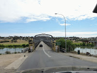
The old Murray bridge
Next day we crossed the Murray river at Murray Bridge and following the Mallee Hwy, arrived back to Victoria. We had a lunch break at Murrayville - which is actually quite far away from the Murray river, but in this region almost everything is named after it - then turned North at Ouyen. This is not the shortest route to Sydney, but we had plenty of time and wanted to spend the night at one of the delightful free camp sites along the Murray, of which there are many.


Our camping guide book showed one such place near Robinvale, at Walshs Bend. 2 km dirt track led to the water, and the site was indeed pretty nice, only a bit dusty and dry. We spent a pleasant evening here sitting at the water's edge, reading and enjoying the scenery.
The Murray at Walshs Bend, and the tree where the fire started

Here we did not know yet what's coming...
Then we had a strange adventure that night. At around 3.30 am I had to get out for some reason:), and as I looked around, I saw that the grass beside the big gum tree, no more than 5-6 metres from our van, is on fire. Metre-high flames shooting up to the sky, it was a scary sight. I called out for Kati to come out and help me to douse the fire. Fortunately the river was close, but we only had a small 5-litre bucket and the water's edge was very slippery. Kati had to hold my hand while I filled the bucket. We managed to put out the grass fire around the tree, but there was a large hole in between the roots of the tree and that hole from inside was still on fire. Apparently that's where it all started. It was hard to get the water inside the roots, but after some struggle the flames stopped, but it was still smoking.

We went back to bed, but could not sleep. Came out again after half an hour, and again, the roots were alight again. We did a second round of dousing, more water, but it was impossible to reach the back of that hole. The earth around the roots was quite hot, it must have been going on for a long time, only we could not see it in daylight. 

Finally we got back to sleep, and there were no more incidents. In the morning, smoke still came out of the hole, but it looked like we managed to get the fire under control. But we were happy to leave that place without any damage.
Morning calm on the river
That day, Sat 11 Nov, we followed the Murray Valley Hwy along the river until a small village called Nyah. Our campsite was behind the harness racing club, again beside the Murray river. It was a very hot day, it felt good to sit beside the van in the shade. After a nice evening, we had a quiet, uneventful night this time. In the morning we had an opportunity to watch a harness driver doing the rounds behind our van, and to meet his horse.
Our campsite at Nyah
The Pevensey at Echuca
Sunday, 12 Nov, we continued along the Murray Valley Hwy South-East. This area is full of lakes of various size, all remainders of the meandering Murray river. We had a rest beside one of them, Lake Boga, then lunch at Cohuna. After lunch we stopped at Echuca, for a nostalgic walk at the old river port. When we had been here the last time, in 2013, most of the port area was closed for renovation, but sadly not much progress has been made since. But the old paddle-steamer, the Pevensey is still there, doing the joy rides on the river.


Cobram in the afternoon - staying in the shade of the tree
We spent the night at another pleasant camp spot in the Cobram Regional Park, overseeing the river from the high bank. There are many good sites in the park according to our guide book, but we had to drive around the narrow dirt roads in the park for a long time until we found a suitable place. Unfortunately the sun was facing us and it was very hot, so it was not as comfortable as we would have liked until sunset. But we had an enjoyable evening and a quiet night again. In the morning, the sun came from behind and it was warm enough to have breakfast outside, watching the river. The only problem was that we got lost in the labyrinth of the dirt roads in the park. Fortunately, after a bit of aimless driving around we found a local family and they led us out to the main road. 
Breakfast at Cobram
From Cobram, we turned North, crossed the Murray river and arrived back to New South Wales. We followed the Newell Hwy crossing Jerilderie then Narrandera. This is the Riverina, an important agricultural region, flat as a tabletop. On the two sides of the road wheat and other grain fields, alternated with grassy paddocks, cattle or sheep grazing. In every little village we saw large silos for grain storage beside a railway line. 

After Narrandera we turned East, and spent the last night at the Bethungra Dam. The dirt road leading up to the dam passes between the very high pylons of the unique rail spiral loop built in 1940 to reduce the uphill grade for this important rail line. The water level was very low in the dam, surrounded by large open fields with a few fellow campers and cattle grazing on the short grass. It was another pleasant campsite.
Bethungra Dam

On Tuesday, 14 Oct, we left after breakfast, and soon reached the Hume Hwy near Gundagai. From here, it was a quick and easy trip back home with a lunch stop near Marulan. 

That was the end of another interesting, pleasant and successful tour. We travelled 4,634 kms in 27 days and the average fuel consumption of our new car was 12.2 l/100 km, about one litre less than the old one - a good result.

More photos can bee seen here.

----------------------

Csütörtökön, nov. 9.-én jöttünk el a Kenguru szigetről, és 14.-én otthon akartunk lenni. Tehát 5 napunk volt a hazaútra, ami kb. 1500 km. Átlag 300 km vezetés mellett még volt idő minden nap egy kicsit pihenni és nézelődni is.


Strathalbyn, anglikán templom
Strathalbyn, hősi emlékmű
A komp fél 2 tájban ért Cape Jervis-be. Mentünk tovább amerről jöttünk, Victor Harbor-én keresztül. Az első éjszakát Strathalbyn-ban töltöttük egy kempingben. Délután még volt időnk kicsit körülnézni a városka központjában. Egy kis folyócska, Angas river, vágja ketté a központot egy nagy kanyarulattal, körülötte szép zöld park, az elesett katonáknak dedikálva. A csendes, széles utcákon jó pár szépen karbantartott régi épület áll. Kellemes kis város.


A régi híd a Murray folyón

Másnap átkeltünk a Murray folyón a Murray Bridge nevű településnél, és a Malley főutat követve hamarosan visszaértünk Victoria államba. Egy Murrayville nevű kisvárosban álltunk meg ebédelni - ami egyébként jó messze van a Murray folyótól, de ezen a vidéken minden arról van elnevezve - aztán Ouyen-nél északra fordultunk. Nem ez a legrövidebb út Sydney-be, de bőven volt időnk, és az estéket a Murray folyó menti kellemes szabad táborhelyeken akartuk tölteni, amiből elég sok van.


A kemping könyvünkből kinéztünk egy ilyen helyet Robinvale mellett egy Walshs Bend nevű folyó-kanyarulatban. Két km földúton lejutottunk a vizpartra és találtunk is egy elég jó helyet, csak kicsit poros és száraz volt. Délután a vízparton üldögéltünk, pihentünk, élveztük a tájat.
A folyó és az ominózus fa Walshs Bend-nél


A kék pöttynél táboroztunk
Éjszaka aztán volt a kellemetlen kalandunk. Fél 3 körül nekem ki kellett mennem valamiért:), és ahogy körülnéztem, észrevettem, hogy a nagy eukaliptusz fa mellett ég a fű, aling 5-6 méterre a lakókocsinktól. Méter magas lángok csaptak föl hangtlanul, elég félelmetes látvány volt. Hívtam Katit hogy jöjjön segíteni oltani. Szerencsére közel volt a víz, de csak egy kis 5-literes vödrünk volt, és a part nagyon csúszós-iszapos volt, a víz meg tele növényekkel. Fognom kellett Kati kezét, úgy mertem tele a vödröt. Sikerült hamar eloltani a fa körül ég füvet, de a fa gyökerei között is volt egy nagy lyuk, ahol belülről izzott-lángolt a fa. Valószínűleg itt kezdődött már korábban. Elég nehéz volt bezúdítani a vizet a lyuk mélyére, de egy kis küszködés után nem láttunk több parazsat, de még erősen füstölt.

Visszamentünk lefeküdni, de aludni nem tudtunk. Fél óra múlva ujra kimentünk megnézni, és a lyuk megint izzott-lángolt. Megint meglocsoltuk még jobban, amennyire tudtuk, de a lyuk mélyére nem nagyon értünk el. A gyökérzet körül a föld is egész forró volt. Ez a tűz nyilván már jóideje izzott a gyökérzet belsejében, csak nem láttuk a füstöt nappali fényben.

Végül csak lefeküdtünk, és az éj további része elmúlt baj nélkül. Reggel a lyuk még mindig füstölt, de úgy látszott, sikerült megfékezni a tüzet. Azért örömmel indultunk tovább erről a helyről.
Hajnal a folyón
Az ügető pálya
Szombaton, nov. 11.-én a Murray Valley utat követtük a folyó mentén egy Nyah nevű kis városkáig. A táborhelyünk a helyi ügető pálya mögött volt a Murray partján. Nagyon meleg nap volt, jól esett a lakókocsi mellett üldögélni az árnyékban. Kellemes esténk volt, és nyugalmas éjszakánk, ezúttal minden incidens nélkül. Reggel még volta alkalmunk közleről megfigyelni egy ügető-kocsist amint járta a köröket a pályán, és a lovát is bemutatta nekünk.


Vasárnap, nov. 12.-én, folytattuk az utat dél-kelet felé a Murray Valley úton. Ez a vidék tele van kisebb-nagyobb tavakkal, amiket a Murray folyó kanyargó medre hagyott hátra. Az egyik nagyobb, Lake Boga, itt megálltunk kicsit pihenni, aztán Cohuna-ban ebédeltünk. 


A Pevensey lapátkerekes
Ebéd után megálltunk Echuca-ban egy kis nosztalgia-sétára. Echuca egy fontos folyami kikötő-központ volt, most is a környék legfontosabb települése. Mikor utoljára itt jártunk, 2013-ban, a régi kikötő nagy része le volt zárva felújítás miatt. Sajnos most is csak azt láttuk, hogy nem sokat haladtak az építkezéssel. De a régi lapátkerekes, a Pevensey, most is megvan, és járja a folyót az érdeklődőkkel.


Cobram, naplemente után
Az éjszakát egy másik nagyon kellemes táborhelyen töltöttük a Cobram Regional Park-ban. A kemping könyvünk szerint sok jó hely van a parkban, de elég sokat autóztunk össze-vissza a parkban mire találtunk egy jó helyet a magas vízparton. Sajnos a délutáni nap éppen szembe sütött és nagyon meleg nap volt, úgyhogy nem volt olyan kellemes naplementéig. De az este és az éjszaka megint élvezetes és nyugodt volt. Reggel a nap hátulról sütött és elég meleg volt, kint reggeliztünk a szabadban, néztük a folyót és a változó fényeket. 
Reggeli a szabadban
Csak éppen folgalmunk nem volt, merre kell kijutni a főútra. Sokáig autóztunk céltalanul a parkbeli földutak között ide-oda, míg végül ráakadtunk egy helybeli családra, akik aztán kivezettek a parkból.

Cobram-tól észak felé fordultunk, átkeltünk a Murray folyón és visszaérkeztünk New South Wales államba. A Newell főútat követtük, Jerilderie és Narrandera városokon keresztül. Ez az ún. Riverina régió, fontos mezőgazdasági terület. Az út két oldalán búza- és más gabona-táblák váltakoztak föves legelőkkel, sok legelésző tehenet, juhot láttunk. Minden kis faluban hatalmas gabonatároló silók állnak a vasútvonal mellett.


A spirál-vasút hídja alatt
Narrandera után keletnek fordultunk, és az utolsó éjszakára Bethunga városka melletti víztározónál álltunk meg. Az 1940-es években átépítették itt a vasutat spirális vonalvezetéssel, hogy az emelkedő meredekségét csökkentsék a felfelé haladó vonatok számára. A tározóhoz felvezető földút ennek a vasúti hídnak a magas pillérjei között vezet föl a hegyoldalba. A tározóban elég kevés víz volt, körülötte széles füves domboldalak, ahol már táborozott néhány lakókocsi, de bőven jutott hely nekünk is. Tehenek legelésztek körülöttünk, de nem zavartuk egymást. Ez is egy nagyon kellemes táborhely volt.
Bethungra víztározó mellett

Kedden, nov. 14.-én reggeli után tovább indultunk, és hamarosan elértük a Hume autóutat Gundagai mellett. Innen már gyorsan lehetett haladni, és egy rövid ebéd-pihenővel Marulan mellett, koradélután hazaértünk.

Ez a túránk is érdekes és élvezetes volt, minden baj nélkül. Összesen 4634 km-t utaztunk 27 nap alatt, és az autónk átlag-fogyasztása 12,2 l/100km volt, kb. egy literrel kevesebb, mint a régivel, amivel elégedettek lehetünk.

További képeket lehet látni itt.


Thursday, 7 December 2017

South Australia Tour - 4: Kangaroo Island

(Magyar változat a végén)

Our campsite in Cape Jervis
Cape Jervis is at the South-Western tip of the Fleurieu peninsula. This is where the ferry service leaves to Kangaroo Island. We had pre-booked tickets for the 9 am ferry on 5 November, and wanted to spend the night before at the Cape Jervis caravan park to be close for the early departure. 

We arrived to Cape Jervis before lunchtime on Saturday, 4 Nov. The "caravan park" turned out to be a little farm with an open grassy field with nice views towards the sea where we could pick any place to set up the van. The amenities were fairly rudimentary but adequate for a one-night stay. 

We went down to the ferry terminal to get a feel for what's ahead of us. It was only a 10-minute drive through the little township, only a few houses and one general store. All around large grassy paddocks, cattle grazing, birds, sunshine, calm and quiet. A row of tall wind turbines enjoyed the strong wind blowing from the South-West. We spent the afternoon resting in the van - the wind was too much for our liking outside.


Embarkation at Cape Jervis
Sunday, 5 Nov, after a quick breakfast we packed up and drove down to the ferry terminal. There were already a lof of cars, motorhomes, motocycles waiting. The embarkation took about half an hour. Our car and van were taken on the ferry in reverse by one of the crew members. 

The sea seemed pretty calm from the shore, but the ship has been rolling quite a bit on the way, some people even got sick. The ferry was full, most of the people were overseas tourist. After about 45 minutes we arrived to the island at a little village called Penneshaw.


Arrival at Penneshaw
After disembarkation we stopped at the visitor centre to get more information about the island. We had to wait through a long queue of people from all over the world asking the same questions and getting the same answers from the service lady, so by the time it was our turn, we already knew everything, all we needed were the information booklets. We also bought the Kangaroo Island Pass, a combined ticket that gave us access to all the fee-paying attractions on the island.

We had pre-booked accommodation for the first two nights at the Kingscote caravan park, about 60 kms from Penneshaw. We drove up there, set up camp, had lunch then in the afternoon we went out to look around.
Sheep milking at the Island Pure Sheep Dairy Farm
Our first stop was at the Island Pure Sheep Dairy farm, not far from Kingscote. This is an interesting place. There are about 75 million sheep in Australia, 3 times as many as people, yet you can hardly find any sheep cheese in the shops - we were always wondering about that. Finally this is a place where they do make lots of different cheeses and other products from sheep milk. We had a short guided tour of the process, saw how the sheep are milked - just like the cows, and tasted a range of cheeses. They were very good, we had to buy a few pieces.


KI Spirits
Then we stopped at the nearby KI Spirits, a boutique distillery supposedly making "the best" gin in Australia. The tasting house is a small corrugated iron cottage surrounded by colourful flowering plants in the middle of a large grassy field. Inside, the number of people indicated that the sign outside the door may be true: "I tried to say no to gin, but it's 40% stronger than me..." When we managed to get to the counter, we also tasted a few varieties, and they were really good. Again, we could not leave without a little souvenir...


Emu Bay
From here, we drove up to Emu Bay, one of the pristine beaches on the North coast of the island. Four kms of white sand, turquoise water, hardly any people around, sea-birds, idyllic surroundings. According to the information booklet dolphins are often playing in the bay, but we have not seen any this time. Also, this is the only beach where you can drive right onto the beach, fortunately there were nobody around then. 


Lavender Farm

On leaving Emu Bay, we made a stop at the Lavender Farm. Rows of different varieties in the garden and a wide range of products - soaps, creams, candles, oils, etc. - made of lavender. I was surprised to learn that there are close to a hundred different varieties of lavender.


The mulberry tree at Reeves Point

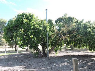
Coming back to Kingscote, we stopped at Reeves Point, an important heritage site where the first European settlement - in the whole of South Australia - was established in 1836. At its peak about 300 people lived here in very difficult conditions, but after 3 years the venture failed due to the lack of water, the poor soil and the difficulty of supply. At that time there were 42 dwellings and workshops, but today only information signs describe the history of the site. One old mulberry tree planted by the first settlers is still alive and standing. 
Pelican feeding

On the way back to the caravan park, we passed beside the Kingscote jetty, where the Pelican Feeding was going on - an entertaining talk about the pelicans and other sea birds for the interested tourists.

Next day, Monday 6 Nov, we planned to visit some attractions in the middle of the island, further away from Kingscote. We thought having lunch somewhere on the way.


Stokes Bay
First, we drove up to Stokes Bay, another famous beach on the North coast. It's a 50 km drive from Kingscote, partly on dirt roads, but well maintained, easy to drive. On arrival at the car park, the bay seems nothing special. But from there, a narrow path leads through a rock tunnel to the beach, which is indeed stunning, definitely worth visiting. It is a great swimming spot with sheltered crystal clear waters - unfortunately not good enough for us in the sunny but cool windy weather. 
Young grass-trees under the eucalyptus forest
Sea lions in Seal Bay
From here we crossed the island down to the South coast. Seal Bay is one of the main tourist attractions on the island. As the name indicates, a large colony of sea lions lives and can be visited on the beach here. We went down to the beach on a guided tour and enjoyed observing the animals as they lay and played in the sand. About 800 sea lions live here. They spend 2-3 days out at sea hunting and feeding, then another 2-3 days resting on the beach. We could stand pretty close to some of them and took lots of photos as we listened to the guide.

Seal Bay from the lookout

After the guided tour we went out to the lookout above the beach. There is a nice view of the whole area and several information boards along the walkway. We could also see the skeleton of a whale among the sand dunes.

What we could not see on the other hand, is any place where we could have lunch here, which was a bit surprising. But fortunately we brought some food with us, so we found a picnic area behind the dunes, and had our lunch there. 


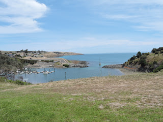
After a stop at the nearby Vivonne Bay general store for coffee, we drove out to the Western tip of the peninsula to look at Vivonne Bay itself, with another nice sandy beach with a jetty in a sheltered bay. It was once voted as Australia's Best Beach - to me, it looked just as beautiful as the others we saw on the North coast, but no better.

That was the end of our tour for the day. 
Grass trees

On Tuesday 7 Nov we had to move to our second accommodation in the Western part of the island. We left quite early after breakfast and got there around 10:30 am. It was a 70 minutes drive on a sealed good quality road with very little traffic. Our home for the next two nights was in the Western KI Caravan Park, a very nice spacious place in bush settings just a few kms from the Flinder Chase National Park. We quickly set up the van, again packed some food for lunch and went on to continue our discovery of the region.

The cliff face at Cape Borda
First we dropped in the national park visitor centre to pick up our entry pass and some more information and maps of the park, then started on a long drive across the park up to Cape Borda at the North-Western tip of the island. The first part of the dirt road inside the park was well maintained but when we got to the main road, to our surprise, it was also a dirt road in very poor condition, so we could only go very slowly. 


But we got there in time to book our place for the next Cape Borda Lighthouse guided tour and still had some time to look around. A track led out to a lookout over the sea to the North and West. It stands at the top of a dramatic 150 m high almost vertical cliff with magnificent views of the sea and the cliff face.

The guided tour of the Cape Barda Lighthouse was very enjoyable and informative. The lighthouse is quite special as it is not very tall - it stands on top of the high cliff, so does not have to be - and it has a rectangular shape - tall towers had to have circular shape for stability in the strong winds, but this short one could be built as rectangular which is much simpler. Our guide explained many more interesting facts about shipwercks, how the lighting works, and the life of the keepers - it seems they had a much more difficult life than one would think. He also fired the gun, which was a regular part of the keepers duty every day at 1 pm to indicate the correct time for any ships nearby.
Fire!
After the tour we had our picnic lunch and coffee beside the lighthouse, then we drove back to the Flinder Chase NP the same way as we came. Although according to the brochure "there is ample wildlife" in the native bushland around here - echidnas, kangaroos, koalas, even platypuses -, we did not see any.  

The road to Cape Couedic

The next attraction was at the Southernmost point of the coast: Cape du Couedic. There is another lighthouse here - circular, more conventional, as it stands much closer to the water, but the real attraction is a bit further below: Admirals Arch, a magnificent archway sculpted from the limestone rock by the wind and sea where hundreds of long-nosed fur seals live on the shore below. The boardwalk leading down to the viewing platform the between the flowering rock fields is in itself an attraction. 


Admirals Arch

From the platform, we could see the arch above, with many stalactites dangling from it, and the smooth rock faces below. It was hard to see the dark seals on the dark rocks facing the sunlight. It was much easier to feel the very strong nasty smell coming from a seal resting under the arch just below the platform - well, I guess they may feel the same about our human body odour ...


The rock face in spring colours
Our first koala-sighting
After getting back to the camp we still had time for a walk in the woods beside the caravan park. We were told that we could find koalas on some of the trees there if we look carefully. That was exciting because during the 27 years we spent in Australia we have never seen any koalas in the wild. So we went out, and indeed, after some searching and with a little help from fellow enthusiasts, we have seen not just one but several koalas. The first we found was pretty high up in the foliage, but then we saw a mother with child much closer. They were sleeping arm-in-arm, as koalas usually do.
During the night we heard some noises coming from behind our van, sounded like wombats probably, and when we looked out, in the moonlight we saw a group of kangaroos grazing just in front of our van. Next morning before breakfast we went on a bit longer loop circuit around the camp, hoping to see some more animals. First we checked on the koalas and confirmed that they are still there, then went on behind the park, around a lagoon, where we saw some Cape Barren Geese, kangaroos, black swans and other water birds. It was a very nice sunny but fresh morning.

After breakfast, our first program was the Kelly Hill Caves, only a few kms from our campsite. On the way we made a detour to check out Hanson Bay, another long untouched sandy beach surrounded by high limestone rock cliffs. 
Kelly Hill Caves
A statctite forming
Kelly Hill Caves is a large underground limestone cave system, of which only a small part can be visited. In fact, we are not very keen on caves - although we had visited several already in Australia -, but the guided tour to this cave was part of our Island Pass, so we did not want to miss it. The tour took about 45 minutes, we saw spectacular examples of stalactite, stalagmite, shawl, helictite and column formations and listened to the explanations about the geology, hydrology and history of the caves. The place was named after the horse of the farmer, which, in 1928, fell into a hole in the ground and disappeared while walking through the hill. The farmer climbed after the horse but it was never found - that's how the cave was discovered. 

We went back to the van for lunch and rest. Then in the afternoon we drove back to Cape Couedic, to visit the other main attraction: Remarkable Rocks
Remarkable Rocks
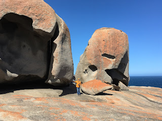
It is remarkable indeed: a large granite outcrop at the tip of the Southern sea cliff. The base is like a huge dome, the surface is smooth, easy and safe to walk on during dry weather. 
The granite boulders on top of the dome appear as seemingly artistic sculptures. Many of the rocks are covered by golden orange lichen. Interpretive signs along the boardwalk leading down to the rocks explain how the erosive forces, alternate heating, cooling, rain and wind, formed the granite boulders over the last 200 million years. It was a very interesting place, definitely one of the top attractions on the island, worth a visit, despite the very strong cold wind constantly blowing from the South.

More photos can be seen here.

On the way back, we stopped at the Flinders Chase NP visitor centre, and went on a walking tour in the surrounding bush, mostly gum and acacia trees and a swampy field. Many different animals are supposed to live around here, but we did not see anything other than a few birds. But when leaving the park, we did see another koala quite close on a nearby tree.

Thursday, 9 Nov, was our last day on the island. Our ferry was leaving at 1.30 pm from Penneshaw, and we had about 120 km drive to get there. In the morning we made another tour of the park and were rewarded by the view of another koala, the first one which was awake and apparently interested in seeing us.


The old port in Penneshaw

After breakfast we packed up and started back to the East. The trip was easy and uneventful, and we reached Penneshaw around half past 11, so we had plenty of time. We had another look in the visitor centre and bought some souvenirs and presents. Then we walked around the little town centre, which seems fairly run-down and abandoned. Many shops are closed and empty. The only business seemingly prospering is the pub, and we helped it further by having lunch at the terrace ovelooking the sea. 


Then it was time to move down to the ferry terminal for embarkation.

----------------------

Cape Jervis egy kis település a Fleurieu félsziget dél-nyugati csücskén. Innen indul a komp a Kenguru szigetre. Nov. 5.-én reggel 9-re volt jegyünk a kompra, és az előző éjszakát már itt akartuk tölteni, hogy közel legyünk a korai induláshoz.


A kemping Cape Jervis-ben
Szombaton, nov. 4.-én már délelőtt megérkeztünk Cape Jervis-be. A "kemping" ahol helyet foglaltunk egy kis helyi farm-gazdaság mellék-kereseti tevékenysége volt. Egy nagy füves területen választhattunk helyet a lakókocsinknak, szép kilátással a tenger felé. A mellékhelyiségek, mosdó, WC, elég egyszerűek voltak, de egy éjszakára megfelelt. 

Lenéztünk a komp-kikötőhöz hogy tudjuk mire számítsunk. Csak tíz percnyire volt a szállásunktól. A kis település csak néhány házból és egy mindenes boltból áll, körülötte széles füves legelők, legelésző tehenek, madarak, napsütés, csend és nyugalom. Kicsit messzebb egy sor magas szélturbinát forgatott az erős hideg délnyugati szél. Délután a lakókocsiban olvastunk-pihentünk, mert kint a napsütés mellett is túl sok volt a hideg szél.


A beszállásra várunk Cape Jervis-ben
Vasárnap (nov. 5) egy gyors reggeli után felpakoltunk és lementünk a komp-kikötőhöz. Jó sok autó, motorkerékpár, lakóautó várakozott már. A beszállás eltartott vagy fél órát, főleg mivel az autóknak háttal kellett felmenni a kompra - én inkább rábíztam ezt a feladatot egy komp-alkalmazottra.

A tenger elég nyugodtnak tűnt a partról, de a hajó így is jócskán dülöngélt az átkelés alatt, többen rosszul voltak. Sok utas volt, a legtöbben turisták a világ minden tájáról. Kb. 45 perc után érkeztünk a szigetre egy Penneshaw nevű kis falunál.

Kiszállás után első utunk, mint minden új helyen, a turista irodába vezetett. Jó hosszú sort kellett végigvárnunk. Mire sorrakerültünk, az előttünk állók mind végigkérdezték ugyanazokat a kérdéseket, és megkapták ugyanazokat a válaszokat, már kívülről tudtunk mindent. Kaptunk néhány térképet és kiadványt és megvettük a kombinált belépőt, ami a sziget összes fizetős látványosságára érvényes.

Az első 2 éjszakára a Kingscote-i kempingben foglaltunk szállást, kb 60 km-re Penneshaw-tól. Felautóztunk oda, felállítottuk a lakókocsit, megebédeltünk, aztán délután elindultunk körülnézni.


Kávézás a juh-farm boltjában
Első megállónk az Island Pure juh-tenyésztő és tejgazdaságnál volt, ami egy érdekes hely. Egész Ausztráliában van kb 75 millió birka, háromszor annyi mint ember, mégis a boltokbn alig lehet juh-sajtot és egyéb juh-tej készítményeket kapni, amit sosem értettünk. Ez végre egy juh-tej készítményekre specializálódott hely volt. Megnéztük hogy fejik a juhokat - gépesítve, csakúgy mint a teheneket -, és megkóstoltunk a különféle sajtokat és más termékeket. Nagyon finomak voltak, vettünk is egy párból kóstolót.


A KI Spirits bejárata

Aztán egy kis lepárló üzemnél álltunk meg (KI Spirits), ahol állítólag "Ausztrália legfinomabb" gin-jét készítik. A kóstoló egy kis hullámbádog házacskában működik, mellette virágzó rózsa- és bodza-bokrok, körülötte nagy füves mező. A bejárat mellett tábla: "Próbáltam ellenállni a gin-nek, de 40%-al erősebb mint én..." Ami igaz lehet, mert bent jó sokan voltak. Mi is megkóstoltunk pár fajtát és innen is vittünk egy kis emléket.


Emu Bay

Innen felmentünk Emu Bay-be. Ez az egyik érintetlen homokos tengeröböl a sziget északi partján. Vagy 4 km hosszú fehér homokos part, türkizkék víztükör, ember csak elvétve, madarak - idilli környezet. Állí1tólag delfinek is élnek az öbölben, de mi nem láttunk. Ez az egyetlen beach ahova autók is lejöhetnek - szerencsére most nem volt egy sem. Nyáron ideális fürdőhely lehet, most még sajnos túl hideg a víz, nekünk legalábbis. 


Levendula Farm termékek

Emu Bay-t elhagyva meglátogattuk a Leveldula Farm-ot. Szép nagy kertjében egyenes sorokban nőnek a különféle levendula-fajták, sajnos most még egyik sem virágzik. A boltban mindenféle levendulából készült termék - szappan, krém, olaj, gyertya, stb. - kapható. Azt is megtudtuk, hogy közel százféle kölönböző levnedula-fajta létezik.


Pelikán-etetés
Kingscote határában megálltunk Reeves Point-nál, ahol az első európai település - egész Dél-Ausztráliában - létesült 1836-ban. Közel 300 ember élt itt nagyon nehéz körülmények között, de 3 év után a telep megszűnt mert nem volt elég víz, rossz volt a termőtalaj és nehéz volt utánpótlást biztosítani. Ma már semmi sem maradt az egykori épületekből, csak információs táblákon olvasható a település története. Egy akkoriban ültetett eperfa még áll és igyekeznek életben tartani.

Hazafelé elmentünk a Kingscote-i móló mellett, ahol éppen pelikán-etetés folyt - egy kis ismeret-terjesztéssel összekötött szórakoztatás a kíváncsi európai turisták részére.


Stokes Bay - alagút a beach-re
Másnap, hétfőn nov. 6.-án a sziget középső részére készültünk, kicsit messzebb Kingscote-tól, úgy terveztük, hogy majd ebédelünk valahol. Először Stokes Bay-be mentünk, ami egy másik híres öböl a sziget északi partján. Mintegy 50 km-es út, részben földút volt, de elég gyorsan lehetett menni rajta. Az öbölbe érkezve a környék nem tűnt különösen érdekesnek. De innen egy szűk szikla-alagúton lehetett átjutni a látványossághoz, egy valóban gyönyörű tiszta, érintetlen homokos beach-hez, amit magas sziklafal vesz körül. Ez is remek fürdőhely lehet nyáron, sajnos most csak nézelődni volt kedvünk a hűvös, szeles időben.


Stokes Bay
Alvó oroszlánfókák
Innen keresztül vágtunk a szigeten, le a déli partra. Seal Bay az egyik fő turista-attrakció a szigeten. Egy nagy oroszlánfóka kolónia él itt, és kísérő vezetővel le lehet menni a partra az állatok közelébe. Mi is lementünk és vagy fél órát nézegettük a fóka-csoportokat egész közelről és hallgattuk a vezető magyarázatát. Mintegy 800 fóka él itt, 2-3 napig messze a tengerben vadásznak, aztán 2-3 napig itt a víz szélén pihennek, játszanak, alszanak. Hihetetlennek túnik, hogy a nagy lomha testükkel milyen fürgén tudnak mozogni a homokon is, állítólag gyorsabban mint az ember.
Bálnacsontváz a homokban

A túravezetés után még kisétáltunk a part fölötti kilátóhoz. Az út melletti tájékoztató táblákról sokat tanulhattunk a fókákról, és meg egyszer megszemléltük a fókákkal pettyezett tengerpartot a kilátótól. Láttunk egy bálna-csontvázat is a homokdűnék között.

Nem láttunk viszont semmi olyan helyet, ahol enni lehetne, ami kicsit meglepő volt ezen a sok turista által látogatott helyen. De szerencsére minden eshetőségre készen hoztunk magunkkal ennivalót, és találtunk egy pihenő-helyet padokkal, ahol meg tudtunk ebédelni.

Ebéd után továbbmentünk a közeli Vivonne Bay-be. Az egyetlen vegyesbolt-nál kávéztunk, aztán kiautóztunk az öböl déli csúcsára megnézni az öblöt magát. Ez is egy szép homokos érintetlen tengerpart egy mólóval az öböl védett oldalán. Egyszer egész Ausztrália legjobb beach-ének választották - én ugyanolyan szépnek láttam, mint a másik kettőt az északi parton, de nem tudnám rangsorolni őket. 
Vivonne Bay

Innen aztán hazamentünk pihenni.

Kedden, okt. 7.-én át kellett költöznünk a második szállásunkra a sziget nyugati odalán. Elég korán elindultunk reggeli után, és már fél 11 felé odaértünk, jó minőségű burkolt úton, alig néhány autóval találkoztunk. A sziget nyugati oldala sokkal elhagyatottabb mint a keleti, nagy része érintetlen nemzeti park. A szállásunk a Western KI Caravan park-ban volt, nagyon kellemes tágas, jól felszerelt kemping, körös-körül fák, ligetek, mezők, alig pár km-re a Flinders Chase nemzeti park bejáratától. 

Út a Flinders Chase nemzeti parkban
Felállítottuk a lakókocsit, bepakoltunk egy kis ennivalót aztán gyorsan tovább indultunk. Sietnünk kellett, hogy elérjük a vezetéses túrát a Cape Borda világítótoronynál. Előbb még beugrottunk a Flinders Chase NP látogatóközpontjába, megkaptuk a belépőnket és további térképeket a parkról, aztán mentünk tovább a parkon keresztül a sziget észak-nyugati csücskébe. Az út a parkban egy jól karbantartott de nagyon kanyargós földút volt, csak lassan lehetett menni de a táj és a növényzet nagyon szép volt. Amikor kiértünk a "főútra", kiderült, hogy az is földút, méghozzá nagyon rossz állapotban, mély keréknyomokkal, még lassabban kellett menni.
A meredek sziklafal a kilátóból lefelé

De azért időben odaértünk, és még volt időnk egy kicsit körülnézni a környéken a vezetés előtt. Egy ösvény kivezetett a sziklás part peremére. A kilátó egy kb. 150 m magas csaknem függőleges sziklafal tetjén áll, csodálatos kilátással a könyező tengerre és az alanti sziklaoldalra.


Cape Borda világítótorony és a túravezető
A túravezetés nagyon élvezetes volt, sok érdekeset hallottunk. A Cape Borda világítótorony több szempontból is különleges: egyrészt a szokásosnál jóval alacsonyabb építmény - mivel egy magas sziklafal tetején áll, ez is elég, másrészt négyzetes alaprajzú - a magas tornyokat kerekre kell építeni hogy jobban ellenélljanak a szél erejánek, de egy ilyen alacsony építmény lehet szögletes is, amit sokkal könnyebb (volt) építeni. Sok mást is mesélt a vezető, hajótörésekről, a világítás részleteiről, a kezelő személyzet életéről - sokkal nehezebb munka volt mint gondolná az ember, különösen egy ilyen helyen, távol minden lakott településtől. A végén elsütötte az ágyút is, ami hozzátartozott a toronyőr mindennapi feladatához pontban du. 1 órakor - a közelben tartózkodó hajók ehhez igazították az órájukat.
Pihenő Cape Borda-nál

A túra után megettük az ebédünket és kávéztunk a világítótorony mellett, aztán visszaautóztunk a nemzeti parkon keresztül amerre jöttünk. A tájékoztató szerint sok különféle állat él errefelé, echidnák (egy sündisznó-szerű erszényes), kenguruk, koalák, sőt még platypus is a patakban, mi sajnos nem láttunk egyet sem.


Fókák a boltív alatt

A következő látnivaló a sziget legdélebbi csücskén volt, a Cape Couedic. Itt is van egy világítótorony, de ez magas és kerek, mivel jóval közelebb van a vízszinthez. De az igazi attrakció kicsit lejjebb a víz szélén van: Admirals Arch, egy hatalmas alagút-boltozat amit a szél és víz erózió vájt ki a mészkő sziklából. Az alján pedig egy fóka-kolónia lakik a vízparti sötét sziklákon. A virágzó apró növényzettel borított sziklaoldalon  levezető deszkázott gyalogút is nagyon szép látvány. 


Egy fóka a sziklaperem alatt
A boltív tetejéről rengeteg stalactite (cseppkő oszlop) lóg, mutatva hogy valamikor ez egy barlang része volt. A sötét színű fókákat elég nehéz volt kivenni a szintén sötét csillogó sziklákon a szembesütő délutáni napfényben. Egy fóka a közelünkben aludt a boltív alján, annak a kelletelen szagát viszont nagyon jól lehetett érezni - gondolom a fókák sem élvezik az emberszagot...


Innen aztán hazamentünk, és, hála a hosszú nyári napoknak, még volt időnk egy kicsit körülsétálni a kemping melletti fasorokban. Azt hallottuk, ott láthatunk koalákat a fákon ha jól körülnézünk. Erre már nagyon vágytunk, mert a 27 év alatt, amit Ausztráliában töltöttünk, még sosem sikerült vadon élő koalákat látnunk. Elindultunk, és egy kis keresgélés után találtunk is, többet is. Az első elég magasan volt a fa koronájában, de aztán láttunk egy mamát a kicsinyével sokkal közelebbről. Békésen összeölelkezve aludtak.


Fekete hattyú család
Éjszaka hallottunk valami kaparászást-röfögést a lakókocsi mögül, valószínűleg wombat lehetett. Mikor kinéztünk, egy kenguru-családot láttunk a holdfényben, a kemping közepén levő füves tisztáson legelésztek. Másnap reggel korán elmentünk egy hosszabb sétára a kemping körül. Megint megnéztük a koalákat - még mindig ott voltak - aztán a park mögött megkerültünk egy kis mocsaras tavacskát, ahol láttunk ludakat (Cape Barren geese), kengurukat, egy fekete hattyú családot és más vizimadarakat. Gyönyörű tiszta napos de hűvös reggel volt.


Reggeli után első programunk a Kelly Hill barlang volt, egész közel a kempinghez. Odafelé még tettünk egy kitérőt Hanson Bay-be, egy másik elhagyatott homokos tengerpart magas mészkő-sziklafalak között.
Kelly Hill cseppkőbarlang
Kelly Hill Caves egy nagy földalatti barlang-rendszer, aminek csak kis része van feltárva és még kevesebb látogatható. Tulajdonképpen mi nem szeretjük a barlangokat - ugyan már megnéztünk jó párat Ausztráliában - de ez a hely is benne volt a kombinált jegyünkben, nem akartuk kihagyni. A vezetés 45 percig tartott, láttunk sok mindenféle cseppkő képződményt, és hallgattuk a vezető magyarázatát. A barlang egy helyi farmer lováról kapta a nevét. 1928-ban a farmer ezen a dombon hajotta keresztül a lovát, mikor a ló egyszecsak eltűnt egy gödörben. A farmer megpróbált utánamászni, de a lovat nem találta meg - így fedezte fel a barlangot.

A barlang-látogatás után visszamentünk a kempingbe ebédelni és pihenni. Délután még egyszer elmentünk a Cape Couedic-hez, a másik fő látnivalót megnézni: Remarkable Rocks (pontos fordításban: figyelemre méltó, emlékezetes sziklák).
Remarkable Rocks
Valóban emlékezetes volt: egy hatalmas gránit domb a déli partvonal egy kis csúcsán. Az alap olyan mint egy dóm teteje, lapos és sima, könnyen és veszély-mentesen járható száraz időben. 

A dóm tetején egy sor hatalmas gránit-tömb fantasztikus formáival modern szobroknak tűnnek. Sok helyen a sziklákat narancssárga zuzmó borítja. A dómhoz levezető ösvény mellett tájékoztató táblák mutatják hogy alakultak ki ezek a sziklaformák a váltakozó hideg-meleg, a szél és a víz eróziós hatására az elmúlt 200 millió év alatt. Sokáig sétáltunk-nézelődtünk, fényképeztünk a sziklák között, a kellemetlen erős hideg szél ellenére. Nagyon érdekes látvány volt, érdemes volt megnézni.

További képeket lehet látni itt.

Visszafelé megálltunk a Flinder Chase NP látogató központjában kicsit nézelődni, aztán még tettünk egy rövid körsétát a park egyik gyalogútját követve. Szép, változatos növényzet, eukaliptusz és akacia fák, aztán egy mocsaras zöld mező  sjanos megint nem láttunk más állatot csak egy pár madarat. De a parkolóban megint láttunk egy alvó koalát az egyik fán.

Csütörtök, nov. 9., volt az utolsó napunk a szigeten. A komp 1.30-kor indult Penneshaw-ból, oda még kb 120 km utat kellett megtennünk. Reggel mégegyszer körbesétáltunk a park mellett, és megint láttunk egy koalát, az elsőt amelyik ébren volt és észre is vett minket, de aztán nem törődött velünk.
Ebéd Penneshaw-ban

Reggeli után felpakoltunk és elindultunk kelet felé. Minden nehézség nélkül eljutottunk Penneshaw-ba, már fél 12 tájban ott voltunk, maradt még bőven időnk körülnézni. Mágegyszer meglátogattuk a turista-központot, vettünk néhány emléket és ajándékot. Aztán körülsétáltunk a kis központban, ami eléggé kihalt és elhanyagolt volt. A legtöbb bolt zárva, üresen, eladó. Az egyetlen hely, ami láthatóan prosperált, az a pub - kocsma és étterem. Mi is segítettünk neki egy kicsit, ott ebédeltünk a tengerre néző teraszon.

Aztán már ideje volt lemenni a komp-kikötőhöz.